208.79.128.78 - IP Lookup: Free IP Address Lookup, Postal Code Lookup, IP Location Lookup, IP ASN, Public IP
Country:
Region:
City:
Location:
Time Zone:
Postal Code:
ISP:
ASN:
language:
User-Agent:
Proxy IP:
Blacklist:
IP information under different IP Channel
ip-api
Country
Region
City
ASN
Time Zone
ISP
Blacklist
Proxy
Latitude
Longitude
Postal
Route
db-ip
Country
Region
City
ASN
Time Zone
ISP
Blacklist
Proxy
Latitude
Longitude
Postal
Route
IPinfo
Country
Region
City
ASN
Time Zone
ISP
Blacklist
Proxy
Latitude
Longitude
Postal
Route
IP2Location
208.79.128.78Country
Region
pennsylvania
City
hummelstown
Time Zone
America/New_York
ISP
Language
User-Agent
Latitude
Longitude
Postal
ipdata
Country
Region
City
ASN
Time Zone
ISP
Blacklist
Proxy
Latitude
Longitude
Postal
Route
Popular places and events near this IP address

Hummelstown, Pennsylvania
Borough in Pennsylvania, United States
Distance: Approx. 1372 meters
Latitude and longitude: 40.26527778,-76.70861111
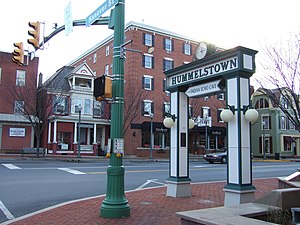
Hummelstown is a borough in Dauphin County, Pennsylvania, United States. The population was 4,535 as of the 2020 census. It is part of the Harrisburg–Carlisle Metropolitan Statistical Area.

South Hanover Township, Pennsylvania
Township in Pennsylvania, United States
Distance: Approx. 2610 meters
Latitude and longitude: 40.3,-76.69972222
South Hanover Township is a township in Dauphin County, Pennsylvania, United States. The population was 7,200 at the 2020 census, an increase over the figure of 6,248 tabulated in 2010.

Lower Dauphin High School
Public high school
Distance: Approx. 1987 meters
Latitude and longitude: 40.2599,-76.7058
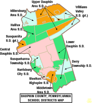
Lower Dauphin High School is a midsized, suburban, public high school located in Hummelstown, Pennsylvania. It is part of the Lower Dauphin School District, serving Hummelstown, East Hanover, South Hanover, Londonderry Township, and Conewago Township. In 2017–2018, enrollment was reported as 1,165 pupils in 9th through 12th grades.
Hershey Center for Applied Research
Distance: Approx. 2533 meters
Latitude and longitude: 40.26269,-76.68628
The Hershey Center for Applied Research (HCAR) is a research park located in Hershey, Pennsylvania that offers life sciences and high technology companies at all phases of the business lifecycle state-of-the-art wet and dry lab facilities and office space, as well as access to capital, business support services, and shared amenities. The first building of the research park was completed April 27, 2007 and is 80,000 square feet (7,400 m2). The campus is master planned to include up to 12 similar buildings.

Union Deposit, Pennsylvania
Census-designated place in Pennsylvania, United States
Distance: Approx. 2682 meters
Latitude and longitude: 40.29027778,-76.68194444
Union Deposit is an unincorporated community and census-designated place in South Hanover Township, Dauphin County, Pennsylvania, United States. It is part of the Harrisburg–Carlisle Metropolitan Statistical Area. As of the 2010 census the population of Union Deposit was 407 residents.

Hoernerstown, Pennsylvania
Unincorporated community in Pennsylvania, United States
Distance: Approx. 1650 meters
Latitude and longitude: 40.28694444,-76.72388889
Hoernerstown is an unincorporated community in South Hanover Township, Dauphin County, Pennsylvania, United States and is a part of the Harrisburg–Carlisle Metropolitan Statistical Area. Hoernerstown was named for a family of settlers.
Beaver Creek (Swatara Creek tributary)
Distance: Approx. 2245 meters
Latitude and longitude: 40.2663,-76.7307
Beaver Creek is an 11.4-mile-long (18.3 km) tributary of Swatara Creek in Dauphin County, Pennsylvania, in the United States. Beaver Creek joins the Swatara Creek near the borough of Hummelstown.

Zion Lutheran Church and Graveyard
Historic church in Pennsylvania, United States
Distance: Approx. 1291 meters
Latitude and longitude: 40.26611111,-76.71083333
Zion Lutheran Church and Graveyard is a historic church on Rosanna Street in Hummelstown, Pennsylvania, USA. It was built in 1815 and added to the National Register of Historic Places in 1979.

Dr. William Henderson House
Historic house in Pennsylvania, United States
Distance: Approx. 1409 meters
Latitude and longitude: 40.265,-76.70722222
Dr. William Henderson House, also known as the Fox House, is a historic home located at Hummelstown, Pennsylvania. It was built in 1854, and is a three-story, brick style townhouse on a stone foundation.
Enoch Matlack House
Historic house in Pennsylvania, United States
Distance: Approx. 1424 meters
Latitude and longitude: 40.26583333,-76.70222222
Enoch Matlack House is a historic home located at Hummelstown, Dauphin County, Pennsylvania. It was built in 1872, and is a 2+1⁄2-story, T-shaped brick building, with a two-story rear section. It has a cross-gable roof.

Keystone Hotel (Hummelstown, Pennsylvania)
United States historic place
Distance: Approx. 1334 meters
Latitude and longitude: 40.26583333,-76.70583333
The Keystone Hotel is an historic, American home that is located in Hummelstown, Dauphin County, Pennsylvania. It was added to the National Register of Historic Places in 1985.
Hershey Lodge
Hotel and convention center in Pennsylvania
Distance: Approx. 2790 meters
Latitude and longitude: 40.27,-76.6775
The Hershey Lodge is a hotel and convention center located in Hershey, Pennsylvania. It has 665 guest rooms and 100,000 square feet of function space, divided between two ballrooms and several other large event spaces. The Lodge is a popular hotel among visitors of Hersheypark due to its shuttles to and from the park and Harrisburg International Airport, bundled admissions to local activities such as the Hershey Gardens, and its comparatively lower price point than the nearby Hotel Hershey.
Weather in this IP's area
few clouds
-2 Celsius
-5 Celsius
-2 Celsius
-2 Celsius
1020 hPa
89 %
1020 hPa
1000 hPa
10000 meters
2.28 m/s
2.58 m/s
160 degree
11 %
