208.79.10.108 - IP Lookup: Free IP Address Lookup, Postal Code Lookup, IP Location Lookup, IP ASN, Public IP
Country:
Region:
City:
Location:
Time Zone:
Postal Code:
IP information under different IP Channel
ip-api
Country
Region
City
ASN
Time Zone
ISP
Blacklist
Proxy
Latitude
Longitude
Postal
Route
Luminati
Country
Region
la
City
saintjoseph
ASN
Time Zone
America/Chicago
ISP
SKRC-SOUTH01
Latitude
Longitude
Postal
IPinfo
Country
Region
City
ASN
Time Zone
ISP
Blacklist
Proxy
Latitude
Longitude
Postal
Route
IP2Location
208.79.10.108Country
Region
arkansas
City
lake village
Time Zone
America/Chicago
ISP
Language
User-Agent
Latitude
Longitude
Postal
db-ip
Country
Region
City
ASN
Time Zone
ISP
Blacklist
Proxy
Latitude
Longitude
Postal
Route
ipdata
Country
Region
City
ASN
Time Zone
ISP
Blacklist
Proxy
Latitude
Longitude
Postal
Route
Popular places and events near this IP address

Lake Village, Arkansas
City in Arkansas, United States
Distance: Approx. 340 meters
Latitude and longitude: 33.32888889,-91.28472222
Lake Village is a city in and the county seat of Chicot County, Arkansas, United States. The population was 2,575 at the 2010 census. It is located in the Arkansas Delta.

Lake Chicot
Lake in Arkansas, United States
Distance: Approx. 1176 meters
Latitude and longitude: 33.3225,-91.27833333
Lake Chicot ( SHE-ko) is a lake adjacent to the Mississippi River. The lake is located on the east side of Lake Village, Arkansas in Chicot County. It is the largest oxbow lake in North America, as well as the largest natural lake in Arkansas.
Lakeside High School (Lake Village, Arkansas)
Public comprehensive school in Lake Village, Arkansas, United States
Distance: Approx. 2578 meters
Latitude and longitude: 33.325,-91.31055556
Lakeside High School is an accredited public high school in Chicot County, Arkansas, United States. It is located on Highway 82 just west of Lake Village. Within the state, the school is referred to as Lake Village or Lakeside Lake Village high school to distinguish itself from Lakeside High School in Hot Springs.

New Hope Missionary Baptist Church Cemetery
Historic cemetery in Arkansas, United States
Distance: Approx. 319 meters
Latitude and longitude: 33.33,-91.28666667
The New Hope Missionary Baptist Church Cemetery is a cemetery on St. Marys Street in Lake Village, Arkansas. The cemetery is located adjacent to a modern church that is located on the site of churches that have served Lake Village's African American population since 1860.

Chicot County Courthouse
United States historic place
Distance: Approx. 256 meters
Latitude and longitude: 33.33333333,-91.28194444
The Chicot County Courthouse is a courthouse in Lake Village, Arkansas, the county seat of Chicot County, built in 1956. Located at the end of the Lake Village Commercial Historic District along Lake Chicot, the courthouse is a culturally significant landmark for both its architectural style and historical importance to the county. It was because of this dual significance that the property was listed on the National Register of Historic Places in 2006.

Carlton House (Lake Village, Arkansas)
Historic house in Arkansas, United States
Distance: Approx. 682 meters
Latitude and longitude: 33.32583333,-91.28305556
The Carlton House is a historic house located at 434 South Lakeshore Drive in Lake Village, Arkansas.
Sam Epstein House
Historic house in Arkansas, United States
Distance: Approx. 652 meters
Latitude and longitude: 33.32611111,-91.28305556
The Sam Epstein House is a historic house at 488 Lakeshore Drive in Lake Village, Arkansas. The Colonial Revival house is notable for its association with Sam Epstein, a Jewish immigrant who was one of Lake Village's first shopkeepers, and eventually amassed more than 10,000 acres (4,000 ha) of land in Chicot County devoted to agricultural purposes. He was active in the civic and economic life of the community, supporting others (most notably H. L. Hunt) in the development of business opportunities.

John Tushek Building
United States historic place
Distance: Approx. 159 meters
Latitude and longitude: 33.33138889,-91.2825
The John Tushek Building is a historic commercial building at 108 Main Street in Lake Village, Arkansas. The two story brick building was built in 1906 by John Tushek, an Austro-Hungarian immigrant who ran a mercantile store on the premises. The building has vernacular Beaux Arts styling popular at the time, presenting facades to both Main and Court Streets.

Lake Village Commercial Historic District
Historic district in Arkansas, United States
Distance: Approx. 151 meters
Latitude and longitude: 33.33111111,-91.28277778
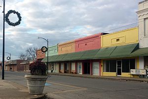
The Lake Village Commercial Historic District encompasses the historic commercial heart of Lake Village, Arkansas, the county seat of Chicot County in the Mississippi River delta region of southeastern Arkansas. The district covers about six square blocks of downtown Lake Village, bounded roughly by Jackson Street to the north, Lakeshore Drive to the east, Church Street to the south, and Chicot Street to the west. This area represents the growth of Lake Village during its period of greatest prosperity, between 1906 and 1960.

Lake Village Confederate Monument
United States historic place
Distance: Approx. 132 meters
Latitude and longitude: 33.33083333,-91.28472222
The Lake Village Confederate Monument is located on the median of Lakeshore Drive, between Main and Jackson Streets in Lake Village, Arkansas. The marble monument depicts a Confederate Army soldier standing in mid stride with his left foot forward. His right hand holds the barrel of a rifle, whose butt rests on the monument base.

Lake Village Post Office
United States historic place
Distance: Approx. 194 meters
Latitude and longitude: 33.33027778,-91.28333333
The Lake Village Post Office is a historic post office at 206 South Cokley Street in Lake Village, Arkansas. The single-story brick Colonial Revival building was built c. 1939; it is roughly square in shape, with a four-sided cupola topped by a bell-cast roof and pyramid.
Dr. E.P. McGehee Infirmary
United States historic place
Distance: Approx. 371 meters
Latitude and longitude: 33.32861111,-91.28472222
The Dr. E.P. McGehee Infirmary is a historic medical complex at 614 South Cokley Street in Lake Village, Arkansas. The complex began as a single wood-frame structure in 1910 serving as a medical clinic for the local African-American population.
Weather in this IP's area
clear sky
9 Celsius
5 Celsius
9 Celsius
9 Celsius
1027 hPa
46 %
1027 hPa
1022 hPa
10000 meters
7.92 m/s
9.9 m/s
345 degree
