208.77.174.228 - IP Lookup: Free IP Address Lookup, Postal Code Lookup, IP Location Lookup, IP ASN, Public IP
Country:
Region:
City:
Location:
Time Zone:
Postal Code:
IP information under different IP Channel
ip-api
Country
Region
City
ASN
Time Zone
ISP
Blacklist
Proxy
Latitude
Longitude
Postal
Route
Luminati
Country
ASN
Time Zone
America/Chicago
ISP
SECURITIESAMERICA
Latitude
Longitude
Postal
IPinfo
Country
Region
City
ASN
Time Zone
ISP
Blacklist
Proxy
Latitude
Longitude
Postal
Route
IP2Location
208.77.174.228Country
Region
nebraska
City
omaha
Time Zone
America/Chicago
ISP
Language
User-Agent
Latitude
Longitude
Postal
db-ip
Country
Region
City
ASN
Time Zone
ISP
Blacklist
Proxy
Latitude
Longitude
Postal
Route
ipdata
Country
Region
City
ASN
Time Zone
ISP
Blacklist
Proxy
Latitude
Longitude
Postal
Route
Popular places and events near this IP address

1913 Easter tornado outbreak
Severe windstorm in the United States
Distance: Approx. 1170 meters
Latitude and longitude: 41.25,-96
On March 23, 1913—Easter Sunday—a devastating tornado outbreak affected the northern Great Plains and sections of the Upper Midwest, lasting approximately 31⁄2 hours. It was the most violent tornado outbreak to affect the northern Great Plains on so early a date in the year—a record that still stands as of 2020. That day, four F4 tornadoes affected portions of eastern Nebraska and western Iowa, killing at least 168 people.

Ak-Sar-Ben (arena)
Distance: Approx. 1048 meters
Latitude and longitude: 41.24,-96.013
The Ak-Sar-Ben Race Track and Coliseum was an indoor arena and horse racing complex in the central United States, located in Omaha, Nebraska. Built to fund the civic and philanthropic activities of the Knights of Ak-Sar-Ben, the thoroughbred race track was built in 1919, and the Coliseum in 1929. The racetrack closed in 1995 and the arena in 2002; the facility was demolished in 2005, and is currently being redeveloped for a variety of uses, including dormitory housing for the University of Nebraska Omaha and the Aksarben Village development.

Nebraska's 2nd congressional district
U.S. House district for Nebraska
Distance: Approx. 1170 meters
Latitude and longitude: 41.25,-96
Nebraska's 2nd congressional district is a congressional district in the U.S. state of Nebraska that encompasses the core of the Omaha–Council Bluffs metropolitan area. It includes all of Douglas County, which includes the state's largest city Omaha; it also includes Saunders County and areas of western Sarpy County. It has been represented in the United States House of Representatives since 2017 by Don Bacon, a member of the Republican Party.

Gorat's
Restaurant in Nebraska, USA
Distance: Approx. 1016 meters
Latitude and longitude: 41.2413,-95.9886
Gorat's Steak House is a restaurant in Omaha, Nebraska, at 4917 Center Street. It is best known as billionaire Warren Buffett's favorite steakhouse, where he annually holds dinners for the largest investors in his company, Berkshire Hathaway, and entertains business colleagues and CEOs, including Michael Eisner, Bill Gates, and Martha Stewart. Gorat's was founded in 1944 by Louis and Nettie Gorat.

Mercy High School (Omaha, Nebraska)
Private all-girls school in Omaha, Nebraska, United States
Distance: Approx. 1422 meters
Latitude and longitude: 41.24472222,-95.985
Mercy High School is a private, all-girls, Roman Catholic high school in Omaha, Nebraska, United States, sponsored by the Sisters of Mercy. It is located in the Roman Catholic Archdiocese of Omaha. It is the only high school in Omaha with a negotiated tuition program, so each family meets with the President at the start of each academic year to agree upon what they will pay for tuition.
Elmwood Park (Omaha)
Neighborhood in Omaha, Nebraska, U.S.
Distance: Approx. 688 meters
Latitude and longitude: 41.23333333,-96
The Elmwood Park neighborhood in Omaha, Nebraska is a historically significant area that was developed in the late 19th and early 20th century. It extends from Leavenworth Street on the north to Center Street on the south; from South 50th Street on the east to South 72nd Street on the west. Home to ethnic Swede celebrations through the 1950s, today the neighborhood's park hosts the city's "Shakespeare on the Green" festival.

Maha Music Festival
Distance: Approx. 1201 meters
Latitude and longitude: 41.23805556,-96.01472222
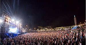
The Maha Festival (known until 2021 as Maha Music Festival) is an independent music festival held in Omaha, Nebraska, United States. The festival is owned and operated by YFC, Inc., a non-profit organization.

Aksarben Village
Building in Nebraska, U.S.
Distance: Approx. 1225 meters
Latitude and longitude: 41.238,-96.015
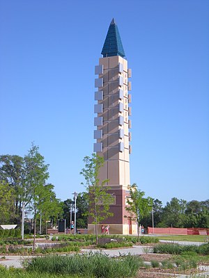
Aksarben Village is a mixed-use development in the central United States, located in Omaha, Nebraska. Measuring over one million square feet (93,000 m2), it is on the land of the former Ak-Sar-Ben coliseum and horse track. There is over 750,000 sq ft (70,000 m2) of space for research and business office and 250,000 sq ft (23,000 m2) of retail and entertainment space.

Elmwood Tower
Residential in Nebraska, U.S.
Distance: Approx. 1475 meters
Latitude and longitude: 41.25194444,-95.99444444
The Elmwood Tower (formerly known as the Masonic Manor) is a high-rise residential building located in midtown Omaha, Nebraska, United States. Completed in 1964, the 320 ft (98 m), 23 story building, is currently the fourth tallest building in Omaha. When construction began in 1961, the Federal Housing Administration (FHA) granted the largest mortgage to the Midwest in their history to the project, totaling $4.9 million USD. The building was originally constructed to house members of the Masons and their families.
Westlawn-Hillcrest Funeral Home and Memorial Park
Funeral services in Douglas County, Nebraska
Distance: Approx. 519 meters
Latitude and longitude: 41.235,-95.99888889
Westlawn-Hillcrest Funeral Home and Memorial Park is a funeral home, cemetery and crematory located at 5701 Center Street in Omaha, Nebraska.

Baxter Arena
Sports arena in Omaha, Nebraska
Distance: Approx. 1117 meters
Latitude and longitude: 41.236,-96.013
Baxter Arena (original working name UNO Community Arena) is a sports arena in the central United States in Omaha, Nebraska. Owned and operated by the University of Nebraska Omaha, it serves as the home of several of the university's intercollegiate athletic teams, known as the Omaha Mavericks. The arena opened to the public on October 23, 2015, when the hockey team defeated Air Force 4–2.
Tal Anderson Field
Baseball park in Nebraska
Distance: Approx. 1588 meters
Latitude and longitude: 41.234,-96.018
Tal Anderson Field is a college baseball park in the central United States, located in Omaha, Nebraska. It is the home field of the University of Nebraska Omaha Mavericks of the Summit League in NCAA Division I. Opened three years ago in 2021 in the Midtown neighborhood, it has a seating capacity of 1,500 for baseball. The artificial turf playing field is aligned northeast by north, at an approximate elevation of 1,030 feet (315 m) above sea level.
Weather in this IP's area
overcast clouds
-10 Celsius
-17 Celsius
-10 Celsius
-9 Celsius
1028 hPa
50 %
1028 hPa
987 hPa
10000 meters
9.26 m/s
13.38 m/s
340 degree
100 %

