Country:
Region:
City:
Latitude and Longitude:
Time Zone:
Postal Code:
IP information under different IP Channel
ip-api
Country
Region
City
ASN
Time Zone
ISP
Blacklist
Proxy
Latitude
Longitude
Postal
Route
Luminati
Country
Region
wi
City
phillips
ASN
Time Zone
America/Chicago
ISP
AIRSTREAMCOMM-NET
Latitude
Longitude
Postal
IPinfo
Country
Region
City
ASN
Time Zone
ISP
Blacklist
Proxy
Latitude
Longitude
Postal
Route
db-ip
Country
Region
City
ASN
Time Zone
ISP
Blacklist
Proxy
Latitude
Longitude
Postal
Route
ipdata
Country
Region
City
ASN
Time Zone
ISP
Blacklist
Proxy
Latitude
Longitude
Postal
Route
Popular places and events near this IP address
Price County, Wisconsin
County in Wisconsin, United States
Distance: Approx. 3800 meters
Latitude and longitude: 45.68,-90.36
Price County is a county in the U.S. state of Wisconsin. As of the 2020 census, the population was 14,054. Its county seat is Phillips.

Elk, Wisconsin
Town in Wisconsin, United States
Distance: Approx. 8864 meters
Latitude and longitude: 45.69861111,-90.51666667
Elk is a town in Price County, Wisconsin, United States. The population was 1,183 at the 2000 census.
Phillips, Wisconsin
City in Wisconsin, United States
Distance: Approx. 552 meters
Latitude and longitude: 45.69166667,-90.40194444
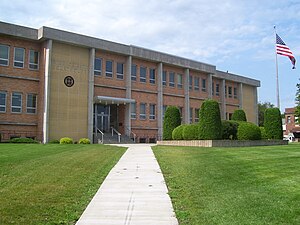
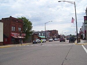
Phillips is a city and the county seat of Price County, Wisconsin, United States. The population was 1,533 at the 2020 census.

Worcester, Wisconsin
Town in Wisconsin, United States
Distance: Approx. 6640 meters
Latitude and longitude: 45.73194444,-90.33388889
Worcester is a town in Price County, Wisconsin, United States. The population was 1,711 at the 2000 census. The unincorporated community of Cranberry Lake is located in the town.

Price County Airport
Airport
Distance: Approx. 1368 meters
Latitude and longitude: 45.70888889,-90.4025
Price County Airport (ICAO: KPBH, FAA LID: PBH) is a county owned public airport located one mile northwest of Phillips, in Price County, Wisconsin, United States. It is included in the Federal Aviation Administration (FAA) National Plan of Integrated Airport Systems for 2021–2025, in which it is categorized as a local general aviation facility. Many U.S. airports use the same three-letter location identifier for the FAA and IATA, but this facility is assigned PBH by the FAA and has no designation from the IATA (which assigned PBH to Paro Airport in Paro, Bhutan).

Wisconsin Concrete Park
United States historic place
Distance: Approx. 3070 meters
Latitude and longitude: 45.67083333,-90.38861111
The Wisconsin Concrete Park is a sculpture park located along Wisconsin Highway 13 in the town of Phillips, Wisconsin. The park includes over 200 folk art sculptures built with concrete and decorated with glass bottles and other found objects. Fred Smith, who ran the Rock Garden Tavern on the property, began building the sculptures in 1948 after retiring from his career as a lumberjack.
Weather in this IP's area
overcast clouds
8 Celsius
5 Celsius
7 Celsius
8 Celsius
1018 hPa
81 %
1018 hPa
965 hPa
10000 meters
5.14 m/s
8.23 m/s
120 degree
100 %
06:45:00
16:45:17

