208.74.255.242 - IP Lookup: Free IP Address Lookup, Postal Code Lookup, IP Location Lookup, IP ASN, Public IP
Country:
Region:
City:
Location:
Time Zone:
Postal Code:
IP information under different IP Channel
ip-api
Country
Region
City
ASN
Time Zone
ISP
Blacklist
Proxy
Latitude
Longitude
Postal
Route
Luminati
Country
ASN
Time Zone
America/Chicago
ISP
VOSTROM-PUBLIC
Latitude
Longitude
Postal
IPinfo
Country
Region
City
ASN
Time Zone
ISP
Blacklist
Proxy
Latitude
Longitude
Postal
Route
IP2Location
208.74.255.242Country
Region
virginia
City
virginia beach
Time Zone
America/New_York
ISP
Language
User-Agent
Latitude
Longitude
Postal
db-ip
Country
Region
City
ASN
Time Zone
ISP
Blacklist
Proxy
Latitude
Longitude
Postal
Route
ipdata
Country
Region
City
ASN
Time Zone
ISP
Blacklist
Proxy
Latitude
Longitude
Postal
Route
Popular places and events near this IP address
Oceana, Virginia
Unincorporated community in Virginia, United States
Distance: Approx. 2240 meters
Latitude and longitude: 36.84222222,-76.01305556
Oceana is a major unincorporated community within Virginia Beach, Virginia, United States. Adjacent to Oceana is the Naval Air Station Oceana. The community is centered at the intersection of Virginia Beach Boulevard and First Colonial Road.
First Colonial High School
High school in Virginia Beach, Virginia, United States
Distance: Approx. 1964 meters
Latitude and longitude: 36.87333333,-76.02861111
First Colonial High School is a high school in Virginia Beach, Virginia. It is a part of the Virginia Beach City Public Schools, serving 1,807 students (2021-22).
Alanton, Virginia
Neighborhood in Virginia Beach, Virginia, United States
Distance: Approx. 2465 meters
Latitude and longitude: 36.88277778,-76.02194444
Alanton is an older, upscale, residential neighborhood in the northern part of Virginia Beach, Virginia, United States. The community was named for Alan McCullough, a prominent Virginia architect, but developed by his father. It is bordered by Baycliff and Cape Henry Collegiate School.
Virginia Beach Friends School
Independent school
Distance: Approx. 1375 meters
Latitude and longitude: 36.85,-76.01
Virginia Beach Friends School (VBFS) is an independent life-skills and college preparatory day school founded in 1955 under the care of the Virginia Beach Friends Meeting. Virginia Beach Friends School has more than 100 students enrolled in three divisions – Early School (Cottage, Treehouse, Pre-K and Kindergarten), Lower School (Grades 1-5), and Middle School (Grades 6-8). It formerly operated a high school, but the high school closed in 2021.

Cape Henry Collegiate School
Private, college-prep, day school in Virginia Beach, Virginia, United States
Distance: Approx. 2286 meters
Latitude and longitude: 36.87694444,-76.02938889
Cape Henry Collegiate (formerly Cape Henry Collegiate School, also known as Cape Henry or CHC) is a private, college-preparatory, coeducational, day school located in Virginia Beach, Virginia.
Andrew B. Cooke House
House in Virginia
Distance: Approx. 2568 meters
Latitude and longitude: 36.877203,-75.989394
The Andrew B. Cooke House in Virginia Beach, Virginia, was designed in 1953 and completed in 1959 for Andrew B. & Maude Cooke. Along with the Pope-Leighey House and the Luis Marden House, it is one of three Frank Lloyd Wright designs in Virginia. A variation of Wright's solar hemicycle designs, the Cooke House features yellow-gold brick and a copper, cantilevered roof.
Virginia Museum of Contemporary Art
Distance: Approx. 2598 meters
Latitude and longitude: 36.8487,-75.9877
The Virginia Museum of Contemporary Art, marketed as Virginia MOCA, is a non-collecting contemporary art museum and community art center in Virginia Beach, Virginia, widely known for its annual Boardwalk Art Show. MOCA itself evolved from a succession of local art associations: the Virginia Beach Art Association (VBAA, 1952-1971), the Virginia Beach Art Center (1971-1989) and the Virginia Contemporary Art Center (1989-2010). MOCA is located just off the Virginia Beach oceanfront.
Dr. John Miller-Masury House
Historic house in Virginia, United States
Distance: Approx. 2436 meters
Latitude and longitude: 36.87833333,-75.99277778
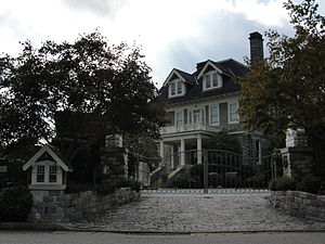
Dr. John Miller-Masury House, also known as Lakeside (1906–1935), Crystal Club (1935–1939), and Greystone Manor (1942-present), is a historic home located at Virginia Beach, Virginia. It was built in 1906–1908, and is a 2+1⁄2-story, five-bay, L-shaped stone-and-slate dwelling.

Shirley Hall
Historic house in Virginia, United States
Distance: Approx. 1270 meters
Latitude and longitude: 36.87333333,-76.00777778
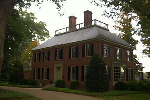
Shirley Hall, also known as Devereaux House, is a historic home located at Virginia Beach, Virginia. It was built in 1940, and is a two-story, five-bay, Georgian Revival style brick dwelling. The main block is covered by a hipped roof with balustrade.

Briarwood (Virginia Beach, Virginia)
Historic house in Virginia, United States
Distance: Approx. 256 meters
Latitude and longitude: 36.86083333,-76.01361111
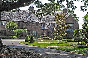
Briarwood, also known as Bingham House, is a historic home located at Virginia Beach, Virginia. It was built in 1932, and is a two-story, 6,000 square foot, Tudor Revival style brick dwelling. It features steeply pitched gabled and hipped roof elements clad in historic slate shingles as well as three corbelled brick chimneys.

2012 Virginia Beach F/A-18 crash
Jet crash in the city of Virginia Beach.
Distance: Approx. 1977 meters
Latitude and longitude: 36.85111111,-75.99416667
On April 6, 2012, a McDonnell Douglas F/A-18D Hornet jet fighter of the United States Navy crashed into an apartment complex in Virginia Beach, Virginia, after suffering a dual engine failure shortly after take-off on a training flight. The building involved was extensively damaged, but there were no fatalities in the accident.

Oceana Neighborhood Historic District
Historic district in Virginia, United States
Distance: Approx. 2380 meters
Latitude and longitude: 36.84111111,-76.015
The Oceana Neighborhood Historic District encompasses an early 20th-century planned neighborhood subdivision in Virginia Beach, Virginia. It consists of 70 acres (28 ha), roughly bounded by Virginia Beach Boulevard, First Colonial Road, and North Oceana Boulevard. This area was platted out in 1906 with a rectilinear street grid, and saw development of its commercial corridors in the 1930s.
Weather in this IP's area
clear sky
7 Celsius
6 Celsius
6 Celsius
8 Celsius
1022 hPa
42 %
1022 hPa
1022 hPa
10000 meters
1.34 m/s
6.26 m/s
238 degree
2 %
