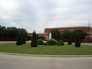
Country:
Region:
City:
Latitude and Longitude:
Time Zone:
Postal Code:
IP information under different IP Channel
ip-api
Country
Region
City
ASN
Time Zone
ISP
Blacklist
Proxy
Latitude
Longitude
Postal
Route
Luminati
Country
Region
il
City
bloomington
ASN
Time Zone
America/Chicago
ISP
COUNTRY-INSURANCE
Latitude
Longitude
Postal
IPinfo
Country
Region
City
ASN
Time Zone
ISP
Blacklist
Proxy
Latitude
Longitude
Postal
Route
db-ip
Country
Region
City
ASN
Time Zone
ISP
Blacklist
Proxy
Latitude
Longitude
Postal
Route
ipdata
Country
Region
City
ASN
Time Zone
ISP
Blacklist
Proxy
Latitude
Longitude
Postal
Route
Popular places and events near this IP address

Central Illinois Regional Airport
Commercial airport near Bloomington, Illinois, USA
Distance: Approx. 2416 meters
Latitude and longitude: 40.47722222,-88.91583333
Central Illinois Regional Airport at Bloomington–Normal (IATA: BMI, ICAO: KBMI, FAA LID: BMI) is a public airport in McLean County, Illinois, three miles east of Bloomington and southeast of Normal. Owned by the Bloomington–Normal Airport Authority, it is also known as Central Illinois Regional Airport (CIRA). The National Plan of Integrated Airport Systems for 2023–2027 categorized it as a primary commercial service airport.
Bloomington High School (Bloomington, Illinois)
Public school in Bloomington, Illinois, United States
Distance: Approx. 3304 meters
Latitude and longitude: 40.4866,-88.9741
Bloomington High School (BHS) is a public secondary school in Bloomington, Illinois, and is part of Bloomington School District 87.
Central Catholic High School (Bloomington, Illinois)
School in Bloomington, Illinois, United States
Distance: Approx. 3123 meters
Latitude and longitude: 40.49305556,-88.92277778
Central Catholic High School (CCHS or Central Catholic) is a private co-educational Catholic high school in Bloomington, Illinois, United States. It serves approximately 320 students in the Bloomington-Normal area. CCHS is one of seven Catholic high schools in the Roman Catholic Diocese of Peoria and the only Catholic high school in McLean County.
David Davis III & IV House
Historic house in Illinois, United States
Distance: Approx. 3422 meters
Latitude and longitude: 40.48055556,-88.98
The David Davis III & IV House is a site on the National Register of Historic Places located in the county seat of McLean County, Illinois, Bloomington. The home was added to the register in 1982 due to its affiliation with the descendants of 19th century U.S. Supreme Court justice and Bloomington native David Davis, namely Illinois state senator David Davis IV. The house is not only listed on the National Register but it is also a contributing property to the local Davis-Jefferson Historic District.

Douglas R4D-3 N763A
United States historic place
Distance: Approx. 2019 meters
Latitude and longitude: 40.48527778,-88.93111111
Former United States Army Air Force aircraft serial number 41-20124 is a World War II era fully restored Douglas DC-3, owned by a private party and based at Marathon Key, FL. Civil registered as N763A the aircraft has also been operated by the United States Navy with the designation R4D-3 and serial number 05078. The aircraft has been listed on the National Register of Historic Places since August 1, 1996.

WWHX
Radio station in Normal, Illinois
Distance: Approx. 2602 meters
Latitude and longitude: 40.45225,-88.96341667
WWHX (100.7 MHz) is a commercial FM radio station in Normal, Illinois, serving the Bloomington-Normal radio market. It is owned by Neuhoff Media through licensee Neuhoff Media Bloomington, LLC. It airs a hot adult contemporary radio format, switching to Christmas music for much of November and December. The studios are at 1 Brickyard Drive in Bloomington.
Illinois Shakespeare Festival
Distance: Approx. 3364 meters
Latitude and longitude: 40.494,-88.9653
The Illinois Shakespeare Festival (ISF) is held in Bloomington, Illinois, United States at Ewing Theatre and in Normal, Illinois, United States at the Center for Performing Arts Theatre at Illinois State University. The Festival began in 1978 and celebrated its 45th season in 2023. The Festival has traditionally presented three plays.
Eastland Mall (Bloomington, Illinois)
Shopping mall in Illinois, United States
Distance: Approx. 2185 meters
Latitude and longitude: 40.486126,-88.955698
Eastland Mall is a shopping mall in Bloomington, Illinois. It opened in 1967 and has expanded several times in its history. It features more than 90 stores and a food court.
Moses Montefiore Congregation
Reform synagogue in Bloomington, Illinois, United States
Distance: Approx. 3189 meters
Latitude and longitude: 40.49138889,-88.96638889
The Moses Montefiore Congregation is a Reform Jewish congregation and synagogue located at 102 Robinhood Lane in Bloomington, Illinois, in the United States.

OSF St. Joseph Medical Center
Hospital in Illinois, United States
Distance: Approx. 1898 meters
Latitude and longitude: 40.4828,-88.9561
OSF St. Joseph Medical Center is a 149-bed Level II trauma center hospital complex in Bloomington, Illinois, USA, and is part of the OSF Healthcare System. St.
Hindu Temple of Bloomington-Normal
Hindu temple in Illinois, United States
Distance: Approx. 2782 meters
Latitude and longitude: 40.454998,-88.915458
Hindu Temple of Bloomington-Normal is a Hindu Temple located in Bloomington, Illinois and serves the Hindu population of the Bloomington-Normal Metropolitan Area. It is located at 1815 Tullamore Ave, in Bloomington, Illinois.
Prairie Aviation Museum
Aviation museum in Bloomington, Illinois
Distance: Approx. 2502 meters
Latitude and longitude: 40.488,-88.926
The Prairie Aviation Museum is an aviation museum located at Central Illinois Regional Airport in Bloomington, Illinois.
Weather in this IP's area
light rain
14 Celsius
14 Celsius
13 Celsius
14 Celsius
1011 hPa
98 %
1011 hPa
980 hPa
10000 meters
4.12 m/s
240 degree
06:30:54
16:47:51

