208.74.131.100 - IP Lookup: Free IP Address Lookup, Postal Code Lookup, IP Location Lookup, IP ASN, Public IP
Country:
 USA
USARegion:
City:
Location:
Time Zone:
Postal Code:
ISP:
ASN:
language:
User-Agent:
Proxy IP:
Blacklist:
IP information under different IP Channel
ip-api
Country
Region
City
ASN
Time Zone
ISP
Blacklist
Proxy
Latitude
Longitude
Postal
Route
db-ip
Country
Region
City
ASN
Time Zone
ISP
Blacklist
Proxy
Latitude
Longitude
Postal
Route
IPinfo
Country
Region
City
ASN
Time Zone
ISP
Blacklist
Proxy
Latitude
Longitude
Postal
Route
IP2Location
208.74.131.100Country
usRegion
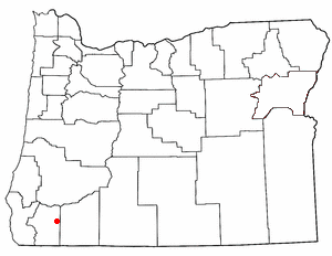
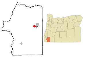
oregon
City
grants pass
Time Zone
America/Los_Angeles
ISP
Language
User-Agent
Latitude
Longitude
Postal
ipdata
Country
Region
City
ASN
Time Zone
ISP
Blacklist
Proxy
Latitude
Longitude
Postal
Route
Popular places and events near this IP address
Harbeck-Fruitdale, Oregon
Unincorporated community in the state of Oregon, United States
Distance: Approx. 3307 meters
Latitude and longitude: 42.41611111,-123.32055556
Harbeck-Fruitdale was formerly a census-designated place (CDP) in Josephine County, Oregon, United States, near Grants Pass. As of the 2000 census, the CDP population was 3,780. It includes the community of Fruitdale.
Redwood, Oregon
Unincorporated community in the state of Oregon, United States
Distance: Approx. 3516 meters
Latitude and longitude: 42.42194444,-123.38722222
Redwood is a census-designated place (CDP) in Josephine County, Oregon, United States. The population was 2,627 at the 2010 census, down from 5,844 at the 2000 census as it has lost territory to the neighboring city of Grants Pass.

Rogue Community College
Distance: Approx. 3332 meters
Latitude and longitude: 42.412,-123.3929
Rogue Community College (RCC) is a public community college with campuses in both Jackson County and Josephine County, falling roughly in the geographic region known as the Rogue Valley in Southern Oregon.
KAJO
Radio station in Oregon, United States
Distance: Approx. 4098 meters
Latitude and longitude: 42.43777778,-123.3575
KAJO (1270 AM, "KAJO AM 1270 & 99.7 FM") is a commercial AC/classic hits and news/talk radio station in Grants Pass, Oregon, broadcasting to the Southern Oregon area. It was owned by Carl Wilson's Grants Pass Broadcasting Corporation. In 2024, Grants Pass Broadcasting was bought Brian and Shanna Diatte.
KAGI
Radio station in Grants Pass, Oregon
Distance: Approx. 4098 meters
Latitude and longitude: 42.43777778,-123.3575
KAGI (930 AM) is a radio station in Grants Pass, Oregon, United States. The station is owned by Southern Oregon University and is part of its Jefferson Public Radio (JPR) network; it airs JPR's "News & Information" service, consisting of news and talk programming. While it principally broadcasts at 930 kHz on the AM band, a translator, K250BZ (97.9 FM), rebroadcasts its programming on the FM band in the Grants Pass area.
New Hope Christian Schools
Private school in Grants Pass, Oregon
Distance: Approx. 4726 meters
Latitude and longitude: 42.359412,-123.366731
New Hope Christian Schools is a private Christian school founded in 1961 located in Grants Pass, Oregon, United States.
KGPZ-LP
Radio station in Grants Pass, Oregon
Distance: Approx. 4351 meters
Latitude and longitude: 42.42277778,-123.39916667
KGPZ-LP (106.7 FM) is a radio station licensed to SongSong Media. The station is currently owned by SonSong Media. KGPZ-LP can be heard at 106.7 FM in Grants Pass and the surrounding area.

Grants Pass Supervisor's Warehouse
United States historic place
Distance: Approx. 4243 meters
Latitude and longitude: 42.437167,-123.338897
The Grants Pass Supervisor's Warehouse is a historic former national forest administrative facility in Grants Pass, Oregon, United States. The warehouse complex was listed on the National Register of Historic Places in 1991.
Rogue River Valley Grange No. 469
United States historic place
Distance: Approx. 4416 meters
Latitude and longitude: 42.44055556,-123.35111111
Rogue River Valley Grange No. 469 was a historic Grange hall located at 2064 Upper River Road in Grants Pass, Oregon. It was built in 1923 in the bungalow craftsman style.
New Hope, Oregon
Unincorporated community in the state of Oregon, United States
Distance: Approx. 4467 meters
Latitude and longitude: 42.362,-123.368
New Hope is an unincorporated community and census-designated place (CDP) in Josephine County, Oregon, United States. As of the 2010 census it had a population of 1,515.

Asante Three Rivers Medical Center
Hospital in Oregon, United States
Distance: Approx. 2493 meters
Latitude and longitude: 42.4215,-123.343
Asante Three Rivers Medical Center (TRMC; formerly known as Three Rivers Community Hospital, TRCH) is a 125-bed general acute care hospital located in Grants Pass in the U.S. state of Oregon. TRMC was built as a merger between two hospitals, Josephine Memorial (General) Hospital and Southern Oregon Medical Center in 2001.

Grants Pass City Hall and Fire Station
United States historic place
Distance: Approx. 4727 meters
Latitude and longitude: 42.43916667,-123.33
The Grants Pass City Hall and Fire Station, at 4th and H Streets in Grants Pass, Oregon, was built in 1912. It was listed on the National Register of Historic Places in 1984. It is a two-story brick building designed by Ashland architect W.F. Bowen.
Weather in this IP's area
overcast clouds
2 Celsius
2 Celsius
2 Celsius
3 Celsius
1013 hPa
95 %
1013 hPa
949 hPa
10000 meters
100 %