208.73.141.40 - IP Lookup: Free IP Address Lookup, Postal Code Lookup, IP Location Lookup, IP ASN, Public IP
Country:
Region:
City:
Location:
Time Zone:
Postal Code:
ISP:
ASN:
language:
User-Agent:
Proxy IP:
Blacklist:
IP information under different IP Channel
ip-api
Country
Region
City
ASN
Time Zone
ISP
Blacklist
Proxy
Latitude
Longitude
Postal
Route
db-ip
Country
Region
City
ASN
Time Zone
ISP
Blacklist
Proxy
Latitude
Longitude
Postal
Route
IPinfo
Country
Region
City
ASN
Time Zone
ISP
Blacklist
Proxy
Latitude
Longitude
Postal
Route
IP2Location
208.73.141.40Country
Region
virginia
City
ashland
Time Zone
America/New_York
ISP
Language
User-Agent
Latitude
Longitude
Postal
ipdata
Country
Region
City
ASN
Time Zone
ISP
Blacklist
Proxy
Latitude
Longitude
Postal
Route
Popular places and events near this IP address

Hanover County, Virginia
County in Virginia, United States
Distance: Approx. 1933 meters
Latitude and longitude: 37.76,-77.49
Hanover County is a county in the Commonwealth of Virginia. As of the 2020 census, the population was 109,979. Its county seat is Hanover.

Ashland, Virginia
Town in Virginia, United States
Distance: Approx. 1190 meters
Latitude and longitude: 37.75944444,-77.47722222
Ashland is a town in Hanover County, Virginia, United States, located 16 miles (26 km) north of Richmond along Interstate 95 and U.S. Route 1. As of the 2020 census it had a population of 7,565, up from 7,225 at the 2010 census. Ashland is named after the Lexington, Kentucky estate of Hanover County native and statesman Henry Clay.
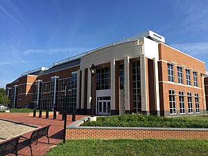
Randolph–Macon College
Private liberal arts college in Ashland, Virginia, U.S.
Distance: Approx. 1563 meters
Latitude and longitude: 37.763,-77.477
Randolph–Macon College is a private liberal arts college in Ashland, Virginia. Founded in 1830, the college has an enrollment of more than 1,500 students. It is the second-oldest Methodist-run college in the country, and the oldest in continuous operation.
Elmont, Virginia
Unincorporated community in Virginia, United States
Distance: Approx. 4580 meters
Latitude and longitude: 37.71138889,-77.4925
Elmont is an unincorporated community in Hanover County in the Central Region of the U.S. state of Virginia. It was located on the former Richmond, Fredericksburg and Potomac Railroad, now owned by CSX Transportation. Elmont was located on the old Washington Highway, and was served by an electric trolley car line between Richmond and Ashland.

Keeble Observatory
Observatory
Distance: Approx. 1467 meters
Latitude and longitude: 37.76238889,-77.47538889
Keeble Observatory is an astronomical observatory owned and operated by Randolph-Macon College. It is located in Ashland, Virginia (USA), named for Dr. William Houston Keeble, distinguished Professor of Physics at Randolph-Macon College from 1919 until his retirement in 1952.

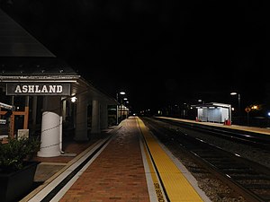
Ashland station (Virginia)
Distance: Approx. 1365 meters
Latitude and longitude: 37.7596,-77.4812
Ashland is an Amtrak intercity train station in Ashland, Virginia, serving Northeast Regional trains bound for Richmond, Newport News and Norfolk as well as many points north. The station is also designated as Ashland's visitor center. The tracks are lined with a cobblestone median in the center of town, making it a popular train-watching site for railfans.

Hanover County Municipal Airport
Airport in Ashland, Virginia
Distance: Approx. 5523 meters
Latitude and longitude: 37.70888889,-77.43638889
Hanover County Municipal Airport (ICAO: KOFP, FAA LID: OFP) is a public airport located 14 miles (22 km) north of the central business district of Richmond, Virginia, and 5 miles (8 km) south of Ashland, Virginia, United States. It is owned by Hanover County in Virginia. This airport uses the three-letter location identifier code "OFP" which is assigned by the FAA; however, there is no three-letter location identifier code from IATA. The four-letter location identifier code "KOFP" is assigned by ICAO. The hours of operations are 0700 to 2000 (7am to 8pm) from April to September, and 0700 to 1900 (7am to 7pm) from October to March.

Hickory Hill (Ashland, Virginia)
Historic house in Virginia, United States
Distance: Approx. 5936 meters
Latitude and longitude: 37.77444444,-77.41305556
Hickory Hill is an estate in Hanover County, Virginia. The 3,300 acre former plantation is located approximately 20 miles (32 km) north of the independent city of Richmond and 5 miles (8.0 km) east of the incorporated town of Ashland. The property was listed in the National Register of Historic Places and the Virginia Landmarks Register in 1974.

Day Field
Distance: Approx. 1683 meters
Latitude and longitude: 37.763947,-77.477796
Day Field is a 5,000-capacity stadium in Ashland, Virginia on the campus of Randolph-Macon College where it serves as home to the school's football program as well as both the men's and women's lacrosse teams. The stadium is named for benefactor Frank L. Day who donated the land it sits on in 1937.
Ashland Historic District
Historic district in Virginia, United States
Distance: Approx. 1216 meters
Latitude and longitude: 37.75833333,-77.48055556
The Ashland Historic District encompasses the historic central core of Ashland, Virginia, now a suburb of nearby Richmond. The town developed in the mid-19th century as a summer resort area, but in the late 19th and early 20th century it grew more significantly as a streetcar suburb of its larger neighbor. Its central core had its biggest building boom between about 1875 and 1920, and contains a large assortment of high-quality residences in Colonial Revival, Queen Anne, and other styles.

Slash Church
Historic church in Virginia, United States
Distance: Approx. 6121 meters
Latitude and longitude: 37.71861111,-77.415
Slash Church, also known as the Upper Church-St. Paul's Parish is a historic Disciples of Christ Church, formerly an Anglican/Episcopal church located at 11353 Mt. Hermon Road, Ashland, Hanover County, Virginia.
Hanover County Public Schools
School district in Virginia
Distance: Approx. 2160 meters
Latitude and longitude: 37.7686993,-77.47518226
Hanover County Public Schools is a school division headquartered in Ashland, Virginia. It serves approximately 17,000 students across 26 schools in Hanover County, including 15 elementary, four middle, and four high schools, one trade and technology center, one K–12 online school, and one alternative education school.
Weather in this IP's area
clear sky
2 Celsius
-1 Celsius
1 Celsius
3 Celsius
1026 hPa
50 %
1026 hPa
1018 hPa
10000 meters
3.6 m/s
240 degree
