208.70.151.230 - IP Lookup: Free IP Address Lookup, Postal Code Lookup, IP Location Lookup, IP ASN, Public IP
Country:
Region:
City:
Location:
Time Zone:
Postal Code:
IP information under different IP Channel
ip-api
Country
Region
City
ASN
Time Zone
ISP
Blacklist
Proxy
Latitude
Longitude
Postal
Route
Luminati
Country
Region
wa
City
marrowstone
ASN
Time Zone
America/Los_Angeles
ISP
NOANET-WA
Latitude
Longitude
Postal
IPinfo
Country
Region
City
ASN
Time Zone
ISP
Blacklist
Proxy
Latitude
Longitude
Postal
Route
IP2Location
208.70.151.230Country
Region
washington
City
port hadlock
Time Zone
America/Los_Angeles
ISP
Language
User-Agent
Latitude
Longitude
Postal
db-ip
Country
Region
City
ASN
Time Zone
ISP
Blacklist
Proxy
Latitude
Longitude
Postal
Route
ipdata
Country
Region
City
ASN
Time Zone
ISP
Blacklist
Proxy
Latitude
Longitude
Postal
Route
Popular places and events near this IP address

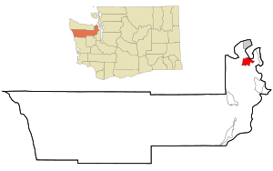
Port Hadlock-Irondale, Washington
Census-designated place in Washington, United States
Distance: Approx. 1448 meters
Latitude and longitude: 48.03666667,-122.775
Port Hadlock-Irondale is a census-designated place (CDP) in Jefferson County, Washington, United States. The population was 3,983 at the 2020 census.
Mystery Bay State Park
State park in Washington, United States
Distance: Approx. 5535 meters
Latitude and longitude: 48.05888889,-122.69444444
Mystery Bay State Park is an eighteen-acre (7.3 ha) Washington marine state park on Mystery Bay, a small inlet off Scow Bay/Kilisut Harbor on the western side of Marrowstone Island. The park is located approximately one-half mile north of the Nordland General Store (which also faces Mystery Bay) on Flagler Road (SR 116). Many older wooden sailboats can be swinging at permanent moorage at the park.
Indian Island, Washington
Unincorporated community in Washington, United States
Distance: Approx. 3304 meters
Latitude and longitude: 48.05194444,-122.72416667
Indian Island is an unincorporated community in Jefferson County, Washington, United States. The whole island is covered by the Marrowstone CDP. It is located between Port Townsend Bay and Kilisut Harbor. Parts also border on Oak Bay and Scow Bay.
Chimacum, Washington
Unincorporated community in Washington, United States
Distance: Approx. 1845 meters
Latitude and longitude: 48.01666667,-122.76666667
Chimacum is an unincorporated community in Jefferson County, Washington, United States, located in the center of the primary agricultural area of the eastern Olympic Peninsula.

Port Townsend Ship Canal
Canal in Jefferson County, Washington
Distance: Approx. 2052 meters
Latitude and longitude: 48.03027778,-122.72944444
The Port Townsend Ship Canal (also known as the Portage Canal) is a 4,800-foot (1,500 m) canal connecting Port Townsend Bay and Oak Bay in Jefferson County, Washington. Built in 1915, the canal separates Indian Island from the Quimper Peninsula of mainland Washington. State Route 116 crosses the only bridge over the canal.

Anderson Lake State Park
Park in the U.S. state of Washington
Distance: Approx. 3609 meters
Latitude and longitude: 48.01861111,-122.80111111
Anderson Lake State Park is a public recreation area on the Quimper Peninsula, seven miles (11 km) south of Port Townsend, in Jefferson County, Washington. The state park has 496 acres (201 ha) of woods and wetland that slope down to 70-acre (28 ha) Anderson Lake. The park offers picnicking, trails for hiking, biking, and equestrian use, non-motorized boating, fishing, and birdwatching.

Fort Townsend State Park
State park in Washington (state), United States
Distance: Approx. 5209 meters
Latitude and longitude: 48.07333333,-122.78944444
Fort Townsend State Park (formerly Old Fort Townsend State Park) is a public recreation area located two miles south of Port Townsend in Jefferson County, Washington. The state park occupies a third of the site of the original Fort Townsend built in 1856. The park includes 3,960 feet (1,210 m) of shoreline on Port Townsend Bay, picnicking and camping areas, 6.5 miles (10.5 km) of hiking trails, and facilities for boating, fishing, and crabbing.
Kinney Point State Park
Distance: Approx. 5634 meters
Latitude and longitude: 48.00861111,-122.68972222
Kinney Point State Park is a 67-acre (27 ha) Washington marine state park in Jefferson County. The park sits on 683 feet (208 m) of shoreline at the south end of Marrowstone Island and has no upland access. The park is part of the Cascadia Marine Trail with campsites restricted to boaters arriving by other than motorized means.
Port Townsend Aero Museum
Aviation museum in Port Townsend, Washington
Distance: Approx. 4684 meters
Latitude and longitude: 48.05666667,-122.80777778
Port Townsend Aero Museum is an aviation museum located at Jefferson County International Airport in Port Townsend, Washington.

Methodist Episcopal Church of Port Hadlock
Historic church in Washington, United States
Distance: Approx. 252 meters
Latitude and longitude: 48.03414722,-122.75653333
Methodist Episcopal Church of Port Hadlock (Barrett House) is a historic Methodist church, now a private home, at Randolph and Matheson Streets in Hadlock, Washington. Built in 1903, the church was the first permanent Methodist church in Hadlock. The congregation shared a traveling minister with the Methodist church in Chimacum.

Tamanowas Rock
Geographical feature in Washington, United States
Distance: Approx. 2928 meters
Latitude and longitude: 48.02208,-122.79339
Tamanowas Rock (Klallam: t̕əménəwəs) (also spelled Tamanous), also called Chimacum Rock, is a 150-foot (46 m) high rock with caves and crevices that lies in a forest adjacent to Anderson Lake State Park, near Port Townsend, Washington.: 169 It is a sacred site to the Coast Salish peoples of the Pacific Northwest and a pilgrimage site. The rock was listed on the National Register of Historic Places in 2015.

Anderson Lake (Jefferson County, Washington)
Lake in Washington state, USA
Distance: Approx. 3607 meters
Latitude and longitude: 48.0188527,-122.8012455
Anderson Lake is a 57-acre (23 ha) body of water lying 1.5 miles (2.4 km) west of Chimacum in Jefferson County, Washington. It is located in Section 9, Township 29N, Range 1W. Anderson Lake reaches a depth of 29 feet (8.8 m) at its deepest point and has a water volume of 1,228 acre-feet (1,515,000 m3). The lake drains into Chimacum Creek and Port Townsend Bay.
Weather in this IP's area
moderate rain
6 Celsius
2 Celsius
5 Celsius
7 Celsius
1009 hPa
87 %
1009 hPa
1004 hPa
10000 meters
6.17 m/s
10.29 m/s
140 degree
75 %
