208.67.112.123 - IP Lookup: Free IP Address Lookup, Postal Code Lookup, IP Location Lookup, IP ASN, Public IP
Country:
Region:
City:
Location:
Time Zone:
Postal Code:
ISP:
ASN:
language:
User-Agent:
Proxy IP:
Blacklist:
IP information under different IP Channel
ip-api
Country
Region
City
ASN
Time Zone
ISP
Blacklist
Proxy
Latitude
Longitude
Postal
Route
db-ip
Country
Region
City
ASN
Time Zone
ISP
Blacklist
Proxy
Latitude
Longitude
Postal
Route
IPinfo
Country
Region
City
ASN
Time Zone
ISP
Blacklist
Proxy
Latitude
Longitude
Postal
Route
IP2Location
208.67.112.123Country
Region
indiana
City
swayzee
Time Zone
America/Indiana/Indianapolis
ISP
Language
User-Agent
Latitude
Longitude
Postal
ipdata
Country
Region
City
ASN
Time Zone
ISP
Blacklist
Proxy
Latitude
Longitude
Postal
Route
Popular places and events near this IP address

Swayzee, Indiana
Town in Indiana, United States
Distance: Approx. 500 meters
Latitude and longitude: 40.505,-85.82638889
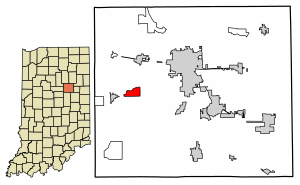
Swayzee is a town in Sims Township, Grant County, Indiana, United States. The population was 981 at the 2010 census. On its welcome sign, Swayzee claims to be "the only Swayzee in the world." This motto is based on a story about a postcard sent by a serviceman overseas during World War II, which although being addressed only to "Swayzee", with no mention of Indiana or any other information, was still said to have been successfully delivered.
Pipe Creek Sinkhole
Distance: Approx. 5660 meters
Latitude and longitude: 40.46081,-85.79462
The Pipe Creek Sinkhole near Swayzee in Grant County, Indiana, is one of the most important paleontological sites in the interior of the eastern half of North America. It is preserved because it was buried by glacial till. Uncovered in 1996 by workers at the Pipe Creek Junior limestone quarry, the sinkhole has yielded a diverse array of fossils from the Pliocene epoch, dating back five million years.

Jackson Township, Howard County, Indiana
Township in Indiana, United States
Distance: Approx. 7560 meters
Latitude and longitude: 40.52388889,-85.90805556
Jackson Township is one of eleven townships in Howard County, Indiana, United States. As of the 2020 census, its population was 605, up from 596 in 2010.

Franklin Township, Grant County, Indiana
Township in Indiana, United States
Distance: Approx. 7860 meters
Latitude and longitude: 40.52305556,-85.73083333
Franklin Township is one of thirteen townships in Grant County, Indiana, United States. As of the 2010 census, its population was 7,211 and it contained 3,553 housing units.

Sims Township, Grant County, Indiana
Township in Indiana, United States
Distance: Approx. 1435 meters
Latitude and longitude: 40.51916667,-85.82833333
Sims Township is one of 13 townships in Grant County, Indiana, United States. As of the 2010 census, its population was 1,779 and it contained 757 housing units.

Herbst, Indiana
Census-designated place in Indiana, United States
Distance: Approx. 2959 meters
Latitude and longitude: 40.51388889,-85.7875
Herbst is an unincorporated census-designated place in Franklin Township, Grant County, Indiana, in the United States. As of the 2010 census, the population was 112.
Roseburg, Grant County, Indiana
Unincorporated community in Indiana, United States
Distance: Approx. 7949 meters
Latitude and longitude: 40.52194444,-85.72944444
Roseburg is an unincorporated community in Franklin Township, Grant County, Indiana.

Sims, Indiana
Census-designated place in Indiana, United States
Distance: Approx. 3114 meters
Latitude and longitude: 40.49944444,-85.85666667
Sims is an unincorporated community and census-designated place (CDP) in Sims Township, Grant County, Indiana. In 2010 it had a population of 156.
Sycamore, Indiana
Unincorporated community in Indiana, United States
Distance: Approx. 8429 meters
Latitude and longitude: 40.49416667,-85.91944444
Sycamore is an unincorporated community in Jackson Township, Howard County, Indiana, United States. It is part of the Kokomo, Indiana Metropolitan Statistical Area.
Oak Hill High School (Indiana)
School in Converse, Grant County, Indiana, United States
Distance: Approx. 8006 meters
Latitude and longitude: 40.579319,-85.821725
Oak Hill High School is a high school located outside of Converse, Indiana. The School was founded in 1959, combining nearby high schools Sweetser, Swayzee, and Converse. Currently, there are three elementary schools in the school district, located in these towns.

Mier, Indiana
Census-designated place in Indiana, United States
Distance: Approx. 7496 meters
Latitude and longitude: 40.57472222,-85.82333333
Mier is an unincorporated community and census-designated place (CDP) in Richland Township, Grant County, Indiana, in the United States. As of the 2010 census it had a population of 78.
Normal, Indiana
Unincorporated community in Indiana, U.S.
Distance: Approx. 4727 meters
Latitude and longitude: 40.46504,-85.82526
Normal is an unincorporated community in Grant County, Indiana, in the United States.
Weather in this IP's area
clear sky
-18 Celsius
-25 Celsius
-19 Celsius
-17 Celsius
1035 hPa
73 %
1035 hPa
1000 hPa
10000 meters
6.17 m/s
270 degree