208.65.37.30 - IP Lookup: Free IP Address Lookup, Postal Code Lookup, IP Location Lookup, IP ASN, Public IP
Country:
Region:
City:
Location:
Time Zone:
Postal Code:
IP information under different IP Channel
ip-api
Country
Region
City
ASN
Time Zone
ISP
Blacklist
Proxy
Latitude
Longitude
Postal
Route
Luminati
Country
Region
nb
City
moncton
ASN
Time Zone
America/Moncton
ISP
FACIL12
Latitude
Longitude
Postal
IPinfo
Country
Region
City
ASN
Time Zone
ISP
Blacklist
Proxy
Latitude
Longitude
Postal
Route
IP2Location
208.65.37.30Country
Region
new brunswick
City
fredericton
Time Zone
America/Moncton
ISP
Language
User-Agent
Latitude
Longitude
Postal
db-ip
Country
Region
City
ASN
Time Zone
ISP
Blacklist
Proxy
Latitude
Longitude
Postal
Route
ipdata
Country
Region
City
ASN
Time Zone
ISP
Blacklist
Proxy
Latitude
Longitude
Postal
Route
Popular places and events near this IP address

CKHJ
Radio station in Fredericton, New Brunswick
Distance: Approx. 3487 meters
Latitude and longitude: 45.99777778,-66.69361111
CKHJ (1260 AM) is a radio station in Fredericton, New Brunswick, Canada. The station broadcasts a country format under the Pure Country branding. The station is owned by Bell Media which also owns sister stations CFXY-FM and CIBX-FM. There are two rebroadcasters of CKHJ on FM due to the AM station's weak signal to the south and east of the city: CKHJ-1-FM on 95.1 in New Maryland, and CKHJ-2-FM in 103.5 in Oromocto.

CKTP-FM
Radio station in Fredericton, New Brunswick
Distance: Approx. 2547 meters
Latitude and longitude: 45.97444444,-66.63111111
CKTP-FM is a Canadian radio station in Fredericton, New Brunswick which goes by the name of 95.7 The Wolf. The station broadcasts a mix of roots rock and blues from its studios on the St. Mary's First Nation, at an FM frequency of 95.7 MHz.

Westmorland Street Bridge
Bridge in Canada
Distance: Approx. 2826 meters
Latitude and longitude: 45.968692,-66.642637
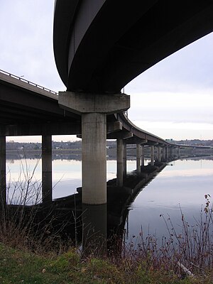
The Westmorland Street Bridge is a bridge crossing the Saint John River in Fredericton, New Brunswick, Canada. Opened on 19 September 1981, the Westmorland Street Bridge is an extension of Westmorland Street in Fredericton's central business district and connects with Route 105 (or the Ring Road) in Nashwaaksis, a neighbourhood of Fredericton since municipal amalgamation in the 1970s.
St. Mary's First Nation
Place in New Brunswick, Canada
Distance: Approx. 3241 meters
Latitude and longitude: 45.96666667,-66.63333333
St. Mary's Band or St. Mary's First Nation (Malecite-Passamaquoddy: Sitansisk Wolastoqiyik) is one of six Wolastoqiyik or Maliseet Nations on the Saint John River in Canada.
Leo Hayes High School
High school in Fredericton, New Brunswick, Canada
Distance: Approx. 2656 meters
Latitude and longitude: 45.97916667,-66.62166667
Leo Hayes High School is a public high school in Fredericton, New Brunswick, Canada, serving students between grades 9 and 12 on the city's north side. The school's motto is Dreams are the Seedlings of Reality.
Nashwaaksis
Distance: Approx. 918 meters
Latitude and longitude: 45.985453,-66.649032
Nashwaaksis is a neighbourhood and former village in the city of Fredericton, New Brunswick; it is located on the north bank of the Saint John River and at the mouth of the Nashwaaksis Stream, which should not be confused with the larger Nashwaak River nearby. The word Nashwaaksis is corrupted from the Maliseet word for the area, Nesuwahkik, with the "-sis" appendage meaning "little Nashwaak".
University of Fredericton
Online University based in Fredricton, New Brunswick
Distance: Approx. 3447 meters
Latitude and longitude: 45.963,-66.6431
The University of Fredericton is a private for-profit online university established in 2005 in Fredericton, New Brunswick. The university's first verified degrees were offered in 2007. It offers MBA, EMBA and Master’s Certificates through its Sandermoen School of Business.

Siege of Fort Nashwaak
Action of King William's War
Distance: Approx. 3382 meters
Latitude and longitude: 45.96358333,-66.64311111
The siege of Fort Nashwaak occurred during King William's War when New England forces from Boston attacked the capital of Acadia, Fort Nashwaak, at present-day Fredericton, New Brunswick. The siege was in retaliation for the French and Indian Siege of Pemaquid (1696) at present day Bristol, Maine. In the English Province of Massachusetts Bay.

Fredericton City Hall
Historic site in Fredericton, New Brunswick
Distance: Approx. 3393 meters
Latitude and longitude: 45.96348011,-66.64322269
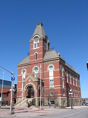
The Fredericton City Hall is the meeting place of the Fredericton City Council in Fredericton, New Brunswick, Canada. The three-storey building was constructed between 1875 and 1876 by architects McKean and Fairweather and built by H. B. Crosby and O. M. Campbell in the Second Empire style. It is located near Phoenix Square in Downtown Fredericton.

Greater Fredericton
Metropolitan area in New Brunswick, Canada
Distance: Approx. 3380 meters
Latitude and longitude: 45.96361111,-66.64305556
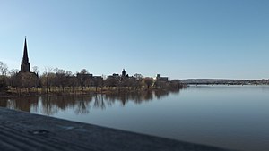
Greater Fredericton is the name given to the area encompassing the City of Fredericton in New Brunswick, Canada and its surroundings. Most of this area is along the Saint John River mainly on portions of Route 105, Route 102 and Route 101. Some of the areas mentioned below are included in the area of Greater Fredericton.
2018 Fredericton shooting
Shooting in Fredericton, Canada
Distance: Approx. 782 meters
Latitude and longitude: 45.987707,-66.654165
The Fredericton shooting was a mass shooting that occurred in Fredericton, New Brunswick, Canada, on the morning of 10 August 2018, in which four people, including two police officers, were killed. The shooter, Matthew Raymond, was found not criminally responsible in 2020.
12 Neighbours
Tiny house community in New Brunswick, Canada
Distance: Approx. 1941 meters
Latitude and longitude: 45.98638889,-66.62611111
12 Neighbours is a Canadian non-profit tiny house community in Fredericton, New Brunswick. Started in 2021 by multi-millionaire software engineer Marcel LeBrun, the community includes 96 tiny homes built between 2021 and 2024. LeBrun founded and funded the project, which was established as a means of combatting the homelessness and poverty crisis in the area.
Weather in this IP's area
light snow
-7 Celsius
-13 Celsius
-7 Celsius
-6 Celsius
999 hPa
73 %
999 hPa
993 hPa
10000 meters
3.6 m/s
300 degree
100 %