208.58.2.84 - IP Lookup: Free IP Address Lookup, Postal Code Lookup, IP Location Lookup, IP ASN, Public IP
Country:
Region:
City:
Location:
Time Zone:
Postal Code:
IP information under different IP Channel
ip-api
Country
Region
City
ASN
Time Zone
ISP
Blacklist
Proxy
Latitude
Longitude
Postal
Route
Luminati
Country
Region
dc
City
washington
ASN
Time Zone
America/New_York
ISP
RCN-AS
Latitude
Longitude
Postal
IPinfo
Country
Region
City
ASN
Time Zone
ISP
Blacklist
Proxy
Latitude
Longitude
Postal
Route
IP2Location
208.58.2.84Country
Region
new jersey
City
princeton
Time Zone
America/New_York
ISP
Language
User-Agent
Latitude
Longitude
Postal
db-ip
Country
Region
City
ASN
Time Zone
ISP
Blacklist
Proxy
Latitude
Longitude
Postal
Route
ipdata
Country
Region
City
ASN
Time Zone
ISP
Blacklist
Proxy
Latitude
Longitude
Postal
Route
Popular places and events near this IP address

Princeton, New Jersey
Borough in New Jersey, United States
Distance: Approx. 1057 meters
Latitude and longitude: 40.358244,-74.666728
Princeton is a borough in Mercer County, in the U.S. state of New Jersey. It was established on January 1, 2013, through the consolidation of the Borough of Princeton and Princeton Township, both of which are now defunct. As of the 2020 United States census, the borough's population was 30,681, an increase of 2,109 (+7.4%) from the 2010 census combined count of 28,572.

Princeton Township, New Jersey
Populated place in Mercer County, New Jersey, US
Distance: Approx. 1157 meters
Latitude and longitude: 40.357115,-74.670165
Princeton Township was a township in Mercer County, in the U.S. state of New Jersey, that existed from 1838 until the end of 2012. On January 1, 2013, it merged with the Borough of Princeton to form Princeton, New Jersey; both Princeton Township and the Borough of Princeton were dissolved in the merger. As of the 2010 United States Census, the township's population was 16,265, reflecting an increase of 238 (+1.5%) from the 16,027 counted in the 2000 census, which had in turn increased by 2,829 (+21.4%) from the 13,198 counted in the 1990 Census.

Princeton North, New Jersey
Populated place in Mercer County, New Jersey, US
Distance: Approx. 1637 meters
Latitude and longitude: 40.36138889,-74.65194444
Princeton North, also known as North Princeton, is an unincorporated community that is located in Princeton, in Mercer County, in the U.S. state of New Jersey. As of the 2000 census, the CDP population was 4,528. While the area was categorized as a census-designated place in the 2000 Census, the CDP status was eliminated by the United States Census Bureau as of the 2010 census.

Princeton Charter School
School in New Jersey
Distance: Approx. 1075 meters
Latitude and longitude: 40.36922222,-74.65702778
The Princeton Charter School (PCS) is a K-8 Charter school in Princeton, New Jersey. Admission to the school is by lottery, available to all residents of the town, and free of charge. The school was founded in 1997, following the passage, by the New Jersey Legislature, of the Charter School Program Act of 1995.

Princeton Public Schools
School district in Mercer County, New Jersey, US
Distance: Approx. 848 meters
Latitude and longitude: 40.361361,-74.663579
Princeton Public Schools (PPS) is a comprehensive community public school district that serves students in pre-kindergarten through twelfth grade from Princeton, in Mercer County, in the U.S. state of New Jersey. Students from Cranbury Township attend the district's high school as part of a sending/receiving relationship. The district administration building is at 25 Valley Road in Princeton.

Princeton Cemetery
Cemetery in Princeton, New Jersey
Distance: Approx. 1608 meters
Latitude and longitude: 40.355,-74.66
Princeton Cemetery is located in Princeton, New Jersey, United States. It is owned by the Nassau Presbyterian Church.

Stuart Country Day School
Catholic school in Mercer County, New Jersey, United States
Distance: Approx. 1339 meters
Latitude and longitude: 40.36777778,-74.68527778
Stuart Country Day School of the Sacred Heart is an independent all-girls Catholic country day school located in Princeton, in Mercer County, in the U.S. state of New Jersey, that serves students from pre-kindergarten through twelfth grade. Stuart is divided into a co-educational Early Childhood Program, a Lower School for junior kindergarten through grade 4, a Middle School for grades 5 through 8, and an Upper School for grades 9 through 12. The school was named for Janet Erskine Stuart.

Princeton High School (New Jersey)
High school in Mercer County, New Jersey, US
Distance: Approx. 1581 meters
Latitude and longitude: 40.357027,-74.656917
Princeton High School (PHS) is a four-year comprehensive public high school in Princeton, New Jersey, operating as part of the Princeton Public Schools district. Students from Cranbury Township attend PHS as part of a sending/receiving relationship with the Cranbury School District. The school has been accredited by the Middle States Association of Colleges and Schools Commission on Elementary and Secondary Schools since 1932 and is accredited through January 2026.

Donald Grant Herring Estate
Historic house in New Jersey, United States
Distance: Approx. 1654 meters
Latitude and longitude: 40.38197222,-74.66508333
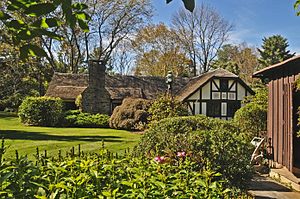
The Donald Grant Herring Estate, called Rothers Barrows, was designed by Wilson Eyre Jr. in 1919 for Donald Herring, a member of the Princeton University faculty. The three properties at 52, 72, and 75-77 Arreton Road are the surviving remnants of the 117-acre estate, which was subdivided in 1949.

Princeton Ice Company
United States historic place
Distance: Approx. 829 meters
Latitude and longitude: 40.36280556,-74.67708333
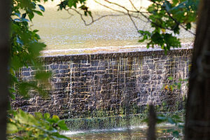
The Princeton Ice Company built a dam in 1884 on former farmland so as to allow for the production of ice for sale to residents and businesses in Princeton, New Jersey. This company was the primary supplier of ice to the town during the era of the frozen water trade before the advent of artificial refrigeration. In 1902 a second dam was added so as to increase ice production capacity.

Tusculum (Princeton, New Jersey)
United States historic place
Distance: Approx. 246 meters
Latitude and longitude: 40.36569444,-74.67116667
Tusculum is a country estate on Cherry Hill Road in Princeton, New Jersey, built in 1773 for John Witherspoon, president of Princeton University and signer of the Declaration of Independence. It is named after the Roman town of Tusculum, which was home to the country villa of Marcus Tullius Cicero. In 1793, the property was made available for purchase as a result of John Witherspoon's declining age, and was sought after by many refugees.
Princeton Shopping Center
Shopping mall in New Jersey, United States
Distance: Approx. 1619 meters
Latitude and longitude: 40.36361111,-74.65111111
The Princeton Shopping Center is an open-air shopping mall in Princeton, New Jersey. Encompassing 255,000 square feet (23,700 square meters) and around fifty stores and restaurants, the center is known for its distinctive mid-century design. It is also known for its community-based atmosphere and appeal.
Weather in this IP's area
mist
7 Celsius
7 Celsius
5 Celsius
9 Celsius
1024 hPa
97 %
1024 hPa
1017 hPa
4023 meters
100 %
