208.53.226.26 - IP Lookup: Free IP Address Lookup, Postal Code Lookup, IP Location Lookup, IP ASN, Public IP
Country:
Region:
City:
Location:
Time Zone:
Postal Code:
IP information under different IP Channel
ip-api
Country
Region
City
ASN
Time Zone
ISP
Blacklist
Proxy
Latitude
Longitude
Postal
Route
Luminati
Country
Region
sd
City
pierre
ASN
Time Zone
America/Chicago
ISP
SDNW-13576
Latitude
Longitude
Postal
IPinfo
Country
Region
City
ASN
Time Zone
ISP
Blacklist
Proxy
Latitude
Longitude
Postal
Route
IP2Location
208.53.226.26Country
Region
south dakota
City
pierre
Time Zone
America/Chicago
ISP
Language
User-Agent
Latitude
Longitude
Postal
db-ip
Country
Region
City
ASN
Time Zone
ISP
Blacklist
Proxy
Latitude
Longitude
Postal
Route
ipdata
Country
Region
City
ASN
Time Zone
ISP
Blacklist
Proxy
Latitude
Longitude
Postal
Route
Popular places and events near this IP address

South Dakota State Capitol
State capitol building of the U.S. state of South Dakota
Distance: Approx. 383 meters
Latitude and longitude: 44.367167,-100.346353
The South Dakota State Capitol is the state capitol building of the U.S. state of South Dakota. Housing the South Dakota State Legislature, it is located in the state capital of Pierre at 500 East Capitol Avenue. The building houses the offices of most state officials, including the Governor of South Dakota.
Methodist Episcopal Church (Pierre, South Dakota)
Historic church in South Dakota, United States
Distance: Approx. 368 meters
Latitude and longitude: 44.37111111,-100.35333333
The Methodist Episcopal Church built in 1910 is an historic Methodist church located at 117 Central Avenue, North in Pierre, South Dakota. The original congregation, which dates from 1880, moved in 1881 from rented halls to its first building on Fort Street. In 1883 it moved to a building on the present Central Avenue site.
Hughes County Courthouse
United States historic place
Distance: Approx. 100 meters
Latitude and longitude: 44.36916667,-100.35055556
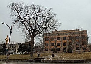
The Hughes County Courthouse, located on Capitol Avenue in Pierre, is the center of government of Hughes County, South Dakota. The courthouse was built from 1934 to 1935, replacing a building built in 1883. Architects Hugill & Blatherwick designed the building in the Moderne style with Art Deco details, a common design choice in courthouses of the period.
Karcher Block
United States historic place
Distance: Approx. 394 meters
Latitude and longitude: 44.36583333,-100.35444444
The Karcher Block is a historic commercial building located at 366 S. Pierre St. in Pierre, South Dakota. Businessman Henry Karcher commissioned the Italianate building in 1884.
Central Block (Pierre, South Dakota)
United States historic place
Distance: Approx. 463 meters
Latitude and longitude: 44.36555556,-100.35527778
The Central Block is a historic commercial building located at 321–325 S. Pierre St. in Pierre, South Dakota. The Italianate masonry building was constructed in 1884 and was one of Pierre's earliest masonry commercial buildings.
Hilger Block
United States historic place
Distance: Approx. 349 meters
Latitude and longitude: 44.36805556,-100.35527778
The Hilger Block is a historic commercial building located at 361 S. Pierre St. in Pierre, South Dakota. J.D. Hilger built the building in 1883 to use as a clothing store.
St. Charles Hotel (Pierre, South Dakota)
United States historic place
Distance: Approx. 50 meters
Latitude and longitude: 44.36833333,-100.35027778
The St. Charles Hotel is a historic hotel located at 207 E. Capitol Ave. in Pierre, South Dakota.
Farr House
Historic house in South Dakota, United States
Distance: Approx. 379 meters
Latitude and longitude: 44.37138889,-100.34888889
The Farr House is a historic house located at 106 E. Wynoka St. in Pierre, South Dakota. Built in 1904, the house was designed by architect E. J. Donahue in the Colonial Revival style.
John E. and Ruth Hipple House
Historic house in South Dakota, United States
Distance: Approx. 287 meters
Latitude and longitude: 44.36916667,-100.3475
The John E. and Ruth Hipple House is a historic house located at 219 N. Highland in Pierre, South Dakota. Built in 1913, the Prairie School house features a roof with a low pitch and overhanging eaves, a front porch, and a horizontal emphasis throughout its design. The home was originally owned by John E. and Ruth Hipple, both of whom were prominent Pierre citizens.
Horner–Hyde House
Historic house in South Dakota, United States
Distance: Approx. 133 meters
Latitude and longitude: 44.36944444,-100.35138889
The Horner–Hyde House is a historic house located at 100 W. Capitol Ave. in Pierre, South Dakota. Henry Horner started building the house in 1889 and continued adding to it until 1913.
Karcher–Sahr House
Historic house in South Dakota, United States
Distance: Approx. 415 meters
Latitude and longitude: 44.36916667,-100.34583333
The Karcher–Sahr House is a historic house located at 222 E. Prospect St. in Pierre, South Dakota. Built in 1910, the house was designed in the Classical Revival style.
KCCR-FM
Radio station in Blunt, South Dakota
Distance: Approx. 114 meters
Latitude and longitude: 44.369052,-100.351869
KCCR-FM (104.5 FM) is a radio station licensed to Blunt, South Dakota, serving the Pierre, South Dakota market. KCCR-FM began transmitting on June 13, 2014.
Weather in this IP's area
clear sky
-1 Celsius
-5 Celsius
-1 Celsius
0 Celsius
1014 hPa
93 %
1014 hPa
960 hPa
10000 meters
3.13 m/s
4.47 m/s
248 degree


