Country:
 United States Virgin Islands
Region:
City:
Latitude and Longitude:
Time Zone:
Postal Code:
IP information under different IP Channel
ip-api
Country
Region
City
ASN
Time Zone
ISP
Blacklist
Proxy
Latitude
Longitude
Postal
Route
IPinfo
Country
Region
City
ASN
Time Zone
ISP
Blacklist
Proxy
Latitude
Longitude
Postal
Route
MaxMind
Country
Region
City
ASN
Time Zone
ISP
Blacklist
Proxy
Latitude
Longitude
Postal
Route
Luminati
Country
VIRegion
t
City
charlotteamalie
ASN
Time Zone
America/St_Thomas
ISP
VIPNAS1
Latitude
Longitude
Postal
db-ip
Country
Region
City
ASN
Time Zone
ISP
Blacklist
Proxy
Latitude
Longitude
Postal
Route
ipdata
Country
Region
City
ASN
Time Zone
ISP
Blacklist
Proxy
Latitude
Longitude
Postal
Route
Popular places and events near this IP address

Roman Catholic Diocese of Saint Thomas
Latin Catholic jurisdiction in the Caribbean
Distance: Approx. 599 meters
Latitude and longitude: 18.34111111,-64.93666667
The Diocese of Saint Thomas in the Virgin Islands (Latin: Diœcesis Sancti Thomae in Insulis Virgineis) is a Latin Church ecclesiastical territory or diocese of the Catholic Church for the U.S. Virgin Islands. It is the only suffragan diocese in the ecclesiastical province of the metropolitan Archdiocese of Washington. The mother church of the diocese is Saints Peter and Paul Cathedral in St.

Saints Peter and Paul Cathedral (St. Thomas, U.S. Virgin Islands)
Church in U.S. Virgin Islands , United States
Distance: Approx. 604 meters
Latitude and longitude: 18.34101111,-64.93679167
Saints Peter and Paul Cathedral is a cathedral of the Roman Catholic Church in the United States Virgin Islands. It is the mother church and seat of the Diocese of Saint Thomas. It is located in the City of Charlotte Amalie.

Blackbeard's Castle
United States historic place
Distance: Approx. 674 meters
Latitude and longitude: 18.34384167,-64.92959167
Blackbeard's Castle is one of five National Historic Landmarks in the U.S. Virgin Islands. It is located in the city of Charlotte Amalie, on the island of St. Thomas.
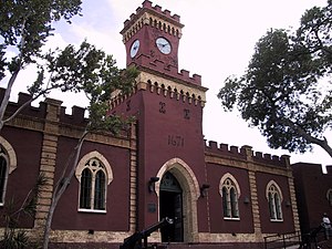
Fort Christian
United States historic place
Distance: Approx. 373 meters
Latitude and longitude: 18.34083333,-64.92972222
Fort Christian is a Dano-Norwegian-built fort in Charlotte Amalie, Saint Thomas, U.S. Virgin Islands. Built 1672-1680, early in the first successful colonial establishment on the island, the fort served as a critical point of defense and government during the entire period of Dano-Norwegian, and later Danish, administration, which ended in 1917 with the sale of the islands to the United States. It currently holds the St.

St. Thomas Synagogue
Reform synagogue in the US Virgin Islands
Distance: Approx. 736 meters
Latitude and longitude: 18.34472222,-64.93305556
St. Thomas Synagogue, officially Congregation Beracha Veshalom Vegmiluth Hasadim (Hebrew: קהל קדוש ברכה ושלום וגמילות חסדים) or The Hebrew Congregation of St. Thomas, is a historic Reform Jewish synagogue located at 2116 Crystal Gade, Queens Quarters, in Charlotte Amalie on the island of Saint Thomas in the U.S. Virgin Islands.

Sts. Peter & Paul School
Private coeducational school in St. Thomas, United States
Distance: Approx. 605 meters
Latitude and longitude: 18.34361111,-64.93138889
Sts. Peter & Paul School is a private Roman Catholic high school in St. Thomas, United States Virgin Islands.

Estate Catherineberg
Distance: Approx. 651 meters
Latitude and longitude: 18.34388889,-64.93333333
Estate Catherineberg is a historic mansion on Denmark Hill in Charlotte Amalie, on Saint Thomas island, in the territory of the United States Virgin Islands. It is owned by the Virgin Islands territorial government and previously served as a residence for the governor of the U.S. Virgin Islands. The last governor to reside there was Charles Turnbull.
Fort Christian, U.S. Virgin Islands
Distance: Approx. 373 meters
Latitude and longitude: 18.34083333,-64.92972222
Fort Christian is a settlement on the island of Saint Thomas in the United States Virgin Islands.

Creque Marine Railway
Distance: Approx. 678 meters
Latitude and longitude: 18.3356,-64.9377
The Creque Marine Railway, formerly the "St Thomas Marine Repair Facility", is an inclined-plane ship railway on Hassel Island, in the bay of Charlotte Amalie off the coast of St. Thomas Island, in the U.S. Virgin Islands. Its site is below Fort Shipley, within Virgin Islands National Park.

Emancipation Garden
Distance: Approx. 374 meters
Latitude and longitude: 18.3412,-64.9303
Emancipation Garden is a park in Saint Thomas, U.S. Virgin Islands The park was built to commemorate the freeing of the slaves which took place on July 3, 1848. A commemorative plaque, a bronze bust of a freed slave blowing a conch shell, and a replica of the Liberty Bell are featured. The park was also ringed with a fence of old ships' anchor chain and cannons recovered from the harbor.
The Real World: St. Thomas
Season of television series
Distance: Approx. 556 meters
Latitude and longitude: 18.33416667,-64.935
The Real World: St. Thomas is the twenty-seventh season of MTV's reality television series The Real World, which focuses on a group of diverse strangers living together for several months in a different city each season, as cameras follow their lives and interpersonal relationships. It is the only season of The Real World to be filmed in the Caribbean, and the second season set in the United States to be filmed outside of the contiguous United States after The Real World: Hawaii.

Hamburg-America Shipping Line Administrative Offices
United States historic place
Distance: Approx. 390 meters
Latitude and longitude: 18.341667,-64.931389
The Hamburg-America Shipping Line Administrative Offices, also known as United States District Courts Building, in Charlotte Amalie in Saint Thomas, U.S. Virgin Islands, was built in 1914. It was listed on the National Register of Historic Places in 1978. It was built for the Hamburg-Amerikanische Packetfahrt Aktien Gesellschaft and held offices for the Superintendent Counsul and also for the Imperial German Consulate.
Weather in this IP's area
scattered clouds
31 Celsius
38 Celsius
31 Celsius
32 Celsius
1012 hPa
74 %
1012 hPa
1012 hPa
10000 meters
2.57 m/s
150 degree
40 %
06:14:14
17:55:00