208.156.113.15 - IP Lookup: Free IP Address Lookup, Postal Code Lookup, IP Location Lookup, IP ASN, Public IP
Country:
Region:
City:
Location:
Time Zone:
Postal Code:
ISP:
ASN:
language:
User-Agent:
Proxy IP:
Blacklist:
IP information under different IP Channel
ip-api
Country
Region
City
ASN
Time Zone
ISP
Blacklist
Proxy
Latitude
Longitude
Postal
Route
db-ip
Country
Region
City
ASN
Time Zone
ISP
Blacklist
Proxy
Latitude
Longitude
Postal
Route
IPinfo
Country
Region
City
ASN
Time Zone
ISP
Blacklist
Proxy
Latitude
Longitude
Postal
Route
IP2Location
208.156.113.15Country
Region
louisiana
City
monroe
Time Zone
America/Chicago
ISP
Language
User-Agent
Latitude
Longitude
Postal
ipdata
Country
Region
City
ASN
Time Zone
ISP
Blacklist
Proxy
Latitude
Longitude
Postal
Route
Popular places and events near this IP address

Monroe, Louisiana
City in Louisiana, United States
Distance: Approx. 2172 meters
Latitude and longitude: 32.50944444,-92.11833333
Monroe is the ninth-largest city in the U.S. state of Louisiana, and is the parish seat and largest city of Ouachita Parish. With a 2020 census-tabulated population of 47,702, it is the principal city of the Monroe metropolitan statistical area, the second-largest metropolitan area in North Louisiana.
University of Louisiana at Monroe
Public university in Monroe, Louisiana, U.S.
Distance: Approx. 3107 meters
Latitude and longitude: 32.527,-92.074
The University of Louisiana at Monroe (ULM) is a public university in Monroe, Louisiana. It is part of the University of Louisiana System.
Biedenharn Museum and Gardens
Museum in Louisiana
Distance: Approx. 2385 meters
Latitude and longitude: 32.5197,-92.1312
The Biedenharn Museum and Gardens is a home museum and botanical garden located beside the Ouachita River at 2006 Riverside Drive in Monroe in Ouachita Parish, Louisiana, United States. It has three exhibits: the historic home and botanical gardens, Coca-Cola museum, and Bible museum. The Coca-Cola Museum opened in 2008 and holds Coca-Cola memorabilia and historical items.

Monroe Civic Center
Arena in Louisiana, United States
Distance: Approx. 2643 meters
Latitude and longitude: 32.502754,-92.107251
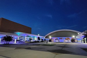
The Monroe Civic Center is a 7,600-seat, full-service, multi-purpose arena located in Monroe, Louisiana, built in 1965. The facility is home to the Monroe Moccasins ice hockey team and was previously home to the original Monroe Moccasins and the Louisiana Bayou Beast indoor football team.

West Monroe High School
Public high school in West Monroe, Louisiana, United States
Distance: Approx. 3425 meters
Latitude and longitude: 32.5115,-92.13896
West Monroe High School is a high school in West Monroe, Louisiana, United States. It is administered by the Ouachita Parish School Board. WMHS is fully accredited by the Southern Association of Colleges and Schools.
St. Frederick High School (Monroe, Louisiana)
Private school in Monroe, , Louisiana, United States
Distance: Approx. 2050 meters
Latitude and longitude: 32.53666667,-92.08888889
St. Frederick High School is a private, Catholic high school in Monroe, Louisiana. The school was established in 1964 by the Daughters of the Cross and named in honor of Rae Frederick Rinehart Jr., whose family donated the land the school is located on.

Neville High School
Public school in Monroe, , Louisiana, United States
Distance: Approx. 1872 meters
Latitude and longitude: 32.52222222,-92.12638889
Neville High School is a high school in Monroe, Louisiana, United States. It is administered by the Monroe City Schools Board. It is located 1/2 mile from the Ouachita River.

Masur Museum of Art
Historic house in Louisiana, United States
Distance: Approx. 2133 meters
Latitude and longitude: 32.510278,-92.095
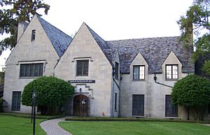
The Masur Museum of Art in Monroe, Louisiana in the United States, is the largest visual arts museum in northeast Louisiana. It is in the former home of the Masur family, the Masur House, also known as the Slagle-Masur House, which is listed on the National Register of Historic Places. The building, constructed in modified Tudor style in 1929, was listed on the National Register in 1982 for its architecture.

First United Methodist Church (West Monroe, Louisiana)
Historic church in Louisiana, United States
Distance: Approx. 3424 meters
Latitude and longitude: 32.49944444,-92.12444444
First United Methodist Church is a historic Methodist church at 101 N. 2nd Street in West Monroe, Louisiana. It was added to the National Register in 2001. Its main block is a Colonial Revival-style two-and-one-half story masonry church erected in 1920.
St. James United Methodist Church (Monroe, Louisiana)
Historic church in Louisiana, United States
Distance: Approx. 1876 meters
Latitude and longitude: 32.50972222,-92.10527778
St. James United Methodist Church is a historic Methodist church building at 916 Adams Street in Monroe, Louisiana. It was built in 1923 in a Gothic Revival style and was added to the National Register of Historic Places in 1992.
Carroll High School (Monroe, Louisiana)
School in Monroe, Ouachita Parish, Louisiana, United States
Distance: Approx. 2350 meters
Latitude and longitude: 32.5154,-92.0858
Carroll High School is a senior high school in Monroe, Louisiana, United States and a part of Monroe City Schools. It was preceded by Monroe Colored High School. Abe E. Pierce III and Joseph A. Johnson Jr.

Roland M. Filhiol House
United States historic place
Distance: Approx. 3425 meters
Latitude and longitude: 32.49611111,-92.11277778
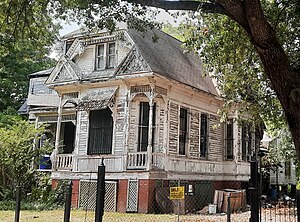
The Roland M. Filhiol House, at 111 Stone Ave. in Monroe, Louisiana, was built in 1895. It was listed on the National Register of Historic Places in 1995.
Weather in this IP's area
clear sky
-2 Celsius
-2 Celsius
-2 Celsius
-2 Celsius
1031 hPa
86 %
1031 hPa
1027 hPa
10000 meters
