Country:
Region:
City:
Latitude and Longitude:
Time Zone:
Postal Code:
IP information under different IP Channel
ip-api
Country
Region
City
ASN
Time Zone
ISP
Blacklist
Proxy
Latitude
Longitude
Postal
Route
Luminati
Country
ASN
Time Zone
America/Chicago
ISP
LLNW
Latitude
Longitude
Postal
IPinfo
Country
Region
City
ASN
Time Zone
ISP
Blacklist
Proxy
Latitude
Longitude
Postal
Route
db-ip
Country
Region
City
ASN
Time Zone
ISP
Blacklist
Proxy
Latitude
Longitude
Postal
Route
ipdata
Country
Region
City
ASN
Time Zone
ISP
Blacklist
Proxy
Latitude
Longitude
Postal
Route
Popular places and events near this IP address

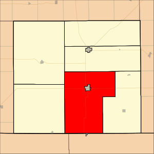
Harper County, Kansas
County in Kansas, United States
Distance: Approx. 6949 meters
Latitude and longitude: 37.2,-98.08333333
Harper County is a county located in the U.S. state of Kansas. Its county seat and most populous city is Anthony. As of the 2020 census, the county population was 5,485.

Anthony, Kansas
City in Harper County, Kansas
Distance: Approx. 1132 meters
Latitude and longitude: 37.15888889,-98.04194444
Anthony is a city in and the county seat of Harper County, Kansas, United States. As of the 2020 census, the population of the city was 2,108.

Township 3, Harper County, Kansas
Township in Kansas, United States
Distance: Approx. 9418 meters
Latitude and longitude: 37.07166667,-98.05861111
Township 3 is a township in Harper County, Kansas, United States. As of the 2010 census, the population is 300.
Chaparral High School (Kansas)
High school in Anthony, Kansas, United States
Distance: Approx. 7319 meters
Latitude and longitude: 37.2186727,-98.0411296
Chaparral High School is a public secondary school in rural Harper County, Kansas, United States, and located approximately halfway between the cities of Anthony and Harper. The school is operated by Chaparral USD 361 school district, and serves students of grades 7 to 12.

Harper County Courthouse (Kansas)
United States historic place
Distance: Approx. 188 meters
Latitude and longitude: 37.15388889,-98.02916667
The Harper County Courthouse, located at 201 N. Jennings Ave. in Anthony, is the seat of government of Harper County, Kansas. Built in 1907, the courthouse replaced a smaller and more modest courthouse and represented the county's prosperity at the time.
Anthony Public Library
United States historic place
Distance: Approx. 2597 meters
Latitude and longitude: 37.15277778,-98.00194444
The current Anthony Public Library is located at 624 E. Main Street in Anthony, Kansas. Its former building located at 104 N. Springfield in Anthony, Kansas, is a Carnegie library which was built in 1911. It was listed on the National Register of Historic Places in 1987 as "Anthony Public (Carnegie) Library".
Anthony Theater
United States historic place
Distance: Approx. 132 meters
Latitude and longitude: 37.15222222,-98.03138889
The Anthony Theater, located at 220 W. Main St. in Anthony, Kansas, is an Art Deco-style theater built in 1936. It was listed on the National Register of Historic Places in 1991.
First Congregational Church (Anthony, Kansas)
United States historic place
Distance: Approx. 18 meters
Latitude and longitude: 37.15333333,-98.03138889
The First Congregational Church, located at 202 N. Bluff Ave. in Anthony, Kansas, was completed in 1910, replacing the 1880 first church of the congregation. It was listed on the National Register of Historic Places in 2014.
Anthony United States Post Office
United States historic place
Distance: Approx. 1094 meters
Latitude and longitude: 37.15388889,-98.01888889
The Anthony United States Post Office, listed on the National Register of Historic Places as US Post Office—Anthony, is located at 121 W. Steadman in Anthony, Kansas. It was built in 1939. It was listed on the National Register in 1989.
Chaparral USD 361
Public school district in Anthony, Kansas
Distance: Approx. 107 meters
Latitude and longitude: 37.15277778,-98.03027778
Chaparral USD 361 is a public unified school district headquartered in Anthony, Kansas, United States. The district includes the communities of Anthony, Harper, Bluff City, Danville, Waldron, Crystal Springs, Duquoin, Freeport, Runnymede, and nearby rural areas.
Weather in this IP's area
overcast clouds
10 Celsius
10 Celsius
10 Celsius
10 Celsius
1007 hPa
90 %
1007 hPa
958 hPa
10000 meters
4.03 m/s
7.54 m/s
318 degree
99 %
07:01:08
17:30:20