207.98.246.163 - IP Lookup: Free IP Address Lookup, Postal Code Lookup, IP Location Lookup, IP ASN, Public IP
Country:
Region:
City:
Location:
Time Zone:
Postal Code:
IP information under different IP Channel
ip-api
Country
Region
City
ASN
Time Zone
ISP
Blacklist
Proxy
Latitude
Longitude
Postal
Route
Luminati
Country
Region
mi
City
warren
ASN
Time Zone
America/Detroit
ISP
WOW-INTERNET
Latitude
Longitude
Postal
IPinfo
Country
Region
City
ASN
Time Zone
ISP
Blacklist
Proxy
Latitude
Longitude
Postal
Route
IP2Location
207.98.246.163Country
Region
alabama
City
lanett
Time Zone
America/Chicago
ISP
Language
User-Agent
Latitude
Longitude
Postal
db-ip
Country
Region
City
ASN
Time Zone
ISP
Blacklist
Proxy
Latitude
Longitude
Postal
Route
ipdata
Country
Region
City
ASN
Time Zone
ISP
Blacklist
Proxy
Latitude
Longitude
Postal
Route
Popular places and events near this IP address

Huguley, Alabama
Census-designated place in Alabama, United States
Distance: Approx. 3474 meters
Latitude and longitude: 32.838003,-85.233139
Huguley ( HEW-goo-lee) is a census-designated place (CDP) and unincorporated community in Chambers County, Alabama, United States. At the 2020 census, the population was 2,470.
Lanett, Alabama
City in Alabama, United States
Distance: Approx. 3472 meters
Latitude and longitude: 32.863424,-85.199684
Lanett is a city in Chambers County, Alabama, United States. At the 2010 census the population was 6,468, down from 7,897 in 2000. Lanett, originally called Bluffton, is located in eastern Alabama, on the Chattahoochee River, southwest of Atlanta.
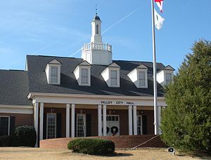
Valley, Alabama
City in Alabama, United States
Distance: Approx. 8424 meters
Latitude and longitude: 32.811387,-85.177938
Valley is a city in Chambers County, Alabama, United States. Valley was incorporated in 1980 combining the four textile mill villages of Fairfax, Langdale, River View, and Shawmut. As of the 2020 census it had a population of 10,529.

West Point, Georgia
City in Georgia, United States
Distance: Approx. 5882 meters
Latitude and longitude: 32.87638889,-85.17388889
West Point is a city in Troup and Harris counties in the U.S. state of Georgia. It is located approximately halfway between Montgomery, Alabama and Atlanta along Interstate 85. As of 2020, its population was 3,719.

Point University
Private Christian college in West Point, Georgia, United States
Distance: Approx. 4742 meters
Latitude and longitude: 32.8791,-85.1869
Point University is a private evangelical Christian college in West Point, Georgia and was founded in 1937 as Atlanta Christian College in East Point. The college announced its name change to Point University in 2011 and relocated its main campus to West Point in June 2012. As of 2022, over 2,000 students are enrolled both onsite and online.

WPCH (AM)
Radio station in Georgia, United States
Distance: Approx. 8043 meters
Latitude and longitude: 32.89666667,-85.15666667
WPCH (1310 AM) is a radio station broadcasting a sports format. Licensed to West Point, Georgia, United States, the station is owned by San Antonio–based iHeartMedia, through licensee iHM Licenses, LLC, and features programming from Fox Sports Radio.
Langdale Historic District
Historic district in Alabama, United States
Distance: Approx. 8860 meters
Latitude and longitude: 32.81194444,-85.17027778
Langdale Historic District is a historic district in Valley, Alabama, and Harris County, Georgia, United States. It was listed on the Alabama Register of Landmarks and Heritage on July 22, 1991, and the National Register of Historic Places (NRHP) on November 12, 1999. It lies primarily in Valley, Alabama, on the west side of the Chattahoochee River.
Springwood School
Private school in Lanett, Alabama, United States
Distance: Approx. 2611 meters
Latitude and longitude: 32.8765,-85.209697
Springwood School is a private school in Lanett, Alabama, United States. The school was founded in 1970 and has been described as segregation academy.
Hawkes Children's Library of West Point
United States historic place
Distance: Approx. 5163 meters
Latitude and longitude: 32.87638889,-85.18166667
The Hawkes Children's Library in West Point, Georgia was built in 1922. It is one of the Hawkes Children's Library buildings inspired and funded with support from Albert King Hawkes, who funded six children's libraries in rural towns throughout Georgia. The building is a work of architectural and engineering firm Robert & Co.
Point Skyhawks
Athletic Teams representing Point University in West Point, Georgia
Distance: Approx. 4742 meters
Latitude and longitude: 32.8791,-85.1869
The Point Skyhawks are the athletic teams that represent Point University, located in West Point, Georgia, in intercollegiate sports in the National Association of Intercollegiate Athletics (NAIA). The Skyhawks primarily compete in the Southern States Athletic Conference (SSAC). They are affiliate members of the Appalachian Athletic Conference for football.
Lanett City School District
School district in Alabama, United States
Distance: Approx. 4191 meters
Latitude and longitude: 32.868213,-85.191384
Lanett City School District is a school district in Chambers County, Alabama, United States. It was established in 1898.
Shawmut Historic District
Historic district in Alabama, United States
Distance: Approx. 5894 meters
Latitude and longitude: 32.84027778,-85.18333333
The Shawmut Historic District, in Valley, Alabama, United States, is a historic district which was listed on the National Register of Historic Places in 1999. The listing included 275 contributing buildings, a contributing structure, and a contributing site on 201 acres (0.81 km2). It is roughly bounded by 25th Boulevard, 29th Boulevard, 20th Avenue, 35th Street, and 38th Boulevard.
Weather in this IP's area
clear sky
13 Celsius
12 Celsius
13 Celsius
13 Celsius
1022 hPa
49 %
1022 hPa
998 hPa
10000 meters
4.23 m/s
6.71 m/s
316 degree
6 %


