Country:
 USA
USARegion:
City:
Latitude and Longitude:
Time Zone:
Postal Code:
IP information under different IP Channel
ip-api
Country
Region
City
ASN
Time Zone
ISP
Blacklist
Proxy
Latitude
Longitude
Postal
Route
IPinfo
Country
Region
City
ASN
Time Zone
ISP
Blacklist
Proxy
Latitude
Longitude
Postal
Route
MaxMind
Country
Region
City
ASN
Time Zone
ISP
Blacklist
Proxy
Latitude
Longitude
Postal
Route
Luminati
Country
USRegion
mi
City
plymouth
ASN
Time Zone
America/Detroit
ISP
123NET
Latitude
Longitude
Postal
db-ip
Country
Region
City
ASN
Time Zone
ISP
Blacklist
Proxy
Latitude
Longitude
Postal
Route
ipdata
Country
Region
City
ASN
Time Zone
ISP
Blacklist
Proxy
Latitude
Longitude
Postal
Route
Popular places and events near this IP address
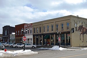
Plymouth, Michigan
City in Michigan, United States
Distance: Approx. 563 meters
Latitude and longitude: 42.37138889,-83.47055556
Plymouth is a city in Wayne County in the U.S. state of Michigan. A western suburb of Detroit, Plymouth is located roughly 27 miles (43.5 km) northwest of downtown Detroit, and 18 miles (29.0 km) northeast of Ann Arbor. As of the 2020 census, the city had a population of 9,370.

Plymouth Charter Township, Michigan
Charter township in Michigan, United States
Distance: Approx. 419 meters
Latitude and longitude: 42.37,-83.48194444
Plymouth Township is a charter township in Wayne County in the U.S. state of Michigan. A western suburb of Detroit, Plymouth Township is located roughly 27 miles (43.5 km) northwest of downtown Detroit, and 16 miles (25.7 km) northeast of Ann Arbor. As of the 2020 census, the township had a population of 27,938.
Plymouth-Canton Educational Park
Public secondary school in the United States
Distance: Approx. 2708 meters
Latitude and longitude: 42.34852,-83.49356
The Plymouth-Canton Educational Park (commonly PCEP or "The Park") encompasses three public secondary schools—Salem High School, Canton High School, and Plymouth High School—in Canton Township, Michigan, United States within Metro Detroit. PCEP is located on a 305-acre (123 ha) campus. PCEP is part of the Plymouth-Canton Community Schools District, serving portions of Wayne County and Washtenaw County, including City of Plymouth, Plymouth Township, and parts of Canton Township, Salem Township, Superior Township, and Northville Township.
WSDP
Radio station in Plymouth, Michigan
Distance: Approx. 2715 meters
Latitude and longitude: 42.3495,-83.4958
WSDP is the student-operated radio station owned by the Plymouth-Canton Educational Park in Canton, Michigan. The station positions itself as 88.1 The Park. WSDP is operated out of Salem High School and has been in operation since February 14, 1972.
Carlton D. Wall House
Historic house in Michigan, United States
Distance: Approx. 2865 meters
Latitude and longitude: 42.37111111,-83.51166667
The Carlton D. Wall House, also known as Snowflake, is a Frank Lloyd Wright designed home in Plymouth Township, Michigan. It is one of Wright's more elaborate Usonian homes. In 1941, recently married Mr.

Henry W. Baker House
Historic house in Michigan, United States
Distance: Approx. 820 meters
Latitude and longitude: 42.37194444,-83.4675
The Henry W. Baker House is located at 233 S. Main St. in Plymouth, Michigan. It was built by its original owner as a private home, but now houses commercial space.

Charles G. Curtiss Sr. House
Historic house in Michigan, United States
Distance: Approx. 928 meters
Latitude and longitude: 42.37194444,-83.46611111
The Charles G. Curtiss Sr. House is a private home at 168 S. Union St. in Plymouth, Michigan in the United States.

Phoenix Mill
Distance: Approx. 2688 meters
Latitude and longitude: 42.3925,-83.46694444
Phoenix Mill was part of Henry Ford's Village industries project and ran from 1922 to 1948 in Plymouth, Michigan.: 162 Generator cutouts, voltage regulators, gauges and light switches for Ford vehicles were produced at the plant.: 162
Plymouth High School (Michigan)
Distance: Approx. 3105 meters
Latitude and longitude: 42.34681111,-83.49885556
Plymouth High School is a public high school in Canton Township, Michigan, United States. Plymouth High School is located on a campus of the Plymouth-Canton Educational Park in Wayne County.

Starkweather School
United States historic place
Distance: Approx. 1740 meters
Latitude and longitude: 42.37833333,-83.45944444
Starkweather School is an educational building located at 550 North Holbrook Street in Plymouth, Michigan. It was listed on the National Register of Historic Places in 2016. It is the only school from its time still extant in Plymouth, and the only school in Plymouth designed by Malcomson and Higginbotham, who designed numerous schools for the Detroit school district.

St. John's Provincial Seminary
Catholic seminary in Michigan
Distance: Approx. 2805 meters
Latitude and longitude: 42.3947,-83.4765
St. John's Provincial Seminary was a Catholic major seminary in the Archdiocese of Detroit that operated between 1949 and 1988 in Plymouth, Michigan.

United States Post Office Plymouth Station
United States historic place
Distance: Approx. 638 meters
Latitude and longitude: 42.37166667,-83.46972222
The United States Post Office Plymouth Station is a former post office located at 860 Penniman Avenue in Plymouth, Michigan. It was listed on the National Register of Historic Places in 2024. The building houses Westborn Market.
Weather in this IP's area
clear sky
13 Celsius
12 Celsius
12 Celsius
15 Celsius
1031 hPa
61 %
1031 hPa
1005 hPa
10000 meters
2.06 m/s
110 degree
07:50:39
18:46:56