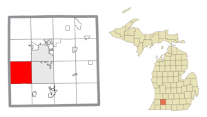
Country:
Region:
City:
Latitude and Longitude:
Time Zone:
Postal Code:
IP information under different IP Channel
ip-api
Country
Region
City
ASN
Time Zone
ISP
Blacklist
Proxy
Latitude
Longitude
Postal
Route
Luminati
Country
Region
mi
City
portage
ASN
Time Zone
America/Detroit
ISP
MERIT-AS-14
Latitude
Longitude
Postal
IPinfo
Country
Region
City
ASN
Time Zone
ISP
Blacklist
Proxy
Latitude
Longitude
Postal
Route
db-ip
Country
Region
City
ASN
Time Zone
ISP
Blacklist
Proxy
Latitude
Longitude
Postal
Route
ipdata
Country
Region
City
ASN
Time Zone
ISP
Blacklist
Proxy
Latitude
Longitude
Postal
Route
Popular places and events near this IP address

Portage, Michigan
City in Michigan, United States
Distance: Approx. 4117 meters
Latitude and longitude: 42.20972222,-85.58861111
Portage is a city in Kalamazoo County, Michigan, United States. The population was 48,891 at the 2020 census. It is the smaller of the two main cities included in the Kalamazoo-Portage Metropolitan Statistical Area, which had a population of 261,670 in 2020.

Texas Charter Township, Michigan
Charter township in Michigan, United States
Distance: Approx. 5765 meters
Latitude and longitude: 42.21222222,-85.69638889
Texas Charter Township is a charter township in Kalamazoo County in the U.S. state of Michigan. As of the 2020 census, the township population was 17,691, up from 14,697 at the 2010 census. It encompasses the entire portion of the survey township T3S R12W. The Texas Township Campus of Kalamazoo Valley Community College is located on the southern side of West O Avenue, just east of 8th Street South.
Portage Central High School
Distance: Approx. 3619 meters
Latitude and longitude: 42.19805556,-85.58916667
Portage Central High School (PCHS) is a high school in Portage, Michigan.

Portage Northern High School
High school in Portage, Michigan, United States of America
Distance: Approx. 5426 meters
Latitude and longitude: 42.2345,-85.6007
Portage Northern High School is a high school in Portage, Michigan. Northern High School serves 1,235 students from ninth through twelfth grades. In addition to meeting the regular education needs of students living in the PNHS attendance area, the school also houses several special education programs that address the needs of students throughout the Portage district.

Al Sabo Preserve
Distance: Approx. 5042 meters
Latitude and longitude: 42.22897778,-85.66693889
Al Sabo Preserve is an area of northeastern Texas Township, in southwestern Kalamazoo County, Michigan. It comprises 741 acres (3.00 km2) of marsh, forest, streams, and rolling hills. Numerous trails provide recreational opportunities throughout the Preserve.

The Crossroads (Portage, Michigan)
Shopping mall in Portage, Michigan
Distance: Approx. 4461 meters
Latitude and longitude: 42.2203,-85.5943
The Crossroads is a shopping mall located in Portage, Michigan. The mall features 100 stores and a food court. The anchor stores are JCPenney and Macy's.
WTOU
Radio station in Kalamazoo, Michigan
Distance: Approx. 6746 meters
Latitude and longitude: 42.23638889,-85.57694444
WTOU (1660 AM) is a commercial radio station licensed by the Federal Communications Commission (FCC) to operate on 1660 kHz from facilities located in Kalamazoo, Michigan.
WZOX
Radio station in Portage, Michigan
Distance: Approx. 3175 meters
Latitude and longitude: 42.215,-85.61
WZOX (96.5 FM) is a radio station in Portage, Michigan. The station currently broadcasts a modern adult contemporary format branded as "Hits 96.5".
WTOU (1560 AM)
Radio station in Portage–Kalamazoo, Michigan
Distance: Approx. 3479 meters
Latitude and longitude: 42.18305556,-85.59166667
WTOU (1560 AM) was the call sign assigned from 2019 until 2020, and the last call sign used on the air, by a radio station licensed to Portage, Michigan. It last broadcast an urban adult contemporary format, provided by ABC Radio Networks (The Touch, or "Today's R&B and Old School"). Owned by Midwest Communications, the station served the greater Kalamazoo, Michigan area.

Former Cathedral Church of Christ the King
Church in Michigan, United States
Distance: Approx. 5461 meters
Latitude and longitude: 42.24,-85.62061111
Cathedral Church of Christ the King was formerly the mother church of the Episcopal Diocese of Western Michigan in Portage, Michigan.

Andrew J. Stevens House
United States historic place
Distance: Approx. 6834 meters
Latitude and longitude: 42.25166667,-85.61444444
The Andrew J. Stevens House is a single-family home located at 4024 Oakland Drive in Kalamazoo, Michigan. It was listed on the National Register of Historic Places in 1983. It is one of the few examples of an L-plan, Greek Revival farmhouse that still exists in Kalamazoo.

Booth-Dunham Estate
United States historic place
Distance: Approx. 5568 meters
Latitude and longitude: 42.22916667,-85.67694444
The Booth-Dunham Estate is a single-family home located at 6059 South Ninth Street Texas Charter Township near Kalamazoo, Michigan. It was listed on the National Register of Historic Places in 1998.
Weather in this IP's area
overcast clouds
8 Celsius
7 Celsius
7 Celsius
9 Celsius
1021 hPa
92 %
1021 hPa
989 hPa
10000 meters
2.57 m/s
330 degree
100 %
07:33:39
17:21:02