207.65.98.69 - IP Lookup: Free IP Address Lookup, Postal Code Lookup, IP Location Lookup, IP ASN, Public IP
Country:
Region:
City:
Location:
Time Zone:
Postal Code:
IP information under different IP Channel
ip-api
Country
Region
City
ASN
Time Zone
ISP
Blacklist
Proxy
Latitude
Longitude
Postal
Route
Luminati
Country
Region
tn
City
maryville
ASN
Time Zone
America/New_York
ISP
ISDN-NET
Latitude
Longitude
Postal
IPinfo
Country
Region
City
ASN
Time Zone
ISP
Blacklist
Proxy
Latitude
Longitude
Postal
Route
IP2Location
207.65.98.69Country
Region
tennessee
City
chattanooga
Time Zone
America/New_York
ISP
Language
User-Agent
Latitude
Longitude
Postal
db-ip
Country
Region
City
ASN
Time Zone
ISP
Blacklist
Proxy
Latitude
Longitude
Postal
Route
ipdata
Country
Region
City
ASN
Time Zone
ISP
Blacklist
Proxy
Latitude
Longitude
Postal
Route
Popular places and events near this IP address

University of Tennessee at Chattanooga
Public university in Chattanooga, Tennessee, US
Distance: Approx. 152 meters
Latitude and longitude: 35.0458,-85.2999
The University of Tennessee at Chattanooga (UT Chattanooga, UTC, or Chattanooga) is a public university in Chattanooga, Tennessee, United States. It was founded in 1886 and is part of the University of Tennessee System.
McKenzie Arena
Arena in Tennessee, United States
Distance: Approx. 603 meters
Latitude and longitude: 35.050382,-85.30091
McKenzie Arena (also called "The Roundhouse") is the primary basketball arena for the University of Tennessee at Chattanooga (UTC) in Chattanooga in the U.S. state of Tennessee. It replaced Maclellan Gymnasium, a 4,177-seat gymnasium now used for women's volleyball and wrestling. Originally called UTC Arena, it was renamed McKenzie Arena on February 21, 2000, in honor of athletic supporters Toby and Brenda McKenzie of Cleveland, Tennessee.

Fort Wood Historic District
Historic district in Tennessee, United States
Distance: Approx. 578 meters
Latitude and longitude: 35.0448,-85.292
Fort Wood Historic District is a historic neighborhood in Chattanooga, Tennessee. It is bounded roughly by Palmetto Street, McCallie Avenue, East 4th Street, and O'Neal Street, just east of the campus of the University of Tennessee at Chattanooga.

First Presbyterian Church (Chattanooga, Tennessee)
Historic church in Tennessee, United States
Distance: Approx. 427 meters
Latitude and longitude: 35.0475,-85.30222222
The First Presbyterian Church in Chattanooga, Tennessee, located at 554 McCallie Avenue, is a historic, downtown congregation of the Presbyterian Church in America (PCA). It was the first Christian congregation founded in the city.
Chamberlain Field
Former stadium in Chattanooga, Tennessee
Distance: Approx. 185 meters
Latitude and longitude: 35.04682983,-85.29932983
Chamberlain Field was an American football stadium in Chattanooga, Tennessee. It hosted the University of Tennessee at Chattanooga football team until they moved to Finley Stadium in 1997. It officially opened on June 3, 1908, and was named in honor of former University of Chattanooga trustee Hiram S. Chamberlain.

Chattanooga School for the Arts & Sciences
Public magnet school in Chattanooga, Tennessee, United States
Distance: Approx. 618 meters
Latitude and longitude: 35.0502,-85.2949
The Chattanooga School for the Arts & Sciences is a K–12 magnet school in Chattanooga, Tennessee. It was opened in 1986 in the former Wyatt Hall building which was used as a high school until 1983. The building was designed in Georgian Revival style by Reuben H. Hunt, a Chattanooga architect.
Maclellan Gymnasium
Distance: Approx. 343 meters
Latitude and longitude: 35.04833333,-85.29944444
Maclellan Gymnasium is a 4,177-seat multi-purpose arena in Chattanooga, Tennessee. It is home to the University of Tennessee at Chattanooga Mocs women's volleyball and wrestling teams. It used to host the Mocs basketball teams until McKenzie Arena opened in 1982.
Mizpah Congregation
Reform synagogue in Tennessee, US
Distance: Approx. 632 meters
Latitude and longitude: 35.0427,-85.2922
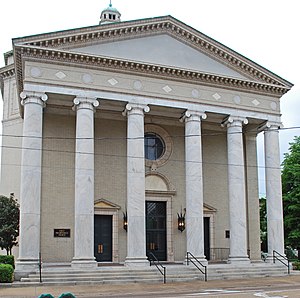
The Mizpah congregation is a Reform Jewish synagogue located at 923 McCallie Avenue in Chattanooga, Tennessee, in the United States. Founded in 1866, the congregation has erected synagogues in 1882, 1904, and its current site, in 1928 that was designated in 1979 as a Tennessee Historical Preservation Site.

Trinity Methodist Episcopal Church (Chattanooga, Tennessee)
Historic church in Tennessee, United States
Distance: Approx. 536 meters
Latitude and longitude: 35.0425,-85.29361111
Trinity Methodist Episcopal Church (also known as Tucker Baptist Church) was a historic church on McCallie Avenue in Chattanooga, Tennessee. It was built in 1899. At one time it housed Tucker Missionary Baptist Church.

First Baptist Church (Chattanooga, Tennessee)
Historic church in Tennessee, United States
Distance: Approx. 434 meters
Latitude and longitude: 35.04527778,-85.30305556
First Baptist Church East 8th Street, historically named Shiloh Baptist Church, is a historic church at 506 E. 8th Street in Chattanooga, Tennessee. The congregation was organized in 1866 as Shiloh Baptist Church by a group of men who had served as soldiers in the Union Army during the Civil War. Initially they worshiped in a blacksmith shop; subsequently they met for worship in members' homes.

Chattanooga State Office Building
Distance: Approx. 462 meters
Latitude and longitude: 35.0461,-85.3033
The Chattanooga State Office Building is a historic building at 540 McCallie Avenue in downtown Chattanooga, Tennessee, in the United States. The six-story building was built in 1950 at a cost of $1.75 million to be the headquarters for the Interstate Life Insurance Company. Designed in the Art Moderne style, the exterior has ruby granite on the bottom, gray-white limestone on the top, and a bronze frieze near the McCallie Avenue doorway.

Christ Church Episcopal (Chattanooga, Tennessee)
United States historic place
Distance: Approx. 317 meters
Latitude and longitude: 35.04611111,-85.30166667
Christ Episcopal Church is an Episcopal Church in Chattanooga, Tennessee. It is a part of the Episcopal Diocese of East Tennessee. In November 1900, a small group from St.
Weather in this IP's area
overcast clouds
-2 Celsius
-8 Celsius
-3 Celsius
-1 Celsius
1021 hPa
76 %
1021 hPa
993 hPa
10000 meters
6.17 m/s
340 degree
100 %