Country:
Region:
City:
Latitude and Longitude:
Time Zone:
Postal Code:
IP information under different IP Channel
ip-api
Country
Region
City
ASN
Time Zone
ISP
Blacklist
Proxy
Latitude
Longitude
Postal
Route
Luminati
Country
Region
ar
City
jonesboro
ASN
Time Zone
America/Chicago
ISP
RITTERNET
Latitude
Longitude
Postal
IPinfo
Country
Region
City
ASN
Time Zone
ISP
Blacklist
Proxy
Latitude
Longitude
Postal
Route
db-ip
Country
Region
City
ASN
Time Zone
ISP
Blacklist
Proxy
Latitude
Longitude
Postal
Route
ipdata
Country
Region
City
ASN
Time Zone
ISP
Blacklist
Proxy
Latitude
Longitude
Postal
Route
Popular places and events near this IP address

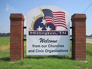
Millington, Tennessee
City in Tennessee, United States
Distance: Approx. 2360 meters
Latitude and longitude: 35.33666667,-89.90222222
Millington is a city in Shelby County, Tennessee, United States, and is a part of the Memphis metropolitan area. As of the 2010 census, it had a population of 10,176. Millington was granted the title "Flag City Tennessee" by the Tennessee State Legislature.

Memphis International Raceway
Motorsport track in the United States
Distance: Approx. 5402 meters
Latitude and longitude: 35.28277778,-89.9475
Memphis International Raceway (formerly known as Memphis Motorsports Park) was an auto racing park located near the Loosahatchie River in Shelby County, Tennessee, United States, approximately ten miles south of Millington, and a few miles north of the city of Memphis.
Millington-Memphis Airport
Airport in Millington, Tennessee
Distance: Approx. 5492 meters
Latitude and longitude: 35.35666667,-89.87027778
The Millington-Memphis Airport (IATA: NQA, ICAO: KNQA, FAA LID: NQA) (formerly known as Millington Municipal Airport or Millington Regional Jetport) is a public airport in the city of Millington, Tennessee, in Shelby County, United States. The airport is located 16 miles (26 km) north of Memphis. It was historically known as Naval Air Station Memphis, and it still provides support to military aircraft visiting the adjacent Naval Support Activity Mid-South.
Millington Central High School
Public school in Millington, Tennessee, United States
Distance: Approx. 3451 meters
Latitude and longitude: 35.34613,-89.89775
Millington Central Middle High School (formerly known as Millington Central High School MCHS) is a public school (grades 7-12 formerly grades 9-12) located in southern Millington, Tennessee, United States, and is a part of the Millington Municipal School District. Millington Central High School was the first accredited school in the Shelby County Schools district. In 2014, the school left the county system, and was administrated by the newly Millington Municipal School District.

Charles W. Baker Airport
Airport in Shelby County, TN
Distance: Approx. 4790 meters
Latitude and longitude: 35.278975,-89.931475
Charles W. Baker Airport (FAA LID: 2M8) is a civil, publicly owned airport. It is located four miles (6 km) southwest of the central business district of Millington, a city in Shelby County, Tennessee, United States. It is 10 miles (16 km) from downtown Memphis.
USA Stadium
Distance: Approx. 2737 meters
Latitude and longitude: 35.33604,-89.92017
The USA Stadium is a baseball stadium in Millington, Tennessee, in the United States. It is located at 4351 Babe Howard Boulevard in Millington. Between 1986 and 1996, it was the training ground for the USA Olympic Baseball team and once hosted the University of Memphis baseball team.
Egypt, Tennessee
Place in Tennessee, United States
Distance: Approx. 8324 meters
Latitude and longitude: 35.2428656,-89.9253652
Egypt is an American populated place in Shelby County, Tennessee at 35.2428656°N 89.9253652°W / 35.2428656; -89.9253652. Its elevation is 299 feet (91 m). Joseph B. Adkison, a recipient of the Medal of Honor for his actions in World War I, was from Egypt.
WXMP-LP
Radio station in Cordova, Tennessee
Distance: Approx. 9301 meters
Latitude and longitude: 35.39822222,-89.88922222
WXMP-LP (106.5 FM) is a radio station licensed to Cordova, Tennessee, United States. The station is currently owned by Millington Community Center, Inc.

Naval Support Activity Mid-South
US Naval base
Distance: Approx. 3789 meters
Latitude and longitude: 35.33472222,-89.86916667
Naval Support Activity Mid-South (NSA Mid-South, NAVSUPPACT Mid-South, NSAMS), in Millington, Tennessee, is a base of the United States Navy. A part of the Navy Region Southeast and the Navy Installations Command, NSA Mid-South serves as the Navy’s Human Resources Center of Excellence. The base is host to several commands and other military tenants: Navy Personnel Command, Navy Recruiting Command, the Navy Manpower Analysis Center, a Marine Corps Reserve Company - Bridge Company C (6th Engineer Support Battalion (ESB), 4th Marine Logistics Group (MLG)) and the US Army Corps of Engineers Finance Center.
Kerrville, Tennessee
Community in Tennessee, United States
Distance: Approx. 8582 meters
Latitude and longitude: 35.38305556,-89.85805556
Kerrville is an unincorporated community on the northeast portion of Shelby County, Tennessee, United States. Kerrville is located along about 3.5 miles to the north of Millington and just to the south of the Tipton County line, along with Atoka and Munford city limits. It is named for Andrew Hart Kerr, who moved from Middle Tennessee to Big Creek and purchased 5,000 acres of land.
Weather in this IP's area
clear sky
18 Celsius
17 Celsius
16 Celsius
19 Celsius
1015 hPa
65 %
1015 hPa
1005 hPa
10000 meters
1.54 m/s
06:36:22
16:52:54