Country:
Region:
City:
Latitude and Longitude:
Time Zone:
Postal Code:
IP information under different IP Channel
ip-api
Country
Region
City
ASN
Time Zone
ISP
Blacklist
Proxy
Latitude
Longitude
Postal
Route
Luminati
Country
Region
ia
City
glenwood
ASN
Time Zone
America/Chicago
ISP
WESTERN-IOWA-NETWORKS-396443
Latitude
Longitude
Postal
IPinfo
Country
Region
City
ASN
Time Zone
ISP
Blacklist
Proxy
Latitude
Longitude
Postal
Route
db-ip
Country
Region
City
ASN
Time Zone
ISP
Blacklist
Proxy
Latitude
Longitude
Postal
Route
ipdata
Country
Region
City
ASN
Time Zone
ISP
Blacklist
Proxy
Latitude
Longitude
Postal
Route
Popular places and events near this IP address

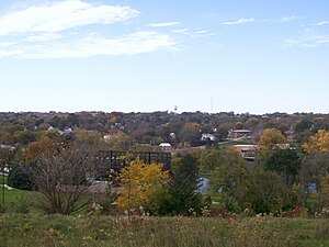
Glenwood, Iowa
City in Iowa, United States
Distance: Approx. 596 meters
Latitude and longitude: 41.04555556,-95.7425
Glenwood is a city in, and the county seat of, Mills County, Iowa, United States. The population was 5,073 in the 2020 census, a decline from 5,358 in 2000.

Pacific Junction, Iowa
City in Iowa, United States
Distance: Approx. 6214 meters
Latitude and longitude: 41.018319,-95.799883
Pacific Junction is a city in Mills County, Iowa, United States. The population was 96 at the time of the 2020 census.
KMMQ
Radio station in Plattsmouth, Nebraska
Distance: Approx. 4940 meters
Latitude and longitude: 41.08666667,-95.71277778
KMMQ (1020 AM, "La Nueva 99.5 y 1020") is a radio station licensed to serve Plattsmouth, Nebraska, United States. The station is owned by NRG Media and the license is held by NRG License Sub, LLC, headquartered in Cedar Rapids, Iowa. Its studios are located at Dodge Street and 50th Avenue in Midtown Omaha, while its transmitter site is located near Glenwood, Iowa.
Mid-America Motorplex
Distance: Approx. 7385 meters
Latitude and longitude: 41.025345,-95.819111
Mid America Motorplex, now renamed Raceway Park of the Midlands (RPM), is an Alan Wilson-designed road circuit in the Omaha – Council Bluffs metropolitan area, in Plattville Township, Mills County, just outside Pacific Junction, Iowa. This facility includes a 2.23 mile road course and a 1/8-mile drag strip, known as I29 Dragway. It is a relatively safe track for people to learn to drive their cars at high-performance driving events.
Glenwood Golf Course
Distance: Approx. 1504 meters
Latitude and longitude: 41.058,-95.728
Glenwood Golf Course is a par 35, nine-hole golf course in Glenwood, Iowa. Thomas Davis designed the course with bent grass greens and bluegrass fairways.

Glenwood Resource Center
Distance: Approx. 838 meters
Latitude and longitude: 41.039743,-95.741494
The Iowa Institution for Feeble-Minded Children was a psychiatric hospital for the treatment of what was then known as mental retardation located in the Loess Hills adjacent to Glenwood, Iowa. The facility is now known as the Glenwood Resource Center. This center has been condemned by the US Department of Justice for violation of the 14th Amendment, due to poor treatment of residents and dangerous experiments on residents.

Pony Creek Park
United States historic place
Distance: Approx. 5150 meters
Latitude and longitude: 41.07111111,-95.78666667
Pony Creek Park is a park in Oak Township, Mills County, Iowa, United States, northwest of Glenwood. Centered around the 83-acre (34 ha) Pony Creek Lake, it offers boating, picnicking, and fishing areas. Other features of the park include woods, a camping area, virgin prairie, and a viewing area for the local loess topography.
Center Township, Mills County, Iowa
Township in Mills County, Iowa, U.S.
Distance: Approx. 6672 meters
Latitude and longitude: 41.0233,-95.6617
Center Township is a township in Mills County, Iowa, United States.
Glenwood Township, Mills County, Iowa
Township in Iowa, USA
Distance: Approx. 1843 meters
Latitude and longitude: 41.03333333,-95.75
Glenwood Township is a township in Mills County, Iowa, United States.
Oak Township, Mills County, Iowa
Township in Iowa, USA
Distance: Approx. 7994 meters
Latitude and longitude: 41.11666667,-95.75
Oak Township is a township in Mills County, Iowa, United States.
Glenwood Community School District
Public school district in Glenwood, Iowa, United States
Distance: Approx. 720 meters
Latitude and longitude: 41.039449,-95.737617
The Glenwood Community School District is a rural public school district based in Glenwood, Iowa. The district is mainly in western Mills County, on the western border of Iowa, with a very small area in southern Pottawattamie County. The district serves the towns of Glenwood, Pacific Junction, and Silver City, the unincorporated village of Mineola, and the surrounding rural areas, The school's mascot is the Rams.
Balfour, Iowa
Unincorporated community in Iowa, United States
Distance: Approx. 5688 meters
Latitude and longitude: 41.04888889,-95.66777778
Balfour is an unincorporated community in Mills County, in the U.S. state of Iowa.
Weather in this IP's area
mist
3 Celsius
2 Celsius
2 Celsius
4 Celsius
1017 hPa
95 %
1017 hPa
979 hPa
1811 meters
1.54 m/s
100 degree
07:00:26
17:12:47