207.250.196.74 - IP Lookup: Free IP Address Lookup, Postal Code Lookup, IP Location Lookup, IP ASN, Public IP
Country:
Region:
City:
Location:
Time Zone:
Postal Code:
ISP:
ASN:
language:
User-Agent:
Proxy IP:
Blacklist:
IP information under different IP Channel
ip-api
Country
Region
City
ASN
Time Zone
ISP
Blacklist
Proxy
Latitude
Longitude
Postal
Route
db-ip
Country
Region
City
ASN
Time Zone
ISP
Blacklist
Proxy
Latitude
Longitude
Postal
Route
IPinfo
Country
Region
City
ASN
Time Zone
ISP
Blacklist
Proxy
Latitude
Longitude
Postal
Route
IP2Location
207.250.196.74Country
Region
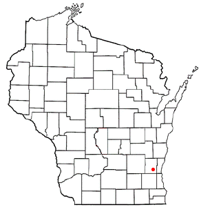
wisconsin
City
germantown
Time Zone
America/Chicago
ISP
Language
User-Agent
Latitude
Longitude
Postal
ipdata
Country
Region
City
ASN
Time Zone
ISP
Blacklist
Proxy
Latitude
Longitude
Postal
Route
Popular places and events near this IP address

Richfield, Wisconsin
Village in Washington County, Wisconsin
Distance: Approx. 5302 meters
Latitude and longitude: 43.256111,-88.193889
Richfield is a village in Washington County, Wisconsin, and is on the edge of the Milwaukee Metropolitan Area . United States. The population was 11,739 at the 2020 census.
Menomonee Falls, Wisconsin
Village in Wisconsin, United States
Distance: Approx. 5548 meters
Latitude and longitude: 43.17888889,-88.11722222
Menomonee Falls is a village in Waukesha County, Wisconsin, United States. The population was 38,527 at the 2020 census, making it the most populous village in Wisconsin. It is part of the Milwaukee metropolitan area.

Germantown, Washington County, Wisconsin
Town in Washington County, Wisconsin
Distance: Approx. 2863 meters
Latitude and longitude: 43.22861111,-88.11027778
Germantown is a town in Washington County, Wisconsin, United States. The population was 278 at the 2000 census. It is surrounded by the village of Germantown.

Germantown, Wisconsin
Village in Washington County, Wisconsin
Distance: Approx. 2019 meters
Latitude and longitude: 43.22305556,-88.12027778
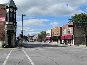
Germantown is a village in Washington County, Wisconsin, United States. The population was 20,917 at the 2020 census. The village surrounds the Town of Germantown, and is part of the Milwaukee metropolitan area.

Milwaukee metropolitan area
Metropolitan area in Wisconsin, United States
Distance: Approx. 3344 meters
Latitude and longitude: 43.25,-88.16666667
The Milwaukee metropolitan area (also known as Metro Milwaukee or Greater Milwaukee) is a major metropolitan area located in Southeastern Wisconsin, consisting of the city of Milwaukee and some of the surrounding area. There are several definitions of the area, including the Milwaukee–Waukesha–West Allis metropolitan area and the Milwaukee–Racine–Waukesha combined statistical area. It is the largest metropolitan area in Wisconsin, and the 39th largest metropolitan area in the United States.

Colgate, Wisconsin
Unincorporated community in Wisconsin, United States
Distance: Approx. 6093 meters
Latitude and longitude: 43.19305556,-88.20666667
Colgate is an unincorporated community in Washington County, Wisconsin, United States, straddling the county line with Waukesha County. Colgate is located partially in the village of Richfield, and the village of Lisbon. Its ZIP Code is 53017.
Calvary Baptist School (Wisconsin)
Pre-K–12th grade school in Menomonee Falls, Wisconsin, US
Distance: Approx. 6307 meters
Latitude and longitude: 43.16777778,-88.14783333
Calvary Baptist School is a private, Baptist school located in Menomonee Falls, Wisconsin, a suburb of Milwaukee. Calvary consists of preschool through twelfth grade and is one of the largest Protestant schools in Wisconsin. It is a member of the American Association of Christian Schools.
Rockfield, Wisconsin
Hamlet in Washington County, Wisconsin, and neighborhood of the Village of Germantown
Distance: Approx. 3994 meters
Latitude and longitude: 43.2575,-88.12611111
Rockfield was a hamlet that was annexed by the Village of Germantown in Washington County, Wisconsin, United States.
Dheinsville, Wisconsin
Distance: Approx. 2856 meters
Latitude and longitude: 43.25,-88.14277778
Dheinsville is an important historical settlement (modern-day neighborhood) in the village of Germantown, Wisconsin, Washington County, United States. Dheinsville is located at the intersection of Highway 167 (Holy Hill Road), State Highway 145, and Maple Road.

Christ Evangelical Church
Historic church in Wisconsin, United States
Distance: Approx. 3026 meters
Latitude and longitude: 43.25055556,-88.15527778
Christ Evangelical Church is a historic church building in Germantown, Wisconsin, United States. It was built in 1862 and was added to the National Register of Historic Places in 1983. The building is now operated as the Christ Church Museum of Local History by the Germantown Historical Society.

Germantown Power Plant
Electrical power station in Germantown, Washington County, Wisconsin
Distance: Approx. 3177 meters
Latitude and longitude: 43.19611111,-88.15027778
Germantown Power Plant is a natural gas fired, electrical peaking power plant located in Germantown, Wisconsin in Washington County. It is a five unit natural gas or #2 low sulfur fuel oil facility. Unit 5, which is powered by natural gas, is the primary unit, with the other four, powered by low sulfur fuel oil, being used during hours of peak energy usage.
Main Street Historic District (Menomonee Falls, Wisconsin)
Historic district in Wisconsin, United States
Distance: Approx. 5640 meters
Latitude and longitude: 43.17944444,-88.11305556
The Main Street Historic District is a cluster of historic buildings around the intersection of Main Street and Appleton Avenue in Menomonee Falls, Wisconsin. It was added to the National Register of Historic Places in 1988. Menomonee Falls was established in 1836 near a series of rapids of the Menomonee River.
Weather in this IP's area
clear sky
-5 Celsius
-12 Celsius
-7 Celsius
-4 Celsius
1024 hPa
57 %
1024 hPa
988 hPa
10000 meters
6.17 m/s
230 degree
