Country:
 USA
USARegion:
City:
Latitude and Longitude:
Time Zone:
Postal Code:
IP information under different IP Channel
ip-api
Country
Region
City
ASN
Time Zone
ISP
Blacklist
Proxy
Latitude
Longitude
Postal
Route
IPinfo
Country
Region
City
ASN
Time Zone
ISP
Blacklist
Proxy
Latitude
Longitude
Postal
Route
MaxMind
Country
Region
City
ASN
Time Zone
ISP
Blacklist
Proxy
Latitude
Longitude
Postal
Route
Luminati
Country
USRegion
ca
City
oakland
ASN
Time Zone
America/Los_Angeles
ISP
TRAVISCU
Latitude
Longitude
Postal
db-ip
Country
Region
City
ASN
Time Zone
ISP
Blacklist
Proxy
Latitude
Longitude
Postal
Route
ipdata
Country
Region
City
ASN
Time Zone
ISP
Blacklist
Proxy
Latitude
Longitude
Postal
Route
Popular places and events near this IP address

Brooklyn, California
Distance: Approx. 758 meters
Latitude and longitude: 37.78853889,-122.24941389
Brooklyn is a former city in Alameda County, California, now annexed to Oakland, California. Brooklyn first formed from the amalgamation in 1856 of two settlements, the sites of which are both now within the city limits of Oakland: San Antonio and Clinton. The name Brooklyn commemorated the ship that had brought Mormon settlers to California in 1846.
Mr. Floppy's Flophouse
Distance: Approx. 658 meters
Latitude and longitude: 37.7893,-122.2485
Mr. Floppy's Flophouse was a mansion in East Oakland that at one time housed a bordello and saloon patronized by writer Jack London; in later years a picture of the writer was placed behind the elegant bar. In the early 1990s it was also the home to a well-known, wild underground party and rave.

Oakland Harbor Light
Lighthouse in California, United States
Distance: Approx. 1057 meters
Latitude and longitude: 37.781335,-122.243817
Oakland Harbor Light is a former lighthouse, now a restaurant in Embarcadero Cove, California.
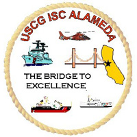
Integrated Support Command Alameda
US Coast Guard base in Alameda, California
Distance: Approx. 1140 meters
Latitude and longitude: 37.782553,-122.249207
Integrated Support Command Alameda (ISC Alameda) is a large operating base of the United States Coast Guard, located on Coast Guard Island[1] in Alameda, California Now known as Base Alameda ISC Alameda provides a wide variety of services in direct support of Coast Guard activities throughout the west coast of the United States of America. Among these are the management of approximately 1200 Coast Guard owned housing units, warehousing, health care services, work-life services, transportation of household goods, and personnel support services. Facilities maintenance is provided to all tenant commands on Coast Guard Island and industrial support is provided throughout the West Coast.
Clinton, Oakland, California
Neighborhood in Oakland, California, U.S.
Distance: Approx. 1104 meters
Latitude and longitude: 37.79638889,-122.25138889
Clinton is a neighborhood in Oakland, California, United States. It lies at an elevation of 36 feet (11 m). Clinton started when brothers named Patten leased land on the east side of the San Antonio Slough from Vincent Peralta in 1850, and joined with others to found the town in 1852.
Nexus Audio Recording Studio
Distance: Approx. 481 meters
Latitude and longitude: 37.786332,-122.24202
Nexus Audio Recording Studio is a recording studio located in East Oakland, California. It was established in October 2004 by Chris Paxton, who presently owns, manages, and is the head engineer. The seven-room facility offers tracking, mixing and mastering for all audio projects, including musical genres as diverse as reggae and rock.
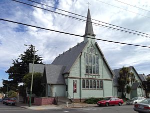
Church of St. James the Apostle
Historic site in Oakland, California
Distance: Approx. 445 meters
Latitude and longitude: 37.791693,-122.246069
The Church of St. James the Apostle, or as it is known today as St. James Episcopal Church or Iglesia Episcopal de Santiago is an Episcopal church in Oakland, California, United States.
Harborside Health Center
Cannabis dispensary in California, US
Distance: Approx. 747 meters
Latitude and longitude: 37.78396,-122.24243
Harborside, formerly Harborside Health Center, is a recreational and medical cannabis dispensary, with its flagship location in Oakland, California, and an additional location in San Jose. Founded in 2006 by Steve DeAngelo and Dave Wedding Dress, Harborside operates as a non-profit patient collective. In December 2011, Harborside Health Center was featured in the Discovery Channel's four-part documentary series, Weed Wars.

White Mansion (Oakland, California)
Historic house in California, United States
Distance: Approx. 1051 meters
Latitude and longitude: 37.79722222,-122.24972222
The White Mansion, also known as the Asa L. White Mansion, is a historic house built in 1878 in Oakland, California. It has been listed on the National Register of Historic Places since October 31, 1980.

Oakland Buddha
Buddha statue in Oakland, California
Distance: Approx. 527 meters
Latitude and longitude: 37.7947,-122.2442
The Oakland Buddha (Vietnamese: Pháp Duyên Tự) is a statue of a Buddha placed in a traffic median in Oakland, California, in 2009. The statue was placed by neighborhood resident Dan Stevenson who was upset about the frequent use of the median for illegal dumping. Stevenson attached the statue to the median using epoxy and rebar to deter theft of the figure.
California Cotton Mills Company Factory
Historic place in Oakland, California
Distance: Approx. 1045 meters
Latitude and longitude: 37.78155,-122.238056
California Cotton Mills Company Factory is a historical building in Oakland, California Fruitvale neighborhood. The California Cotton Mills Company Factory was founded in 1883. The building was listed on the National Register of Historic Places on January 30, 2013.
Ellen Kenna House
Mansion in Oakland, California, US
Distance: Approx. 498 meters
Latitude and longitude: 37.79507,-122.24097
The Ellen Kenna House is a historic Victorian mansion in Oakland, California. It was built in 1888. It is 8,500 square feet.
Weather in this IP's area
few clouds
20 Celsius
20 Celsius
16 Celsius
25 Celsius
1011 hPa
72 %
1011 hPa
1008 hPa
10000 meters
5.66 m/s
290 degree
20 %
06:54:43
19:10:28