Country:
 USA
USARegion:
City:
Latitude and Longitude:
Time Zone:
Postal Code:
IP information under different IP Channel
ip-api
Country
Region
City
ASN
Time Zone
ISP
Blacklist
Proxy
Latitude
Longitude
Postal
Route
IPinfo
Country
Region
City
ASN
Time Zone
ISP
Blacklist
Proxy
Latitude
Longitude
Postal
Route
MaxMind
Country
Region
City
ASN
Time Zone
ISP
Blacklist
Proxy
Latitude
Longitude
Postal
Route
Luminati
Country
USRegion
tx
City
pflugerville
ASN
Time Zone
America/Chicago
ISP
TEXASNET-ASN
Latitude
Longitude
Postal
db-ip
Country
Region
City
ASN
Time Zone
ISP
Blacklist
Proxy
Latitude
Longitude
Postal
Route
ipdata
Country
Region
City
ASN
Time Zone
ISP
Blacklist
Proxy
Latitude
Longitude
Postal
Route
Popular places and events near this IP address

Sunset Valley, Texas
City in Texas, United States
Distance: Approx. 2478 meters
Latitude and longitude: 30.22555556,-97.81611111
Sunset Valley is a city in Travis County, Texas, United States. The population was 683 at the time of the 2020 census. An enclave, it is surrounded on all sides by the city of Austin.

Barton Creek Square
Shopping mall in Texas, United States
Distance: Approx. 1348 meters
Latitude and longitude: 30.2576,-97.8068
Barton Creek Square is an enclosed shopping mall located in southwest Austin, Texas in the United States, near the intersection of Texas State Highway Loop 1 and Texas State Highway Loop 360. The mall is eponymously named after Barton Creek, Texas. Anchor stores are Dillard's, JCPenney, Macy's, and Nordstrom.
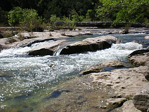
Barton Creek Greenbelt
Public park in Austin, Texas
Distance: Approx. 501 meters
Latitude and longitude: 30.24388889,-97.80972222
The Barton Creek Greenbelt in Austin, Texas is managed by the City of Austin's Park and Recreation Department. The Greenbelt is a 7.25-mile (11.67 km) stretch of public land spanning from Zilker Park west to the Lost Creek neighborhood. The Barton Creek Greenbelt runs parallel to the first 6.5 miles of Barton Creek before ending on a steep .75 mile hill commonly referred to as the hill of life.
Andrew M. Cox Ranch Site
United States historic place
Distance: Approx. 289 meters
Latitude and longitude: 30.2431,-97.8057
The Andrew M. Cox Ranch Site is a historic collection of ruined buildings and structures in Austin, Texas, United States. The site is located on either side of Barton Creek near the intersection of Loop 360 and the Mopac Expressway. It included a small collection of wall enclosures (no habitable buildings remain onsite) and wagon tracks in the native limestone.

Barton Hills, Austin, Texas
Distance: Approx. 2675 meters
Latitude and longitude: 30.25805556,-97.78111111
Barton Hills is a neighborhood in Austin, Texas. It is located in south Austin, and encompasses part of ZIP code 78704. Barton Hills is bounded by South Lamar and Zilker neighborhoods to the east, Barton Springs Road and Zilker Park to the north, Barton Creek and the Spyglass-Barton's Bluff neighborhood to the west and the Capital of Texas Highway to the south.
Westgate, Austin, Texas
Distance: Approx. 2359 meters
Latitude and longitude: 30.22479375,-97.80025916
Westgate is a neighborhood in Austin, Texas, located southwest of the city's urban core. It includes ZIP code 78745. Westgate's boundaries are Ben White Boulevard and the South Lamar and Barton Hills neighborhood to the north, Manchaca Road and the South Manchaca neighborhood on the east, Stassney Lane and the Garrison Park on the south and West Gate Boulevard and the city of Sunset Valley the west.
Spyglass-Barton's Bluff, Austin, Texas
Distance: Approx. 2036 meters
Latitude and longitude: 30.25816032,-97.78950232
Spyglass-Barton's Bluff is a neighborhood in Austin, Texas. It is located southwest of the city's urban core, and encompasses ZIP codes 78746 and 78704. Sometimes known as Barton's Bluff-Spyglass, the neighborhood is a narrow strip of land that runs between Mopac Expressway and Barton Creek in northwest Austin.
South River City, Austin, Texas
Distance: Approx. 2675 meters
Latitude and longitude: 30.25805556,-97.78111111
South River City is a community located in Austin, Texas. Also frequently called Travis Heights, the neighborhood is located south of the city's urban core, just below Lake Lady Bird in South Austin. The area encompasses a portion of ZIP code 78704.

Texas Health and Science University
Distance: Approx. 2260 meters
Latitude and longitude: 30.234154,-97.785494
Texas Health and Science University (THSU) is a private for-profit university with its main campus in Austin, Texas and a second campus in San Antonio. It offers graduate and doctoral degrees in acupuncture, and traditional Chinese medicine with a Chinese herbal medicine specialty.

Ann Richards School for Young Women Leaders
Middle school & high school in Austin, Texas, United States
Distance: Approx. 1945 meters
Latitude and longitude: 30.236,-97.788
The Ann Richards School for Young Women Leaders is an all-girls college preparatory public school of choice for students in grades 6–12 located in Austin, Texas. The school is named for former Texas governor Ann Richards and is part of the Austin Independent School District. In 2015 it was named the 19th most challenging high school in the nation by The Washington Post.

Airmen's Cave
Cave in Austin, Texas, United States
Distance: Approx. 1352 meters
Latitude and longitude: 30.241673,-97.791595
Airman's Cave is a cave located adjacent to the portion of Barton Creek located in Travis County in south Austin, Texas. The cave is 3,444 metres (11,299 ft) long, and characterized by long crawls and tight passages. It lies inside the Barton Creek Greenbelt public park and is managed by the City of Austin's Parks and Recreation Department.

Westgate Transit Center
Bus station in Austin, Texas
Distance: Approx. 2156 meters
Latitude and longitude: 30.2309,-97.7903
Westgate Transit Center is a Capital Metropolitan Transportation Authority bus station in Austin, Texas. It is located underneath the elevated freeway of Ben White Boulevard (US 290-SH 71), in between Packsaddle Pass and Menchaca Road. The station features a park and ride lot with over 200 parking spaces, and is served by several local bus routes as well as CapMetro Rapid Route 803.
Weather in this IP's area
clear sky
33 Celsius
36 Celsius
32 Celsius
35 Celsius
1014 hPa
45 %
1014 hPa
994 hPa
10000 meters
1.79 m/s
4.02 m/s
315 degree
2 %
07:27:10
19:11:30