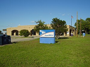
Country:
 USA
USARegion:
City:
Latitude and Longitude:
Time Zone:
Postal Code:
IP information under different IP Channel
ip-api
Country
Region
City
ASN
Time Zone
ISP
Blacklist
Proxy
Latitude
Longitude
Postal
Route
IPinfo
Country
Region
City
ASN
Time Zone
ISP
Blacklist
Proxy
Latitude
Longitude
Postal
Route
MaxMind
Country
Region
City
ASN
Time Zone
ISP
Blacklist
Proxy
Latitude
Longitude
Postal
Route
Luminati
Country
USRegion
tx
City
austin
ASN
Time Zone
America/Chicago
ISP
TEXASNET-ASN
Latitude
Longitude
Postal
db-ip
Country
Region
City
ASN
Time Zone
ISP
Blacklist
Proxy
Latitude
Longitude
Postal
Route
ipdata
Country
Region
City
ASN
Time Zone
ISP
Blacklist
Proxy
Latitude
Longitude
Postal
Route
Popular places and events near this IP address

Shady Hollow, Texas
CDP in Texas, United States
Distance: Approx. 5519 meters
Latitude and longitude: 30.16444444,-97.86305556
Shady Hollow is a census-designated place (CDP) in southwestern Travis County, Texas, United States, and is partially in the City of Austin. It is located ten miles (16 km) southwest of Downtown Austin, near the Travis/Hays county line. The population was 4,822 at the 2020 census.

Sunset Valley, Texas
City in Texas, United States
Distance: Approx. 3829 meters
Latitude and longitude: 30.22555556,-97.81611111
Sunset Valley is a city in Travis County, Texas, United States. The population was 683 at the time of the 2020 census. An enclave, it is surrounded on all sides by the city of Austin.
Regents School of Austin
Private school in Austin, Texas, United States
Distance: Approx. 4651 meters
Latitude and longitude: 30.254519,-97.845369
Regents School of Austin is a private, classical, non-denominational Christian school located in Austin, Texas.

Lady Bird Johnson Wildflower Center
Botanical garden and arboretum in Texas
Distance: Approx. 3534 meters
Latitude and longitude: 30.18527778,-97.87055556
The Lady Bird Johnson Wildflower Center at The University of Texas at Austin is the state botanical garden and arboretum of Texas. The center features more than 900 species of native Texas plants in both garden and natural settings and is home to a breadth of educational programs and events. The center is 284 acres and located 10 miles southwest of downtown Austin, Texas just inside the edge of the distinctive Texas Hill Country.
Bowie High School (Austin, Texas)
Public school in Austin, Texas, United States
Distance: Approx. 2939 meters
Latitude and longitude: 30.187,-97.856
James Bowie High School is a public high school in the southwest region of Austin, Texas. It is named after James Bowie, a prominent figure in Texan History who played a role in the Texas Revolution and gained recognition for his actions in the Battle of the Alamo. With 2,875 students, James Bowie High School is the largest school within the Austin Independent School District and the fourth largest secondary school in Central Texas.
Circle C Ranch
Master-planned community in Texas, United States
Distance: Approx. 5204 meters
Latitude and longitude: 30.197,-97.904
Circle C Ranch (also known as Circle C) is a large master-planned community in southwest Austin, Texas, USA. Development of Circle C Ranch began in 1982, with the first homes in the community in built in 1986. During development, the subdivision was featured prominently in a long and contentious environmental legal battle regarding urban development in the vicinity of Barton Springs and over Edwards Aquifer. The controversy surrounding its development and later annexation by the city of Austin was a landmark in municipal annexation rights in Texas.
Oak Hill, Austin, Texas
Unincorporated community in Texas, United States
Distance: Approx. 2523 meters
Latitude and longitude: 30.23527778,-97.85972222
Oak Hill is an unincorporated community and collection of neighborhoods located in southwestern Austin, Texas, United States.
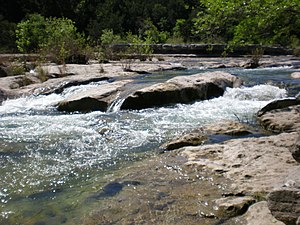
Barton Creek Greenbelt
Public park in Austin, Texas
Distance: Approx. 5400 meters
Latitude and longitude: 30.24388889,-97.80972222
The Barton Creek Greenbelt in Austin, Texas is managed by the City of Austin's Park and Recreation Department. The Greenbelt is a 7.25-mile (11.67 km) stretch of public land spanning from Zilker Park west to the Lost Creek neighborhood. The Barton Creek Greenbelt runs parallel to the first 6.5 miles of Barton Creek before ending on a steep .75 mile hill commonly referred to as the hill of life.
Westgate, Austin, Texas
Distance: Approx. 5260 meters
Latitude and longitude: 30.22479375,-97.80025916
Westgate is a neighborhood in Austin, Texas, located southwest of the city's urban core. It includes ZIP code 78745. Westgate's boundaries are Ben White Boulevard and the South Lamar and Barton Hills neighborhood to the north, Manchaca Road and the South Manchaca neighborhood on the east, Stassney Lane and the Garrison Park on the south and West Gate Boulevard and the city of Sunset Valley the west.
Scenic Brook, Austin, Texas
Distance: Approx. 4423 meters
Latitude and longitude: 30.236538,-97.890604
Scenic Brook is a neighborhood located in southwest Austin, Texas. Scenic Brook is located in ZIP codes 78735 and 78736. The boundaries are the intersections of U.S. Route 290 and Texas State Highway 71 to on the north, south, and east sides, and Covered Bridge Drive and Scenic Brook Drive on the west side.
Granada Hills, Austin, Texas
Distance: Approx. 4762 meters
Latitude and longitude: 30.221,-97.902
Granada Hills is a neighborhood located in southwest Austin, Texas. Granada Hills is located in ZIP code 78737. The neighborhood boundaries are FM 1826 on the south and east sides, Highway 290 and the Scenic Brook neighborhood to the north, and Southview Road and Belterra on the west side.

Tanglewood Forest, Austin, Texas
Neighbourhood
Distance: Approx. 4396 meters
Latitude and longitude: 30.17777778,-97.83333333
Tanglewood Forest is a neighborhood of southern Austin, Texas that was formerly its own census-designated place in Travis County, active as of the 1990 U.S. Census. It was formerly governed from a municipal utility district. In 1997 the city of Austin announced it was annexing Tanglewood Forest.
Weather in this IP's area
few clouds
33 Celsius
35 Celsius
31 Celsius
35 Celsius
1014 hPa
46 %
1014 hPa
988 hPa
10000 meters
4.02 m/s
6.26 m/s
71 degree
20 %
07:27:21
19:11:42