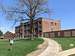
Country:
Region:
City:
Latitude and Longitude:
Time Zone:
Postal Code:
IP information under different IP Channel
ip-api
Country
Region
City
ASN
Time Zone
ISP
Blacklist
Proxy
Latitude
Longitude
Postal
Route
Luminati
Country
Region
ia
City
gooselake
ASN
Time Zone
America/Chicago
ISP
AUREON-5056
Latitude
Longitude
Postal
IPinfo
Country
Region
City
ASN
Time Zone
ISP
Blacklist
Proxy
Latitude
Longitude
Postal
Route
db-ip
Country
Region
City
ASN
Time Zone
ISP
Blacklist
Proxy
Latitude
Longitude
Postal
Route
ipdata
Country
Region
City
ASN
Time Zone
ISP
Blacklist
Proxy
Latitude
Longitude
Postal
Route
Popular places and events near this IP address

Charlotte, Iowa
City in Iowa, United States
Distance: Approx. 7694 meters
Latitude and longitude: 41.96111111,-90.46972222
Charlotte ( shar-LOT) is a city in Clinton County, Iowa, United States. The population was 389 at the 2020 census.

Goose Lake, Iowa
City in Iowa, United States
Distance: Approx. 1392 meters
Latitude and longitude: 41.9675,-90.38083333
Goose Lake is a city in Clinton County, Iowa, United States. The population was 239 at the time of the 2020 census.

Miles, Iowa
City in Iowa, United States
Distance: Approx. 9254 meters
Latitude and longitude: 42.0475,-90.315
Miles is a small city in southeastern Jackson County, Iowa, United States. The population was 408 at the time of the 2020 census.
Preston, Iowa
City in Iowa, United States
Distance: Approx. 7914 meters
Latitude and longitude: 42.05027778,-90.39472222
Preston is a city in Jackson County, Iowa, United States. The population was 949 at the time of the 2020 census.

Black Hawk Purchase
Distance: Approx. 9054 meters
Latitude and longitude: 41.9,-90.4
The Black Hawk Purchase, also known as the Forty-Mile Strip or Scott's Purchase, extended along the West side of the Mississippi River from the north boundary of Missouri North to the Upper Iowa River in the northeast corner of Iowa. It was fifty miles wide at the ends, and forty in the middle, and is sometimes called the "Forty-Mile Strip". The land, originally owned by the Sauk, Meskwaki (Fox), and Ho-Chunk (Winnebago) Native American people, was acquired by treaty following their defeat by the United States in the Black Hawk War.

Center Township, Clinton County, Iowa
Township in Iowa, United States
Distance: Approx. 8568 meters
Latitude and longitude: 41.90333333,-90.37111111
Center Township is a township in Clinton County, Iowa, United States. At the 2000 census, its population was 626.

Deep Creek Township, Clinton County, Iowa
Township in Iowa, United States
Distance: Approx. 1207 meters
Latitude and longitude: 41.99083333,-90.37972222
Deep Creek Township is a township in Clinton County, Iowa, United States. As of the 2000 census, its population was 713.
Bryant, Iowa
Unincorporated community in Iowa, United States
Distance: Approx. 4558 meters
Latitude and longitude: 41.96333333,-90.33
Bryant is an unincorporated community in northeastern Clinton County, Iowa, United States. It lies along local roads northwest of the city of Clinton, the county seat of Clinton County. Its elevation is 804 feet (245 m).
Polygonal Barn, Van Buren Township
United States historic place
Distance: Approx. 8303 meters
Latitude and longitude: 42.05027778,-90.34666667
The Polygonal Barn, Van Buren Township was a historic building located in Van Buren Township in rural Jackson County, Iowa, United States. It was built in 1920 by Gus Klenney as a sale barn. They house livestock that are shown and sold to buyers.
Goose Lake (Clinton County, Iowa)
Lake in Clinton County, Iowa
Distance: Approx. 2259 meters
Latitude and longitude: 41.967889,-90.402203
Goose Lake is a lake in Clinton County, Iowa, in the United States. Goose Lake was named from the many wild geese seen there by early settlers.
Easton Valley Community School District
Public school district in Preston, Iowa, United States
Distance: Approx. 7681 meters
Latitude and longitude: 42.047712,-90.398147
Easton Valley Community School District is a rural public school district headquartered in Preston, Iowa, United States. It is located in sections of Jackson and Clinton counties, and serves Preston, Miles, Sabula, and Spragueville. It operates its PreKindergarten through grade 6 elementary school in Miles, and its grade 7-12 secondary (middle-high) school in Preston.
Northeast Community School District
Public school district in Goose Lake, Iowa, United States
Distance: Approx. 1639 meters
Latitude and longitude: 41.965879,-90.374705
Northeast Community School District is a rural public school district headquartered in Goose Lake, Iowa. Located entirely in Clinton County, it serves Goose Lake, Andover, and Charlotte.
Weather in this IP's area
few clouds
13 Celsius
13 Celsius
12 Celsius
14 Celsius
1008 hPa
86 %
1008 hPa
983 hPa
10000 meters
4.25 m/s
8.95 m/s
264 degree
17 %
06:39:40
16:50:35
