207.173.86.186 - IP Lookup: Free IP Address Lookup, Postal Code Lookup, IP Location Lookup, IP ASN, Public IP
Country:
Region:
City:
Location:
Time Zone:
Postal Code:
ISP:
ASN:
language:
User-Agent:
Proxy IP:
Blacklist:
IP information under different IP Channel
ip-api
Country
Region
City
ASN
Time Zone
ISP
Blacklist
Proxy
Latitude
Longitude
Postal
Route
db-ip
Country
Region
City
ASN
Time Zone
ISP
Blacklist
Proxy
Latitude
Longitude
Postal
Route
IPinfo
Country
Region
City
ASN
Time Zone
ISP
Blacklist
Proxy
Latitude
Longitude
Postal
Route
IP2Location
207.173.86.186Country
Region
washington
City
vancouver
Time Zone
America/Los_Angeles
ISP
Language
User-Agent
Latitude
Longitude
Postal
ipdata
Country
Region
City
ASN
Time Zone
ISP
Blacklist
Proxy
Latitude
Longitude
Postal
Route
Popular places and events near this IP address

Glenn L. Jackson Memorial Bridge
Bridge between Oregon and Washington, United States
Distance: Approx. 2021 meters
Latitude and longitude: 45.59305556,-122.54861111
The Glenn L. Jackson Memorial Bridge, or I-205 Bridge, is a segmental bridge that spans the Columbia River between Portland, Oregon and Vancouver, Washington. It carries Interstate 205, a freeway bypass of Portland, Oregon. The structure is maintained by the Oregon Department of Transportation.
Evergreen High School (Vancouver, Washington)
Public school in Vancouver, Washington, United States
Distance: Approx. 3837 meters
Latitude and longitude: 45.63666667,-122.52555556
Evergreen High School is a public high school that is located in Vancouver, Washington. It was founded shortly after the district was formed in 1945, and Evergreen High school was the first high school in the Evergreen Public Schools school district.
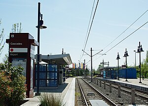
Cascades station
Tram-train station in Portland, OG
Distance: Approx. 4155 meters
Latitude and longitude: 45.572256,-122.558033
Cascades is a light rail train station in the MAX Light Rail system. It is served by the Red Line and is located in Portland, Oregon; it is the third stop north on the Airport MAX section. When the line first opened, trains paused here in order to simulate a station stop for timetable purposes, but the stop was not announced nor were the doors opened.

Government Island (Oregon)
Island on the Columbia River in Oregon, United States
Distance: Approx. 3343 meters
Latitude and longitude: 45.575,-122.508
Government Island is a 1,760-acre (710 ha) island in the Columbia River north of Portland, in Multnomah County, in the U.S. state of Oregon. Though Interstate 205 passes over it on the Glenn L. Jackson Memorial Bridge, access to the island is only by boat. There is a city controlled locked gate in the fence surrounding the freeway.

Mountain View High School (Washington)
Secondary school in Vancouver, Washington, United States
Distance: Approx. 1300 meters
Latitude and longitude: 45.6125,-122.51833333
Mountain View High School is a public high school located in Vancouver, Washington. It was the second high school built in the Evergreen Public Schools, and one of four high schools in the area.
Multnomah Education Service District
Distance: Approx. 4183 meters
Latitude and longitude: 45.56614722,-122.54132778
Multnomah Education Service District (MESD) is an education service district that coordinates school events and activities throughout the school districts in Multnomah County, Oregon, United States. Its administrative offices are located at 11611 NE Ainsworth Circle in Portland.
Electric Lightwave
American fiber optic communications company
Distance: Approx. 3190 meters
Latitude and longitude: 45.599,-122.4855
Electric Lightwave, was originally formed in 1988, by John Warta, John Rivenburgh, Earl Kamsky and Richard Furnival. The company was formed to compete with US West and GTE in the Pacific Northwest. Portland General Electric was an initial investor, then Citizens Utilities became the largest investor in 1990.

Evergreen Field
Airport in Vancouver, Washington
Distance: Approx. 1984 meters
Latitude and longitude: 45.62,-122.5275
Evergreen Field (FAA LID: 59S), also known as Evergreen Airport, was a public-use airport located five miles (8.0 km) east of the central business district of Vancouver, a city in Clark County, Washington, United States. It was located northeast of the intersection of Southeast Mill Plain Boulevard & Southeast 136th Avenue. The airport was established in August 1944 after Roy C. Sugg was granted a permit by the Clark County planning commission for an airport on Mill Plain Road "seven miles east of Vancouver".
Banfield Pet Hospital
American company
Distance: Approx. 3516 meters
Latitude and longitude: 45.616306,-122.485809
Banfield Pet Hospital is a privately owned company based in Vancouver, Washington, United States, that operates veterinary clinics. Part of the Mars Inc. family of companies, Banfield owns clinics in the United States, Mexico, and the United Kingdom.
Cascades Volcano Observatory
Research center in Washington, United States
Distance: Approx. 2493 meters
Latitude and longitude: 45.61083333,-122.49666667
The David A. Johnston Cascades Volcano Observatory (CVO) is a volcano observatory in the US that monitors volcanoes in the northern Cascade Range. It was established in the summer of 1980, after the eruption of Mount St. Helens.
John Stanger House
Historic house in Washington, United States
Distance: Approx. 4092 meters
Latitude and longitude: 45.606554,-122.578368
The John Stanger House is a house located in Vancouver, Washington in the Jane Weber Evergreen Arboretum and is listed on the National Register of Historic Places. It is considered the oldest private home in Clark county still on its original site and the second oldest residence in the county. The home's site was settled circa 1840 by John Stranger, a millwright for the Hudson's Bay Company who came to the area in 1838 and later assisted in the construction of a water-powered gristmill in nearby Mill Creek for Fort Vancouver.
Legacy High School (Vancouver, Washington)
Alternative school in Vancouver, Washington, United States
Distance: Approx. 3967 meters
Latitude and longitude: 45.63777778,-122.52916667
Legacy High School is an alternative high school in Vancouver, Clark County, Washington. Legacy is the only alternative high school in the Evergreen Public Schools school district and has the lowest student enrollment. Legacy High School's principal is Andy Schoonover.
Weather in this IP's area
clear sky
0 Celsius
-3 Celsius
-2 Celsius
2 Celsius
1028 hPa
69 %
1028 hPa
1017 hPa
10000 meters
3.13 m/s
5.36 m/s
111 degree


