207.171.57.232 - IP Lookup: Free IP Address Lookup, Postal Code Lookup, IP Location Lookup, IP ASN, Public IP
Country:
Region:
City:
Location:
Time Zone:
Postal Code:
IP information under different IP Channel
ip-api
Country
Region
City
ASN
Time Zone
ISP
Blacklist
Proxy
Latitude
Longitude
Postal
Route
Luminati
Country
Region
ca
City
ridgecrest
ASN
Time Zone
America/Los_Angeles
ISP
RACE
Latitude
Longitude
Postal
IPinfo
Country
Region
City
ASN
Time Zone
ISP
Blacklist
Proxy
Latitude
Longitude
Postal
Route
IP2Location
207.171.57.232Country
Region
california
City
ridgecrest
Time Zone
America/Los_Angeles
ISP
Language
User-Agent
Latitude
Longitude
Postal
db-ip
Country
Region
City
ASN
Time Zone
ISP
Blacklist
Proxy
Latitude
Longitude
Postal
Route
ipdata
Country
Region
City
ASN
Time Zone
ISP
Blacklist
Proxy
Latitude
Longitude
Postal
Route
Popular places and events near this IP address

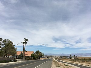
Ridgecrest, California
City in California, United States
Distance: Approx. 6 meters
Latitude and longitude: 35.6225,-117.67083333
Ridgecrest is a city in Kern County, California, United States, along U.S. Route 395 in the Indian Wells Valley in northeastern Kern County, adjacent to the Naval Air Weapons Station China Lake (NAWS, or China Lake). It was incorporated as a city in 1963. The population was 27,959 at the 2020 census, up slightly from 27,616 at the 2010 census, making it the third-largest city in Kern County.

China Lake Acres, California
Census-designated place in California, United States
Distance: Approx. 8650 meters
Latitude and longitude: 35.64055556,-117.76388889
China Lake Acres is a census-designated place (CDP) in Kern County, California, United States. The population was 1,876 at the 2010 census, up from 1,761 at the 2000 census.

Naval Air Weapons Station China Lake
US Navy R&D installation in California
Distance: Approx. 7273 meters
Latitude and longitude: 35.68555556,-117.69194444
Naval Air Weapons Station (NAWS) China Lake is a large military installation in California that supports the research, testing and evaluation programs of the United States Navy. It is part of Navy Region Southwest under Commander, Navy Installations Command, and was originally known as Naval Ordnance Test Station (NOTS). The installation is located in the Western Mojave Desert region of California, approximately 150 miles (240 km) north of Los Angeles.
KLOA (AM)
Radio station in Ridgecrest, California
Distance: Approx. 1330 meters
Latitude and longitude: 35.63444444,-117.67083333
KLOA (1240 AM) is a radio station broadcasting a sports format, licensed to and serving Ridgecrest, California, United States. The station is currently owned by Adelman Broadcasting, Inc. and features programming from Infinity Sports Network.

Sherman E. Burroughs High School
Public school in Ridgecrest, California, United States
Distance: Approx. 1766 meters
Latitude and longitude: 35.63532,-117.6594
Sherman E. Burroughs High School is a public high school located in Ridgecrest, California. Established in 1945, the school is located in the upper Mojave Desert and is adjacent to the Naval Air Weapons Station China Lake. It derives its name from U.S. Navy officer Admiral Sherman E. Burroughs, who served as the first commanding officer of the base at China Lake (then known as the Naval Ordnance Test Station at China Lake).
Ridgecrest Regional Hospital
Hospital in Ridgecrest, California
Distance: Approx. 2016 meters
Latitude and longitude: 35.64061,-117.6711
Ridgecrest Regional Hospital is a hospital located in Ridgecrest, California which is just east of the Southern Sierra Mountains in the Indian Wells Valley. It has two specialty units, including pediatric and intensive care. The hospital was established in the mid-1940s out of a need for medical care for the workforce of the growing China Lake Naval Weapons Station.It is the only regional healthcare system in the area and provides a variety of services to the region.

Cerro Coso Community College
Public college in Ridgecrest, California
Distance: Approx. 6130 meters
Latitude and longitude: 35.5675,-117.6675
Cerro Coso Community College is a public community college in the Eastern Sierra region of Southern California. It was established in 1973 as a separate college within the Kern Community College District. The college offers traditional and online courses and two-year degrees.
Maturango Museum
Museum in Ridgecrest, California
Distance: Approx. 892 meters
Latitude and longitude: 35.63041,-117.66935
Maturango Museum is located in Ridgecrest, California. The museum is best known for the guided tours of the Coso Rock Art District located on China Lake Naval Weapons Station. The museum offers exhibits and displays featuring both the natural and the cultural history and diversity of the Northern Mojave Desert with exhibits of animals, plants, rocks and minerals, Native American artifacts, and contemporary arts and crafts.
China Lake, Kern County, California
Unincorporated community in California, United States
Distance: Approx. 3263 meters
Latitude and longitude: 35.65083333,-117.66166667
China Lake is an unincorporated community in Kern County, California. It is located 2.5 miles (4 km) north-northeast of Ridgecrest, at an elevation of 2,264 feet (690 m). The place is on China Lake, a dry lake near the Naval Air Weapons Station China Lake.

China Lake Museum
Military museum in Ridgecrest, California
Distance: Approx. 859 meters
Latitude and longitude: 35.6299,-117.6682
The China Lake Museum is a military museum in Ridgecrest, California focused on the history of Naval Air Weapons Station China Lake and the development of naval aviation armament and technology.
KZFX
Radio station in California, United States
Distance: Approx. 64 meters
Latitude and longitude: 35.62222222,-117.67027778
KZFX (93.7 FM, "Z-93.7" and "The Super Rock") is a commercial radio station in Ridgecrest, California, United States, broadcasting to the area along US-395 from Ridgecrest to Lone Pine. The station is owned by KZFX, LLC, and broadcasts a classic rock format.
Ridgecrest Heights, California
Census-designated place in California
Distance: Approx. 3786 meters
Latitude and longitude: 35.6019,-117.70418056
Ridgecrest Heights is a census-designated place (CDP) in northeastern Kern County, California, United States, bordered in the north and east by Ridgecrest. The population of Ridgecrest Heights was 380 in the 2020 census.
Weather in this IP's area
clear sky
8 Celsius
6 Celsius
8 Celsius
8 Celsius
1020 hPa
26 %
1020 hPa
931 hPa
10000 meters
3.58 m/s
4.47 m/s
173 degree

