Country:
 USA
USARegion:
City:
Latitude and Longitude:
Time Zone:
Postal Code:
IP information under different IP Channel
ip-api
Country
Region
City
ASN
Time Zone
ISP
Blacklist
Proxy
Latitude
Longitude
Postal
Route
IPinfo
Country
Region
City
ASN
Time Zone
ISP
Blacklist
Proxy
Latitude
Longitude
Postal
Route
MaxMind
Country
Region
City
ASN
Time Zone
ISP
Blacklist
Proxy
Latitude
Longitude
Postal
Route
Luminati
Country
USRegion
vt
City
burlington
ASN
Time Zone
America/New_York
ISP
TVC-AS1
Latitude
Longitude
Postal
db-ip
Country
Region
City
ASN
Time Zone
ISP
Blacklist
Proxy
Latitude
Longitude
Postal
Route
ipdata
Country
Region
City
ASN
Time Zone
ISP
Blacklist
Proxy
Latitude
Longitude
Postal
Route
Popular places and events near this IP address

List of lighthouses in the United States
Distance: Approx. 441 meters
Latitude and longitude: 44.48055556,-73.22977778
This is a list of lighthouses in the United States. The United States has had approximately a thousand lights as well as light towers, range lights, and pier head lights. Michigan has the most lights of any state with over 150 past and present lights.
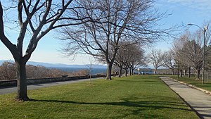
Battery Park (Burlington, Vermont)
Distance: Approx. 472 meters
Latitude and longitude: 44.4810733,-73.2199423
Battery Park is a public park overlooking Lake Champlain at the western end of downtown Burlington, Vermont. The park includes a bandshell, a playground, and various monuments, including a bronze statue of Civil War veteran General William W. Wells, and a red oak sculpture of Chief Gray Lock, a veteran of Gray Lock's War. Locally, it is popular for its wide, sweeping views of Lake Champlain.

Coast Guard Station Burlington
US Coast Guard station in Burlington, Vermont
Distance: Approx. 276 meters
Latitude and longitude: 44.48055556,-73.22416667
Coast Guard Station Burlington, Vermont is a United States Coast Guard station established in 1948 as a four-man light attendant station on Juniper Island. Currently the Station is located on the waterfront of Burlington, Vermont, in a facility built in 1993. Some of the missions they conduct are maritime law enforcement, search and rescue, and ice rescue.
Burlington School District
School district in Vermont, US
Distance: Approx. 633 meters
Latitude and longitude: 44.4776,-73.2224
Burlington School District is a school district in Vermont, United States. It has its headquarters in Burlington. The budget for 2009-10 was $49.9 million.
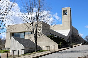
Cathedral Church of St. Paul (Burlington, Vermont)
Church in Vermont, United States
Distance: Approx. 644 meters
Latitude and longitude: 44.47984444,-73.21840833
The Cathedral Church of St. Paul is an Episcopal cathedral located in Burlington, Vermont, United States. It is the seat of the Diocese of Vermont.
Duplex at 73-75 Sherman Street
United States historic place
Distance: Approx. 542 meters
Latitude and longitude: 44.48194444,-73.21861111
The Duplex at 73-75 Sherman Street is a historic multiunit residential building in Burlington, Vermont. Built about 1912 as a livery stable, it was adapted into a residential duplex in 1927. It is a good local example of vernacular Colonial Revival architecture, built as worker housing in the growing city.

William Fitzgerald Block
United States historic place
Distance: Approx. 602 meters
Latitude and longitude: 44.48222222,-73.21777778
The William Fitzgerald Block is a historic mixed-use commercial and residential building at 57-63 North Champlain Street in Burlington, Vermont. Built about 1887, it is a well-preserved example of a period neighborhood store with residences above. It was listed on the National Register of Historic Places in 2012.

House at 44 Front Street
Historic house in Vermont, United States
Distance: Approx. 355 meters
Latitude and longitude: 44.48305556,-73.22083333
44 Front Street in Burlington, Vermont is a well-preserved vernacular Queen Anne Revival house. Built about 1860 and significantly altered in 1892, it is representative of two periods of the city's growth in the 19th century. It was listed on the National Register of Historic Places in 2008.

North Street Historic District (Burlington, Vermont)
Historic district in Vermont, United States
Distance: Approx. 678 meters
Latitude and longitude: 44.48416667,-73.21694444
The North Street Historic District encompasses the traditional commercial area serving the residential Old North End neighborhood of Burlington, Vermont. It extends for ten blocks along North Street between North Avenue and North Winooski Avenue, and has served as the neighborhood's commercial center for over 150 years. It was listed on the National Register of Historic Places in 2001.

John B. Robarge Duplex
Historic house in Vermont, United States
Distance: Approx. 657 meters
Latitude and longitude: 44.48416667,-73.21722222
The John B. Robarge Duplex is a historic multi-unit residence at 58-60 North Champlain Street in Burlington, Vermont. Built 1878–79, it is one of the city's few examples of an Italianate two-family house. It was listed on the National Register of Historic Places in 2005.

Roberge-Desautels Apartment House
Historic residential building in Vermont, United States
Distance: Approx. 650 meters
Latitude and longitude: 44.48194444,-73.21722222
The Robarge-Desautels Apartment House is a historic multi-unit residence at 54 North Champlain Street in Burlington, Vermont. Built about 1900, it is a well-preserved example of a Queen Anne style apartment house. It was listed on the National Register of Historic Places in 2014.

Grand Point North
Annual music festival in Burlington, Vermont
Distance: Approx. 456 meters
Latitude and longitude: 44.47975,-73.22163889
Grand Point North is an annual two-day music festival founded by Grace Potter & The Nocturnals, produced by Grace Potter and Higher Ground Presents, and held at Waterfront Park in Burlington, Vermont. The last festival took place in 2019. The festival was first held in 2011 and typically takes place over a weekend in mid-September.
Weather in this IP's area
clear sky
11 Celsius
10 Celsius
9 Celsius
13 Celsius
1032 hPa
70 %
1032 hPa
1025 hPa
10000 meters
0.33 m/s
0.6 m/s
219 degree
07:12:15
18:03:19