207.114.32.60 - IP Lookup: Free IP Address Lookup, Postal Code Lookup, IP Location Lookup, IP ASN, Public IP
Country:
Region:
City:
Location:
Time Zone:
Postal Code:
IP information under different IP Channel
ip-api
Country
Region
City
ASN
Time Zone
ISP
Blacklist
Proxy
Latitude
Longitude
Postal
Route
Luminati
Country
Region
pa
City
redlion
ASN
Time Zone
America/New_York
ISP
PBW-COMMUNICATIONS
Latitude
Longitude
Postal
IPinfo
Country
Region
City
ASN
Time Zone
ISP
Blacklist
Proxy
Latitude
Longitude
Postal
Route
IP2Location
207.114.32.60Country
Region
maryland
City
cockeysville
Time Zone
America/New_York
ISP
Language
User-Agent
Latitude
Longitude
Postal
db-ip
Country
Region
City
ASN
Time Zone
ISP
Blacklist
Proxy
Latitude
Longitude
Postal
Route
ipdata
Country
Region
City
ASN
Time Zone
ISP
Blacklist
Proxy
Latitude
Longitude
Postal
Route
Popular places and events near this IP address

DigiBarn Computer Museum
A museum of computer history
Distance: Approx. 675 meters
Latitude and longitude: 39.4857,-76.6632
The DigiBarn Computer Museum, or simply DigiBarn, is a computer history museum in Boulder Creek, California, United States. The museum is housed in a 90-year-old barn constructed from old-growth Redwood in the Santa Cruz Mountains, which is adjacent to Silicon Valley. It was co-founded by Bruce Damer and Allan Lundell on May 7, 2001.
National Electronics Museum
Museum in Linthicum, Maryland
Distance: Approx. 651 meters
Latitude and longitude: 39.48583333,-76.66277778
The National Electronics Museum, located in Hunt Valley, Maryland, displays the history of the United States defense electronics. The museum houses exhibits containing assortments of telegraphs, radios, radars and satellites. Located near the light rail stop at Gilroy Road, the museum displays hands-on electronics.

Hunt Valley Towne Centre
Outdoor shopping mall in Hunt Valley, Maryland
Distance: Approx. 888 meters
Latitude and longitude: 39.49805556,-76.655
Hunt Valley Towne Centre, formerly Hunt Valley Mall, is an outdoor shopping mall in northern Baltimore County, Maryland, with 58 stores. The development was constructed following the closure of Hunt Valley Mall (other than its anchor stores) in 2000. The new centre started operating in 2003.
Warren Road station
Light rail station in Cockeysville, Maryland, US
Distance: Approx. 1846 meters
Latitude and longitude: 39.47588889,-76.65366667
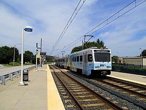
Warren Road station is a Baltimore Light Rail station located off Warren Road in Cockeysville, Maryland. The station opened in 1997 as part of the system's northern extension. It has two side platforms serving two tracks.
Gilroy Road station
Light rail station in Hunt Valley, Maryland, US
Distance: Approx. 1078 meters
Latitude and longitude: 39.48185278,-76.66192222
Gilroy Road station is a Baltimore Light Rail station located in an industrial park in Hunt Valley, Maryland. It opened in 1997 as part of the system's northern extension. The station has two side platforms serving two tracks.
McCormick Road station
Light rail station in Hunt Valley, Maryland, US
Distance: Approx. 273 meters
Latitude and longitude: 39.48955556,-76.65897222
McCormick Road station is a Baltimore Light Rail station located in an industrial park in Hunt Valley, Maryland. It is named after the adjacent road, itself named for McCormick & Company, whose offices are nearby. The station was opened in 1997 as part of the system's northern extension.
Pepper Road station
Light rail station in Maryland, United States
Distance: Approx. 408 meters
Latitude and longitude: 39.49213889,-76.65622222
Pepper Road station is a Baltimore Light Rail station located in an industrial park in Hunt Valley, Maryland. The station opened in 1997 as part of the system's northern extension. It has a single side platform serving a single track.
Hunt Valley station
Light rail station in Hunt Valley, Maryland, US
Distance: Approx. 807 meters
Latitude and longitude: 39.49618333,-76.65373611
Hunt Valley station is a Baltimore Light Rail station located at the Hunt Valley Towne Centre shopping complex in Hunt Valley, Maryland. The station opened in 1997 as the terminus of a northern extension of the Light Rail system. It has a single island platform serving two tracks, which continue east of the platform as tail tracks.
Greetings & Readings
Distance: Approx. 874 meters
Latitude and longitude: 39.4982,-76.6556
Greetings & Readings of Hunt Valley was the largest independent bookstore in Baltimore and was a member of the American Booksellers Association. The store occupied 30,000 square feet (2,800 m2) of retail and warehouse space on the second floor of the main Hunt Valley Towne Centre plaza, the final northbound destination of the Baltimore Light Rail, before closing in January 2019.
Baltimore County School No. 7
Historic school building in Maryland
Distance: Approx. 1659 meters
Latitude and longitude: 39.49527778,-76.64222222
Baltimore County School No. 7, also known as Ashland School, is a historic school building located at Cockeysville, Baltimore County, Maryland. It was constructed in 1882 at the entrance to the village of Ashland, associated with the Ashland Iron Works.

Beaver Dam (Maryland)
Distance: Approx. 1444 meters
Latitude and longitude: 39.47888889,-76.65694444
Beaver Dam is a flooded marble quarry in Cockeysville, Maryland that has been used as a swimming location since the 1930s. Currently, a 30-acre swim club is located there with two swimming pools, a volleyball court, picnic tables and grills, a creek, and snack house. The 40 foot deep freshwater quarry has floating platforms, two rolling logs, diving and jumping platforms, and a rope swing.

System Source Computer Museum
Computer Museum in Hunt Valley, Maryland, U.S.
Distance: Approx. 629 meters
Latitude and longitude: 39.4861,-76.66306
The System Source Computer Museum, located in Hunt Valley, Maryland, USA, exhibits notable computing devices from ancient times until the present. Over 5,000 objects are on display and many of the computation devices are operational. STEM activities are offered to organized tour groups.
Weather in this IP's area
overcast clouds
3 Celsius
0 Celsius
2 Celsius
5 Celsius
1026 hPa
70 %
1026 hPa
1008 hPa
10000 meters
2.91 m/s
5.24 m/s
25 degree
100 %


