206.82.196.25 - IP Lookup: Free IP Address Lookup, Postal Code Lookup, IP Location Lookup, IP ASN, Public IP
Country:
Region:
City:
Location:
Time Zone:
Postal Code:
ISP:
ASN:
language:
User-Agent:
Proxy IP:
Blacklist:
IP information under different IP Channel
ip-api
Country
Region
City
ASN
Time Zone
ISP
Blacklist
Proxy
Latitude
Longitude
Postal
Route
db-ip
Country
Region
City
ASN
Time Zone
ISP
Blacklist
Proxy
Latitude
Longitude
Postal
Route
IPinfo
Country
Region
City
ASN
Time Zone
ISP
Blacklist
Proxy
Latitude
Longitude
Postal
Route
IP2Location
206.82.196.25Country
Region
california
City
irvine
Time Zone
America/Los_Angeles
ISP
Language
User-Agent
Latitude
Longitude
Postal
ipdata
Country
Region
City
ASN
Time Zone
ISP
Blacklist
Proxy
Latitude
Longitude
Postal
Route
Popular places and events near this IP address
Pao Fa Temple
Buddhist monastery and temple in California
Distance: Approx. 1257 meters
Latitude and longitude: 33.69204,-117.82969
Pao Fa Temple (Chinese: 寶法寺; pinyin: Bǎofǎ Sì; Pe̍h-ōe-jī: Pó-hoat-sī) is one of the largest Buddhist monasteries and Buddhist temples in the United States. It is located in Irvine, California.

Woodbridge High School (Irvine, California)
Public high school in Irvine, California
Distance: Approx. 2347 meters
Latitude and longitude: 33.6784,-117.80674
Woodbridge High School (WHS) is a public high school located in Irvine, California, United States, serving grades 9–12. Woodbridge is in the Irvine Unified School District. Founded in 1980, it has an approximate enrollment of 2,400 students.

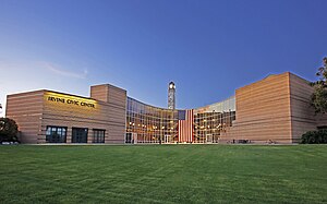
Irvine, California
City in California, United States
Distance: Approx. 1516 meters
Latitude and longitude: 33.66944444,-117.82305556
Irvine () is a master-planned city in central Orange County, California, United States, in the Los Angeles metropolitan area. The Irvine Company started developing the area in the 1960s and the city was formally incorporated on December 28, 1971. The 66-square-mile (170 km2) city had a population of 307,670 at the 2020 census.

Irvine Police Department
Police department for the city of Irvine, California
Distance: Approx. 787 meters
Latitude and longitude: 33.68614462,-117.82619654
The Irvine Police Department is the local law enforcement agency of the city of Irvine, California, United States. The department's jurisdiction includes the entire city of Irvine, which covers nearly 70 square miles (180 km2) and a population of over 270,000, as well as the Orange County Great Park. It also supplements the jurisdiction of the University of California, Irvine, Police Department, whose jurisdiction includes the University of California, Irvine campus and surrounding areas of the city.

Rancho San Joaquin
Mexican land grant in California
Distance: Approx. 1497 meters
Latitude and longitude: 33.69,-117.82
Rancho San Joaquin, the combined Rancho Cienega de las Ranas and Rancho Bolsa de San Joaquin, was a 48,803-acre (197.50 km2) Mexican land grant in the San Joaquin Hills, within present-day Orange County, California. It was granted to José Antonio Andres Sepúlveda. In Spanish Cienega de las Ranas means "Marsh of the Frogs" and Bolsa means "Pocket", and usually in reference to wetlands landforms.
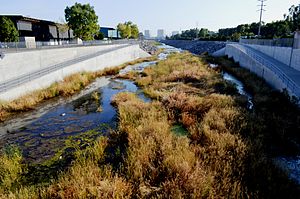
Peters Canyon Wash
Stream in Orange County, California
Distance: Approx. 1872 meters
Latitude and longitude: 33.69399615,-117.81922743
Peters Canyon Wash is a tributary of San Diego Creek in central Orange County in the U.S. state of California.
Irvine Ranch Water District
Distance: Approx. 1944 meters
Latitude and longitude: 33.66460233,-117.83942384
Irvine Ranch Water District (IRWD) is a California Special District formed in 1961 and incorporated under the California water code. The IRWD headquarters is located in Irvine, California. IRWD offers the following services: potable water sales, sewer service, and the sale of reclaimed (or recycled) water.

Shepherd's Grove
Church in California, United States
Distance: Approx. 2446 meters
Latitude and longitude: 33.677155,-117.805878
Shepherd's Grove is a congregation of the Presbyterian Church (USA) in Irvine, California, United States. The church was founded by Robert H. Schuller in 1955 as the Garden Grove Community Church and renamed to Crystal Cathedral Ministries after its church building, the Crystal Cathedral, in 1981. The congregation is now pastored by Bobby V. Schuller, grandson of Robert H. Schuller, and the organization has changed its name to Shepherd's Grove Ministries.

San Joaquin Marsh Wildlife Sanctuary
Wildlife sanctuary in California
Distance: Approx. 2286 meters
Latitude and longitude: 33.663,-117.844
The San Joaquin Marsh Wildlife Sanctuary is a 300-acre (120 ha; 0.47 sq mi) constructed wetland in Irvine, California, in the flood plain of San Diego Creek just above its outlet into the Upper Newport Bay.
Alphaeon Corporation
American healthcare company
Distance: Approx. 1930 meters
Latitude and longitude: 33.67833333,-117.8525
Alphaeon Corporation is a company focused on healthcare products and services based in Irvine, California. Alphaeon Corporation serves healthcare providers in the self-pay segment; primarily plastic surgery, ophthalmology, dentistry, and dermatology.
The District (Tustin)
Shopping mall in California, United States
Distance: Approx. 1929 meters
Latitude and longitude: 33.6977,-117.8268
The District is a large outdoor shopping center and entertainment hub in Tustin, California. It was developed by Vestar Development Co. and was the largest shopping center in Orange County to open in more than a decade when it opened in 2007.
Westcliff University
For-profit university in Irvine, California
Distance: Approx. 1577 meters
Latitude and longitude: 33.6855,-117.848
Westcliff University (WU) is a private, for-profit university in Irvine, California. Founded in 1993, it offers bachelor's, master's, and doctorate degrees, as well as certificate programs and continuing education courses.
Weather in this IP's area
clear sky
26 Celsius
26 Celsius
24 Celsius
28 Celsius
1022 hPa
9 %
1022 hPa
1012 hPa
10000 meters
2.57 m/s
180 degree

