Country:
 USA
USARegion:
City:
Latitude and Longitude:
Time Zone:
Postal Code:
IP information under different IP Channel
ip-api
Country
Region
City
ASN
Time Zone
ISP
Blacklist
Proxy
Latitude
Longitude
Postal
Route
IPinfo
Country
Region
City
ASN
Time Zone
ISP
Blacklist
Proxy
Latitude
Longitude
Postal
Route
MaxMind
Country
Region
City
ASN
Time Zone
ISP
Blacklist
Proxy
Latitude
Longitude
Postal
Route
Luminati
Country
USRegion
ca
City
hanford
ASN
Time Zone
America/Los_Angeles
ISP
KCOENET
Latitude
Longitude
Postal
db-ip
Country
Region
City
ASN
Time Zone
ISP
Blacklist
Proxy
Latitude
Longitude
Postal
Route
ipdata
Country
Region
City
ASN
Time Zone
ISP
Blacklist
Proxy
Latitude
Longitude
Postal
Route
Popular places and events near this IP address

Lemoore, California
City in California, United States
Distance: Approx. 4573 meters
Latitude and longitude: 36.30083333,-119.78277778
Lemoore (formerly, La Tache and Lee Moore's) is a city in Kings County, California, United States. Lemoore is located 7.5 miles (12 km) west-southwest of Hanford, at an elevation of 230 feet (70 m). It is part of the Hanford-Corcoran Metropolitan Statistical Area (MSA Code 25260).

Lemoore Station, California
Census-designated place in California, United States
Distance: Approx. 6263 meters
Latitude and longitude: 36.26055556,-119.89194444
Lemoore Station is a census-designated place (CDP) in Naval Air Station Lemoore, Kings County, California, United States. It is part of the Hanford–Corcoran Metropolitan Statistical Area. The population was 7,438 as of the 2010 United States Census.
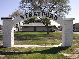
Stratford, California
Census-designated place in California, United States
Distance: Approx. 9995 meters
Latitude and longitude: 36.18944444,-119.82305556
Stratford (formerly, Stratton) is a census-designated place (CDP) in Kings County, California, United States. Stratford is located 14 miles (23 km) southwest of Hanford, at an elevation of 203 feet (62 m). It is part of the Hanford–Lemoore Metropolitan Statistical Area.
Lemoore High School
American public high school
Distance: Approx. 4625 meters
Latitude and longitude: 36.29777778,-119.78
Lemoore Union High School (commonly known as Lemoore High School or Lemoore High) is a public school located in Lemoore, California. It serves grades 9 through 12 and is accredited through the California Department of Education. Its enrollment for 2006-2007 was 2066 students.

Santa Rosa Rancheria
Distance: Approx. 7984 meters
Latitude and longitude: 36.23611111,-119.755
Santa Rosa Rancheria is the reservation of the Santa Rosa Indian Community of the Santa Rosa Rancheria. It is located 4.5 miles (7.24 km) southeast of Lemoore, California. Established in 1934 on about 40 acres (16 hectares), the Santa Rosa Rancheria belongs to the federally recognized Tachi Yokuts tribe.
KGAR-LP
Radio station in Lemoore, California
Distance: Approx. 4678 meters
Latitude and longitude: 36.2975,-119.77916667
KGAR-LP (93.3 FM) is a high school radio station broadcasting a variety music format. Licensed to Lemoore, California, United States, the station serves the Visalia-Tulare area. The station is currently owned by Lemoore Union High School District.
R.J. Neutra Elementary School
School district in California, United States
Distance: Approx. 5575 meters
Latitude and longitude: 36.26027778,-119.88361111
The R. J. Neutra Elementary School is an elementary school on the Naval Air Station Lemoore Base located in the San Joaquin Valley, in Lemoore Station, Kings County, California.
Halls Corner, California
Unincorporated community in California, United States
Distance: Approx. 7265 meters
Latitude and longitude: 36.3425,-119.80638889
Halls Corner is an unincorporated community in Kings County, California. It is located 3 miles (4.8 km) north-northwest of Lemoore, at an elevation of 230 feet (70 m). Hall's Corner is the intersection of California State Route 41 and Grangeville Boulevard.

Tachi Palace
Casino in California
Distance: Approx. 7184 meters
Latitude and longitude: 36.23693,-119.76562
Tachi Palace Hotel & Casino is an Indian casino and hotel on the Santa Rosa Rancheria in Lemoore, California.
Lemoore College
American community college
Distance: Approx. 1483 meters
Latitude and longitude: 36.2924,-119.8239
Lemoore College is a public community college in Lemoore, California. It was built in 2002 and serves students in the San Joaquin Valley. In addition, classes are offered at Lemoore Naval Air Station.
Weather in this IP's area
clear sky
8 Celsius
7 Celsius
8 Celsius
10 Celsius
1019 hPa
46 %
1019 hPa
1011 hPa
10000 meters
2.57 m/s
240 degree
07:11:12
18:16:26