206.72.17.130 - IP Lookup: Free IP Address Lookup, Postal Code Lookup, IP Location Lookup, IP ASN, Public IP
Country:
 USA
USARegion:
City:
Location:
Time Zone:
Postal Code:
ISP:
ASN:
language:
User-Agent:
Proxy IP:
Blacklist:
IP information under different IP Channel
ip-api
Country
Region
City
ASN
Time Zone
ISP
Blacklist
Proxy
Latitude
Longitude
Postal
Route
db-ip
Country
Region
City
ASN
Time Zone
ISP
Blacklist
Proxy
Latitude
Longitude
Postal
Route
IPinfo
Country
Region
City
ASN
Time Zone
ISP
Blacklist
Proxy
Latitude
Longitude
Postal
Route
IP2Location
206.72.17.130Country
usRegion
iowa
City
wheatland
Time Zone
America/Chicago
ISP
Language
User-Agent
Latitude
Longitude
Postal
ipdata
Country
Region
City
ASN
Time Zone
ISP
Blacklist
Proxy
Latitude
Longitude
Postal
Route
Popular places and events near this IP address

Lowden, Iowa
City in Iowa, United States
Distance: Approx. 7680 meters
Latitude and longitude: 41.85777778,-90.92583333
Lowden is a city in Cedar County, Iowa, United States. The population was 807 at the time of the 2020 census.
Calamus, Iowa
City in Iowa, United States
Distance: Approx. 6624 meters
Latitude and longitude: 41.82666667,-90.75972222
Calamus () is a small town in Clinton County, Iowa, United States, located on the historical Lincoln Highway, which was the first transcontinental highway for automobiles across the U.S.. Calamus is the only town in Olive Township and had a population of 356 at the 2020 census, which was a 9.6% decrease from 2000. Calamus was named after Calamus Creek, which received its name from the great quantities of sweet flag growing in it, derived from the botanical name Acorus calamus, commonly called Sweet Flag or Calamus.

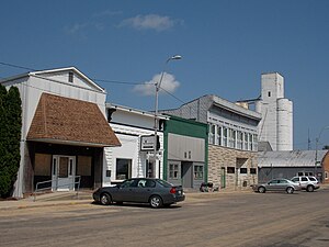
Wheatland, Iowa
City in Iowa, United States
Distance: Approx. 120 meters
Latitude and longitude: 41.83277778,-90.83944444
Wheatland is a city in Clinton County, Iowa, United States. The population was 775 at the time of the 2020 census.

Menke Observatory
Astronomical observatory in Iowa, US
Distance: Approx. 7821 meters
Latitude and longitude: 41.77194444,-90.79430556
Menke Observatory is an astronomical observatory owned and operated by St. Ambrose University. It is located northwest of Dixon, Iowa (USA) on the southern bank of the Wapsipinicon River.

Spring Rock Township, Clinton County, Iowa
Township in Iowa, United States
Distance: Approx. 2178 meters
Latitude and longitude: 41.81666667,-90.85166667
Spring Rock Township is a township in Clinton County, Iowa, United States. As of the 2000 census, its population was 1,142.

Big Rock, Iowa
Census-designated place in Iowa, United States
Distance: Approx. 7148 meters
Latitude and longitude: 41.77027778,-90.82638889
Big Rock is an unincorporated community and census-designated place in Scott and Clinton counties, Iowa, United States. The community is named for a large boulder.
Calamus–Wheatland High School
Public secondary school in Wheatland, Iowa, United States
Distance: Approx. 432 meters
Latitude and longitude: 41.83767026,-90.83870285
Calamus–Wheatland High School is a rural public, four-year high school located in Wheatland, Iowa. The school is part of the Calamus–Wheatland Community School District. Located approximately one mile north of U.S. Highway 30 in Wheatland, Calamus–Wheatland High School draws students from several communities in western and southwestern Clinton County, including Calamus, Wheatland and Toronto; the district also includes a small portion of northwestern Scott County, drawing students from the unincorporated community of Big Rock and rural areas north and west of Dixon.

City Hotel (Wheatland, Iowa)
United States historic place
Distance: Approx. 330 meters
Latitude and longitude: 41.83083333,-90.83888889
City Hotel, also known as Seifert's Tavern and the Wheatland Feed Mill, on 214 South Main Street in Wheatland, Iowa was listed on the National Register of Historic Places for Clinton County, Iowa in 2007.
Rock Creek (Wapsipinicon River tributary)
River in Iowa, U.S
Distance: Approx. 6721 meters
Latitude and longitude: 41.779748,-90.802923
Rock Creek is a river in U.S. state of Iowa. It is a tributary of the Wapsipinicon River. Rock Creek takes its name from the ancient rock it contains.

Lincoln Hotel (Lowden, Iowa)
United States historic place
Distance: Approx. 7738 meters
Latitude and longitude: 41.857825,-90.92656667
The Lincoln Hotel is a historic building located in Lowden, Iowa, United States. It was listed on the National Register of Historic Places in 1996. The Lincoln Highway was established in 1913 and passed through Lowden.

Kreinbring Phillips 66 Gas Station
United States historic place
Distance: Approx. 7452 meters
Latitude and longitude: 41.857825,-90.92286944
Kreinbring Phillips 66 Gas Station is a historic building located in Lowden, Iowa, United States. The Lincoln Highway was established in 1913 and passed through Lowden. In Iowa the highway became U.S. Highway 30 (US 30) in the 1920s.
Calamus–Wheatland Community School District
School district in Iowa
Distance: Approx. 463 meters
Latitude and longitude: 41.837956,-90.838719
Calamus–Wheatland Community School District is a rural public school district headquartered in Wheatland, Iowa. Most of the district is in Clinton County with a portion in Scott County. The district serves Wheatland, Calamus, and Toronto.
Weather in this IP's area
snow
-8 Celsius
-12 Celsius
-8 Celsius
-6 Celsius
1014 hPa
89 %
1014 hPa
985 hPa
196 meters
2.24 m/s
4.47 m/s
10 degree
100 %