206.56.245.45 - IP Lookup: Free IP Address Lookup, Postal Code Lookup, IP Location Lookup, IP ASN, Public IP
Country:
Region:
City:
Location:
Time Zone:
Postal Code:
ISP:
ASN:
language:
User-Agent:
Proxy IP:
Blacklist:
IP information under different IP Channel
ip-api
Country
Region
City
ASN
Time Zone
ISP
Blacklist
Proxy
Latitude
Longitude
Postal
Route
db-ip
Country
Region
City
ASN
Time Zone
ISP
Blacklist
Proxy
Latitude
Longitude
Postal
Route
IPinfo
Country
Region
City
ASN
Time Zone
ISP
Blacklist
Proxy
Latitude
Longitude
Postal
Route
IP2Location
206.56.245.45Country
Region
louisiana
City
pineville
Time Zone
America/Chicago
ISP
Language
User-Agent
Latitude
Longitude
Postal
ipdata
Country
Region
City
ASN
Time Zone
ISP
Blacklist
Proxy
Latitude
Longitude
Postal
Route
Popular places and events near this IP address

Pineville, Louisiana
City in Louisiana, United States
Distance: Approx. 2157 meters
Latitude and longitude: 31.33888889,-92.4125
Pineville is a city in Rapides Parish, Louisiana, United States. It is located across the Red River from the larger Alexandria, and is part of the Alexandria Metropolitan Statistical Area. The population was 14,555 at the 2010 census.

Louisiana National Guard Training Center Pineville
US Army installation in Louisiana
Distance: Approx. 3012 meters
Latitude and longitude: 31.37569444,-92.389525
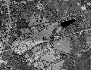
Louisiana National Guard Training Center Pineville (previously Camp Beauregard) is a Louisiana National Guard installation located northeast of Pineville, Louisiana, primarily in Rapides Parish, but also extending northward into Grant Parish. It is operated and owned by the Louisiana National Guard as one of their main training areas. The current base covers 12,500 acres (51 km2) and is home to many different units and elements of the Louisiana Army National Guard.
Louisiana Christian University
Baptist university in Pineville, Louisiana, US
Distance: Approx. 4136 meters
Latitude and longitude: 31.32527778,-92.42666667
Louisiana Christian University (LC) is a private Baptist university in Pineville, Louisiana. It enrolls 1,100 to 1,200 students. It is affiliated with the Louisiana Baptist Convention (Southern Baptist Convention).
Alexandria National Cemetery (Louisiana)
Historic veterans cemetery in Rapides Parish, Louisiana
Distance: Approx. 4741 meters
Latitude and longitude: 31.3225,-92.43222222
Alexandria National Cemetery is a United States National Cemetery located in the city of Pineville, in Rapides Parish, Louisiana. It occupies approximately 8 acres (3.2 ha), and is site to over 10,000 interments as of the end of 2020.
KJMJ
Catholic radio station in Alexandria, Louisiana
Distance: Approx. 5001 meters
Latitude and longitude: 31.30833333,-92.41583333
KJMJ (580 AM) is a Catholic radio station broadcasting from Alexandria, Louisiana, United States. It is the originating station of Radio Maria USA, The World Family of Radio Maria's US operations, airing Catholic programming including a mix of traditional Catholic worship and contemporary Christian music, along with a weekday Mass, frequent recitals of the Holy Rosary and various talk and teaching programs on the Catholic faith. It is simulcast on nine full powered stations and one low powered translator, and its audio stream can be accessed from its website and via apps for iPhone, BlackBerry, Windows and Android mobile phone devices.

Pineville High School (Louisiana)
Public high school in Pineville, Louisiana, United States
Distance: Approx. 4069 meters
Latitude and longitude: 31.33472222,-92.4325
Pineville High School (PHS) is a coeducational public high school located in Pineville, in Rapides Parish in central Louisiana, United States. The school opened in 1952.

Central Louisiana State Hospital Dairy Barn
United States historic place
Distance: Approx. 4852 meters
Latitude and longitude: 31.33361111,-92.44083333
The Central Louisiana State Hospital Dairy Barn is located in Pineville, Louisiana. It was added to the National Register of Historic Places on May 15, 1986. Its National Register nomination describes it:The Central Louisiana State Hospital Dairy Barn is of statewide significance in the area of architecture as a very unusual example of a farm outbuilding.

Cottingham House
Historic house in Louisiana, United States
Distance: Approx. 3862 meters
Latitude and longitude: 31.32805556,-92.42555556
Cottingham House is located in Pineville, Louisiana. It was added to the National Register of Historic Places on September 8, 1987. The house was built in 1907 for Dr.

Old LSU Site
United States historic place
Distance: Approx. 4343 meters
Latitude and longitude: 31.35861111,-92.43722222
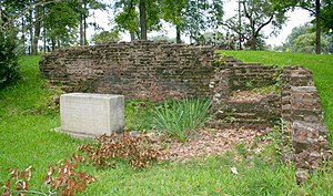
The Old LSU Site is located in Pineville, Louisiana. In November 1859, the institution's main building was completed. The institution's first superintendent was Major William Tecumseh Sherman.

Tioga Commissary
United States historic place
Distance: Approx. 5099 meters
Latitude and longitude: 31.38305556,-92.42861111
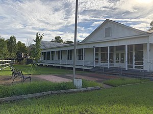
Tioga Commissary is located in Tioga, Louisiana. It was added to the National Register of Historic Places on October 16, 1986. Located north of Alexandria the Commissary is part of the Tioga Heritage Park and Museum In 1905 Stephen Lee purchased a sawmill, built by Julius Levin, and surrounding land from Daniel F. Clark, owner of Union Lumber Company.
Alexandria Hall-Louisiana College
United States historic place
Distance: Approx. 4136 meters
Latitude and longitude: 31.32527778,-92.42666667
Alexandria Hall-Louisiana College is a Classical Revival structure built in 1920, located in Pineville, Louisiana. Alexandria Hall was named to honor the people of Alexandria, Louisiana. The building is part of the campus of Louisiana Christian University, formerly Louisiana College.
J. Levy Dabadie Correctional Center
Distance: Approx. 2755 meters
Latitude and longitude: 31.37333333,-92.38916667
J. Levy Dabadie Correctional Center (JLDCC or DCC) was a men's prison adjacent to the Louisiana National Guard base on the grounds of Camp Beauregard and in Pineville, Louisiana. A facility of the Louisiana Department of Public Safety and Corrections, JLDCC is about 1 mile (1.6 km) east of the intersection of U.S. Route 165 and Louisiana Highway 116. Dabadie opened in 1970.
Weather in this IP's area
clear sky
-3 Celsius
-5 Celsius
-3 Celsius
-1 Celsius
1031 hPa
82 %
1031 hPa
1026 hPa
10000 meters
1.54 m/s
290 degree


