206.54.196.70 - IP Lookup: Free IP Address Lookup, Postal Code Lookup, IP Location Lookup, IP ASN, Public IP
Country:
Region:
City:
Location:
Time Zone:
Postal Code:
IP information under different IP Channel
ip-api
Country
Region
City
ASN
Time Zone
ISP
Blacklist
Proxy
Latitude
Longitude
Postal
Route
Luminati
Country
Region
tx
City
missouricity
ASN
Time Zone
America/Chicago
ISP
GRANDECOM-AS1
Latitude
Longitude
Postal
IPinfo
Country
Region
City
ASN
Time Zone
ISP
Blacklist
Proxy
Latitude
Longitude
Postal
Route
IP2Location
206.54.196.70Country
Region
texas
City
missouri city
Time Zone
America/Chicago
ISP
Language
User-Agent
Latitude
Longitude
Postal
db-ip
Country
Region
City
ASN
Time Zone
ISP
Blacklist
Proxy
Latitude
Longitude
Postal
Route
ipdata
Country
Region
City
ASN
Time Zone
ISP
Blacklist
Proxy
Latitude
Longitude
Postal
Route
Popular places and events near this IP address

Sienna, Texas
Census-designated master-planned community in Fort Bend County, Texas
Distance: Approx. 4256 meters
Latitude and longitude: 29.49305556,-95.50666667
Sienna, formerly known as Sienna Plantation, is a census-designated place and master-planned community located in Fort Bend County, Texas, United States. It is mostly in the extraterritorial jurisdiction (ETJ) of Missouri City with the remainder in the ETJ of Arcola. The population was 20,204 at the 2020 census, up from 13,721 at the 2010 census.

KXLN-DT
TV station in Rosenberg, Texas
Distance: Approx. 4554 meters
Latitude and longitude: 29.56255556,-95.50997222
KXLN-DT (channel 45) is a television station licensed to Rosenberg, Texas, United States, serving as the Houston-area outlet for the Spanish-language network Univision. It is owned and operated by TelevisaUnivision alongside Alvin-licensed UniMás station KFTH-DT (channel 67). The two stations share studios near the Southwest Freeway (adjacent to the I-610/I-69 interchange) on Houston's southwest side; KXLN-DT's transmitter is located near Missouri City, in unincorporated northeastern Fort Bend County.
KYAZ
TV station in Katy, Texas
Distance: Approx. 4554 meters
Latitude and longitude: 29.56255556,-95.50997222
KYAZ (channel 51) is a television station licensed to Katy, Texas, United States, serving as the Houston area outlet for the classic television network MeTV. Owned and operated by Weigel Broadcasting, the station maintains studios at One Arena Place on Bissonnet Street on Houston's southwest side, and its transmitter is located near Missouri City, Texas.

KTBU
TV station in Conroe, Texas
Distance: Approx. 4554 meters
Latitude and longitude: 29.56255556,-95.50997222
KTBU (channel 55) is a television station licensed to Conroe, Texas, United States, serving as the Houston area outlet for the digital multicast network Quest. It is owned and operated by Tegna Inc. alongside CBS affiliate KHOU (channel 11).

Hightower High School
Public school in Texas, United States
Distance: Approx. 3197 meters
Latitude and longitude: 29.5314,-95.4976
Hightower High School is a secondary school (grades 9–12) located at 3333 Hurricane Lane, Missouri City, Texas, United States, adjacent to The Fort Bend Parkway Toll Road. Hightower is administered by Fort Bend Independent School District and its mascot is Poseidon, but they are known as the Hightower Hurricanes. Hightower serves parts of Missouri City, a portion of the city of Arcola, sections of the unincorporated area of Fresno, a small section of western Pearland, and the neighborhood of Lake Shore Harbour, which is located in the extraterritorial jurisdiction of Missouri City.

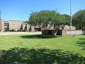
Elkins High School (Missouri City, Texas)
Public school in Missouri City, Texas, United States
Distance: Approx. 3503 meters
Latitude and longitude: 29.5452,-95.5581
Lawrence E. Elkins High School, more commonly known as Elkins High School is a comprehensive public high school in Missouri City, Texas, that serves communities in Sugar Land and Missouri City. The school, which handles grades 9 through 12, is a part of the Fort Bend Independent School District. Elkins was established in 1992, with its first graduating class in 1995.
KZJL
TV station in Houston
Distance: Approx. 4554 meters
Latitude and longitude: 29.56255556,-95.50997222
KZJL (channel 61) is a television station in Houston, Texas, United States, broadcasting the Spanish-language network Estrella TV. It is owned and operated by Estrella Media and is sister to four radio stations. KZJL's studios are located on Bering Drive on the city's southwest side, and its transmitter is located near Missouri City, in unincorporated northeastern Fort Bend County.
KHLM-LD
Television station in Texas, United States
Distance: Approx. 4554 meters
Latitude and longitude: 29.56255556,-95.50997222
KHLM-LD (channel 12) is a low-power religious television station in Houston, Texas, United States, owned and operated by the Christian Television Network. The station's transmitter is located near Missouri City, in unincorporated northeastern Fort Bend County.
Trammels, Missouri City, Texas
Neighborhood in Fort Bend, Texas, United States
Distance: Approx. 1263 meters
Latitude and longitude: 29.53472222,-95.5375
Trammels (sometimes spelled Trammells) was an unincorporated area near State Highway 6 in eastern Fort Bend County, Texas, United States.
DeWalt, Missouri City, Texas
Neighborhood in Fort Bend, Texas, United States
Distance: Approx. 4331 meters
Latitude and longitude: 29.55666667,-95.55666667
DeWalt or Dewalt was an unincorporated area in Fort Bend County, in the U.S. state of Texas. The former community was located on State Highway 6 (SH 6) between Oilfield Road and Farm to Market Road 1092 (FM 1092). DeWalt has been absorbed by the municipality of Missouri City, a Houston suburb.

Ridge Point High School
Public secondary school in Missouri City, Texas, United States
Distance: Approx. 3924 meters
Latitude and longitude: 29.49202,-95.51724
Ridge Point High School (RPHS) is a public high school located in Sienna (formerly Sienna Plantation), an unincorporated area and planned community in Fort Bend County, Texas. Opened in 2010, the school serves more than 3000 students in grades 9–12. It is classified as a 6A school by the UIL. The principal is Leonard Brogan.
KUVM-LD
Television station in Texas, United States
Distance: Approx. 4554 meters
Latitude and longitude: 29.56255556,-95.50997222
KUVM-LD (channel 10) is a low-power television station licensed to Missouri City, Texas, United States, serving the Houston area. The station is owned by Innovate Corp.
Weather in this IP's area
fog
14 Celsius
14 Celsius
13 Celsius
16 Celsius
1013 hPa
96 %
1013 hPa
1010 hPa
402 meters
2.06 m/s
170 degree
100 %