206.54.193.187 - IP Lookup: Free IP Address Lookup, Postal Code Lookup, IP Location Lookup, IP ASN, Public IP
Country:
Region:
City:
Location:
Time Zone:
Postal Code:
IP information under different IP Channel
ip-api
Country
Region
City
ASN
Time Zone
ISP
Blacklist
Proxy
Latitude
Longitude
Postal
Route
Luminati
Country
Region
tx
City
houston
ASN
Time Zone
America/Chicago
ISP
GRANDECOM-AS1
Latitude
Longitude
Postal
IPinfo
Country
Region
City
ASN
Time Zone
ISP
Blacklist
Proxy
Latitude
Longitude
Postal
Route
IP2Location
206.54.193.187Country
Region
texas
City
houston
Time Zone
America/Chicago
ISP
Language
User-Agent
Latitude
Longitude
Postal
db-ip
Country
Region
City
ASN
Time Zone
ISP
Blacklist
Proxy
Latitude
Longitude
Postal
Route
ipdata
Country
Region
City
ASN
Time Zone
ISP
Blacklist
Proxy
Latitude
Longitude
Postal
Route
Popular places and events near this IP address

Sheldon, Texas
Unincorporated Community and Census-designated place in Texas, United States
Distance: Approx. 6145 meters
Latitude and longitude: 29.86055556,-95.13388889
Sheldon is an unincorporated community and a census-designated place (CDP) in northeastern Harris County, Texas, United States, located completely inside the extraterritorial jurisdiction of the City of Houston. The Sheldon area is located along Beltway 8 and US Highway 90, approximately twelve miles (19 km) northeast of Downtown Houston. Since the 1950s, the population growth of Sheldon has grown to extend past the statistical census-designated place (CDP) boundary originally delineated by the United States Census Bureau.

Lake Houston
Municipal water reservoir in northeast of downtown Houston, Texas
Distance: Approx. 7663 meters
Latitude and longitude: 29.95883333,-95.14883333
Lake Houston is a reservoir on the San Jacinto River, 15 miles (24 km) northeast of downtown Houston, Texas, United States. The reservoir is the primary municipal water supply for the city of Houston.

Sheldon Lake
Reservoir on Carpenters Bayou in Texas, United States
Distance: Approx. 3042 meters
Latitude and longitude: 29.87033333,-95.17283333
Sheldon Lake is a reservoir in Sheldon Lake State Park (SLSP) located in Harris County approximately 16 mi. (26 km) northeast of downtown Houston, Texas. It is positioned within the San Jacinto River Basin, on Carpenters Bayou.
Beaumont Place, Texas
Unincorporated community in Texas, US
Distance: Approx. 6799 meters
Latitude and longitude: 29.83722222,-95.19972222
Beaumont Place is an unincorporated community in east central Harris County, Texas, United States. It is located along Beaumont Highway (U.S. Highway 90) and the Southern Pacific Railroad. It is 2 miles (3.2 km) southwest of the Sheldon Reservoir.
Houmont Park, Texas
Unincorporated community in Harris County, Texas
Distance: Approx. 6435 meters
Latitude and longitude: 29.8425,-95.20638889
Houmont Park is an unincorporated area in east central Harris County, Texas, United States. It is located along Beaumont Highway (U.S. Highway 90) and the Southern Pacific Railroad, 2 miles (3.2 km) southwest of the Sheldon Reservoir. The subdivision developed during the 1950s and the 1960s, as Greater Houston expanded in size.
Dyersdale, Texas
Unincorporated community in Texas, US
Distance: Approx. 7303 meters
Latitude and longitude: 29.89166667,-95.25777778
Dyersdale is an unincorporated community in Harris County, Texas, United States. The name originates from Clement C. Dyer, one of the "Old Three Hundred" of Stephen F. Austin's colonists. A post office opened in 1913.
Summer Creek High School
Public school in Texas, United States
Distance: Approx. 4082 meters
Latitude and longitude: 29.92556,-95.20795
Summer Creek High School (SCHS) is a high school in unincorporated Harris County, Texas, and a part of the Humble Independent School District. It serves several areas, including Summerwood and Fall Creek, the two neighborhoods that the school get its name from. Built to relieve the overcrowded Atascocita HS and Humble HS, SCHS is approximately 435,000 square feet (40,400 m2) and is a comprehensive, ninth through twelfth grade high school for 3,200 students; The campus has athletic facilities and playing fields, an auditorium, a natatorium, a career and vocational education facilities, a food court and a learning resource center.
Dwight D. Eisenhower Park (Houston)
Public park in Harris County, Texas
Distance: Approx. 4843 meters
Latitude and longitude: 29.90694444,-95.13361111
Dwight D. Eisenhower Park is a park located in Harris County, Texas on the south coast of Lake Houston It is owned and managed by Harris County Precinct One, which acquired the park from the City of Houston in 1995.
Buckhorn Lake (Houston)
Reservoir in Harris County, Texas
Distance: Approx. 4871 meters
Latitude and longitude: 29.886056,-95.133264
Buckhorn Lake is a private lake in Harris County in the state of Texas, United States. The lake is approximately 60 acres (24 ha) filled with cypress trees and was created by an underwater creek and spring. It is well stocked for fishing.

C.E. King High School
Public school in Houston, Harris County, Texas, United States
Distance: Approx. 5833 meters
Latitude and longitude: 29.8485,-95.2068
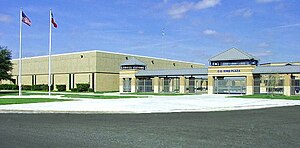
C.E. King High School is a secondary school located in unincorporated Harris County, Texas, United States and serves grades 9 through 12. It is the only high school in the Sheldon Independent School District. The school serves unincorporated areas of northeast Harris County including the Sheldon CDP and several nearby communities (Beaumont Place, Houmont Park) and subdivisions.

Crenshaw Memorial Stadium
Distance: Approx. 5871 meters
Latitude and longitude: 29.849238,-95.209529
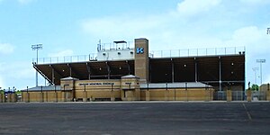
J.H. Crenshaw Memorial Stadium is a multi-purpose stadium in unincorporated Harris County located northeast of Houston, Texas. The stadium is owned and operated by Sheldon Independent School District and is composed of a track and field which are used for various sports. The stadium is situated in the space between C.E. King Middle School and C.E. King High School and is shared by C.E. King Middle school and Michael R. Null Middle School.

Sheldon Lake State Park and Environmental Learning Center
State park in Texas, United States
Distance: Approx. 3042 meters
Latitude and longitude: 29.87033333,-95.17283333
Sheldon Lake State Park and Environmental Learning Center is a 2,800-acre outdoor education and recreation facility in northeast Harris County managed by the Texas Parks and Wildlife Department. The site is located along Sheldon Lake reservoir. The federal government constructed the reservoir on Carpenter's Bayou in 1942 in order to support growing war-related industries along the Houston Ship Channel.
Weather in this IP's area
broken clouds
17 Celsius
17 Celsius
17 Celsius
18 Celsius
1014 hPa
85 %
1014 hPa
1012 hPa
10000 meters
0.89 m/s
2.24 m/s
58 degree
72 %