Country:
 USA
USARegion:
City:
Latitude and Longitude:
Time Zone:
Postal Code:
IP information under different IP Channel
ip-api
Country
Region
City
ASN
Time Zone
ISP
Blacklist
Proxy
Latitude
Longitude
Postal
Route
IPinfo
Country
Region
City
ASN
Time Zone
ISP
Blacklist
Proxy
Latitude
Longitude
Postal
Route
MaxMind
Country
Region
City
ASN
Time Zone
ISP
Blacklist
Proxy
Latitude
Longitude
Postal
Route
Luminati
Country
USASN
Time Zone
America/Chicago
ISP
LIGHTEDGE-AS-02
Latitude
Longitude
Postal
db-ip
Country
Region
City
ASN
Time Zone
ISP
Blacklist
Proxy
Latitude
Longitude
Postal
Route
ipdata
Country
Region
City
ASN
Time Zone
ISP
Blacklist
Proxy
Latitude
Longitude
Postal
Route
Popular places and events near this IP address

Carlsbad, California
City in California, United States
Distance: Approx. 3203 meters
Latitude and longitude: 33.12194444,-117.29694444
Carlsbad is a beach city in the North County area of San Diego County, California, United States. The city is 35 miles (56 km) north of downtown San Diego and 87 miles (140 km) south of downtown Los Angeles. As of the 2020 census, the population of the city was 114,746.

Carlsbad State Beach
Protected beach in Southern California, USA
Distance: Approx. 2285 meters
Latitude and longitude: 33.14722222,-117.34583333
Carlsbad State Beach is a protected beach in the state park system of California, United States, located in Carlsbad. It is a San Diego County beach with coastal bluffs. Popular activities include swimming, surfing and bodyboarding several nearby breaks, scuba diving, fishing, and beachcombing.
Terramar, Carlsbad, California
Distance: Approx. 668 meters
Latitude and longitude: 33.131,-117.336
Terramar is located in Carlsbad, California. It is a small oceanfront neighborhood community developed by William Cannon in the 1950s. It has its own Association called the Terramar Association, with a set of rules.
Carlsbad High School (California)
Public school in Carlsbad, California, US
Distance: Approx. 3375 meters
Latitude and longitude: 33.16261389,-117.32887778
Carlsbad High School is a public high school in Carlsbad, California.

Carlsbad Poinsettia station
Railway station in Carlsbad, California, United States
Distance: Approx. 2734 meters
Latitude and longitude: 33.10916667,-117.31916667
Carlsbad Poinsettia station is a commuter rail station in Carlsbad, California that is on the NCTD COASTER commuter rail line. The station serves the Poinsettia and La Costa communities of Carlsbad, and is the southernmost of the two COASTER stations in Carlsbad, the other being Carlsbad Village station about four miles to the north. It is also located about four miles away from the LEGOLAND California Theme Park and five miles from McClellan-Palomar Airport; there are transit services that are provided for transport to those destinations.

Agua Hedionda Lagoon
Lagoon in Carlsbad, California, US
Distance: Approx. 1144 meters
Latitude and longitude: 33.1425,-117.3275
The Agua Hedionda Lagoon ("agua hedionda" means "fetid water" in Spanish) is a lagoon in Carlsbad, California, that is fed by the Agua Hedionda Creek. Stewardship of much of the lagoon is held by NRG Energy due to its ownership of the former Encina Power Station. November 2000, the Agua Hedionda Lagoon was designated as a critical habitat for the tidewater goby.
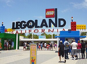
Legoland California
Theme park in Carlsbad, California
Distance: Approx. 1782 meters
Latitude and longitude: 33.12666667,-117.31111111
Legoland California Resort is a theme park, miniature park, and aquarium in Carlsbad, California, based on the Lego toy brand. Opening on March 20, 1999, it was the first Legoland park to open outside of Europe. The park is currently owned by Merlin Entertainments, which took a controlling interest in 2005.
Claude "Bud" Lewis Carlsbad Desalination Plant
Desalination plant in Carlsbad, California
Distance: Approx. 938 meters
Latitude and longitude: 33.13888889,-117.33527778
The Claude "Bud" Lewis Carlsbad Desalination Plant is a desalination plant in Carlsbad, California. The San Diego County Water Authority (SDCWA), the recipient of the fresh water produced by the plant, calls it "the nation’s largest, most technologically advanced and energy-efficient seawater desalination plant." Opened on December 14, 2015, the entire desalination project cost about $1 billion for the plant, pipelines, and upgrades to existing SDCWA facilities to use the water.

South Carlsbad State Beach
State park in California, United States
Distance: Approx. 3286 meters
Latitude and longitude: 33.10388889,-117.31944444
South Carlsbad State Beach (which includes South Ponto) is a public beach in Carlsbad, California. Known for being a place for swimming, surfing, skin diving, fishing, and picnicking, the campground, which is led by the stairway from the beach, is very popular during the summer. This beach is located immediately south of Carlsbad State Beach.

Encina Power Station
Power station in California, US
Distance: Approx. 869 meters
Latitude and longitude: 33.13638889,-117.33694444
The Encina Power Station (EPS) was a large natural gas and oil-fueled electricity generating plant in Carlsbad in San Diego County, California. Constructed in 1954, it was one of the major suppliers of electricity for the region. On December 11, 2018, the plant was put into "retired" status and officially stopped operations.

The Flower Fields
Flower garden in California, United States
Distance: Approx. 1479 meters
Latitude and longitude: 33.123066,-117.317591
The Flower Fields is a flower garden in Carlsbad Ranch in Carlsbad, California. The Giant Tecolote Ranunculus flowers that make up the garden are in bloom for approximately six to eight weeks each year, from early March through early May. The garden is typically open to visitors between March 1 and Mother's Day.
Split Pavilion
Former sculpture in Carlsbad, California
Distance: Approx. 3295 meters
Latitude and longitude: 33.1554,-117.3511
Split Pavilion was a public sculpture by the American artist Andrea Blum, located in Carlsbad, California. Installed in 1992, the sculpture was the subject of significant local controversy. It was ultimately removed by the city of Carlsbad in 1999.
Weather in this IP's area
clear sky
22 Celsius
22 Celsius
20 Celsius
25 Celsius
1012 hPa
66 %
1012 hPa
1010 hPa
10000 meters
6.69 m/s
9.77 m/s
230 degree
06:56:16
18:12:06