Country:
Region:
City:
Latitude and Longitude:
Time Zone:
Postal Code:
IP information under different IP Channel
ip-api
Country
Region
City
ASN
Time Zone
ISP
Blacklist
Proxy
Latitude
Longitude
Postal
Route
IPinfo
Country
Region
City
ASN
Time Zone
ISP
Blacklist
Proxy
Latitude
Longitude
Postal
Route
MaxMind
Country
Region
City
ASN
Time Zone
ISP
Blacklist
Proxy
Latitude
Longitude
Postal
Route
Luminati
Country
ASN
Time Zone
America/Chicago
ISP
LIGHTEDGE-AS-02
Latitude
Longitude
Postal
db-ip
Country
Region
City
ASN
Time Zone
ISP
Blacklist
Proxy
Latitude
Longitude
Postal
Route
ipdata
Country
Region
City
ASN
Time Zone
ISP
Blacklist
Proxy
Latitude
Longitude
Postal
Route
Popular places and events near this IP address

College Area, San Diego
Community of San Diego in California
Distance: Approx. 968 meters
Latitude and longitude: 32.77183056,-117.06893889
The College Area is a residential community in the Mid-City region of San Diego, California, United States. It is dominated by San Diego State University (SDSU), after which the area is named. Several neighborhoods in the College Area were developed in the 1930s, with others becoming established in the post-war period.
KCR (San Diego State University)
Radio station
Distance: Approx. 930 meters
Latitude and longitude: 32.77361111,-117.06944444
KCR College Radio is an American online radio station.

San Diego State University College of Engineering
Distance: Approx. 998 meters
Latitude and longitude: 32.7775,-117.07055556
San Diego State University College of Engineering provides San Diego State University students with undergraduate and graduate engineering education. The College of Engineering offers eight degree programs.
San Diego State University College of Education
Distance: Approx. 864 meters
Latitude and longitude: 32.77527778,-117.06916667
The San Diego State University College of Education is home of SDSU's teacher education and training programs. It offers undergraduate programs, teaching credentials for degree holders, master's degrees and both the Ed.D and Ph.D doctoral degrees. The college prepares undergraduate and graduate students for careers as professional educators, including careers as administrators, teachers, professors, school psychologists and counselors, resource and training specialists, and educational support personnel.
1996 San Diego State University shooting
1996 school shooting in San Diego, California
Distance: Approx. 1004 meters
Latitude and longitude: 32.7776,-117.0706
The San Diego State University shooting was a school shooting that occurred at the San Diego State University (SDSU) engineering building on August 15, 1996, in San Diego, California. Three professors were killed by master's degree student Frederick Martin Davidson. Three months later, a copycat threat flier was sent, with threats against professors and racial insults.

UC San Diego Health East station
San Diego trolley station
Distance: Approx. 313 meters
Latitude and longitude: 32.777174,-117.05686
UC San Diego Health East station (formerly Alvarado station and Alvarado Medical Center station) is a station on San Diego Trolley's Green Line in the College Area. The station is located across the street from East Campus Medical Center at UC San Diego Health, and near the intersection of Alvarado Road and Reservoir Drive. The street-level station has side platforms.
Phoebe Hearst Elementary School (San Diego)
Public school in San Diego, California, United States
Distance: Approx. 984 meters
Latitude and longitude: 32.78437,-117.064004
Phoebe Hearst Elementary School is a public elementary school in the Del Cerro area of San Diego, California, under the San Diego Unified School District. It enrolls around 520 students in grades K-5.

Malcolm A. Love Library
Primary library of San Diego State University
Distance: Approx. 967 meters
Latitude and longitude: 32.77527778,-117.07027778
Malcolm A. Love Library (commonly referred to as University Library) is an academic library at San Diego State University. The library first opened in 1971. It is named after former university president Malcolm A. Love.
Aztec Student Union
Student union in San Diego, California
Distance: Approx. 975 meters
Latitude and longitude: 32.77375833,-117.07000556
The Aztec Student Union is a student union in the center of San Diego State University's campus, just east of Malcolm A. Love Library. It was known as the Aztec Center from 1968 to 2011, when it was demolished for the Aztec Student Union. It leads into the heart of the SDSU campus and is located near many classrooms and administrative services.

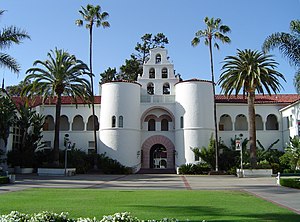
Hepner Hall
United States historic place
Distance: Approx. 1041 meters
Latitude and longitude: 32.77583333,-117.07111111
Hepner Hall is an academic building at San Diego State University. The original entrance to the university, it is the oldest building on the campus. It was designed by the senior architectural designer of the California Division of the State Architect, Howard Spencer Hazen, and completed in 1931.
East Campus Medical Center at UC San Diego Health
Hospital in San Diego, California
Distance: Approx. 291 meters
Latitude and longitude: 32.77666667,-117.05694444
East Campus Medical Center at UC San Diego Health is a 306-bed acute care hospital operated by UC San Diego Health in San Diego, California, adjacent to San Diego State University. It serves the College Area and is one of only two hospitals serving East County, San Diego.
D.Z. Akin's
Restaurant in California, United States
Distance: Approx. 1039 meters
Latitude and longitude: 32.775038,-117.048981
D.Z. Akin's Delicatessen is a New York-style Jewish deli and restaurant in San Diego, California. It was opened in 1980 by Zvika and Debbie Akin. They are known for their "fresser" sandwich, a Yiddish term for "one who eats." It has 16 slices of pastrami, turkey, corned beef, roast beef, and others with cheese and tomato on rye bread.
Weather in this IP's area
clear sky
22 Celsius
21 Celsius
19 Celsius
24 Celsius
1012 hPa
59 %
1012 hPa
999 hPa
10000 meters
5.14 m/s
250 degree
06:54:51
18:11:21