Country:
 USA
USARegion:
City:
Latitude and Longitude:
Time Zone:
Postal Code:
IP information under different IP Channel
ip-api
Country
Region
City
ASN
Time Zone
ISP
Blacklist
Proxy
Latitude
Longitude
Postal
Route
IPinfo
Country
Region
City
ASN
Time Zone
ISP
Blacklist
Proxy
Latitude
Longitude
Postal
Route
MaxMind
Country
Region
City
ASN
Time Zone
ISP
Blacklist
Proxy
Latitude
Longitude
Postal
Route
Luminati
Country
USASN
Time Zone
America/Chicago
ISP
LIGHTEDGE-AS-02
Latitude
Longitude
Postal
db-ip
Country
Region
City
ASN
Time Zone
ISP
Blacklist
Proxy
Latitude
Longitude
Postal
Route
ipdata
Country
Region
City
ASN
Time Zone
ISP
Blacklist
Proxy
Latitude
Longitude
Postal
Route
Popular places and events near this IP address

University City High School (San Diego)
Public school in San Diego, California, United States
Distance: Approx. 1309 meters
Latitude and longitude: 32.86077778,-117.20367222
University City High School (UCHS) is a comprehensive four-year public high school in the University City section of San Diego, California, United States. It is part of the San Diego Unified School District. The school opened its doors in September 1981.

La Jolla Country Day School
Independent/private school
Distance: Approx. 1153 meters
Latitude and longitude: 32.87833333,-117.21694444
La Jolla Country Day School (known informally as "Country Day" or "LJCDS") is an independent school in University City, a community of San Diego, California. The school contains a lower school (consisting of nursery through fourth grade), a middle school (grades 5–8), and an upper school (grades 9–12). The school's motto is "Scientia Pacifica" (peace through knowledge).
KHHS-LP
Radio station in California, United States
Distance: Approx. 790 meters
Latitude and longitude: 32.87777778,-117.21222222
KHHS-LP (107.5 FM) was a radio station broadcasting a Christian radio format. Licensed to San Diego, California, United States, the station was owned by Horizon Christian Fellowship. Horizon Christian Fellowship surrendered the station's license to the Federal Communications Commission (FCC) on June 19, 2015.
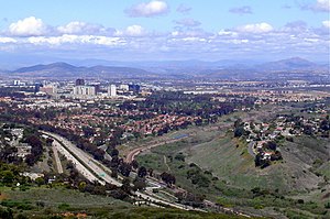
University City, San Diego
Community of San Diego in California
Distance: Approx. 372 meters
Latitude and longitude: 32.87,-117.21
University City (UC) is a community in San Diego, California, located in the northwestern portion of the city next to the University of California, San Diego. The area was originally intended to serve as housing for the faculty of the university, hence the name. University City is bordered by La Jolla and Interstate 5 to the west, Miramar and Interstate 805 to the east, and North Clairemont and Highway 52 to the south, giving the community a triangular-shaped boundary.

Westfield UTC
Outdoor shopping mall in San Diego, California, United States
Distance: Approx. 538 meters
Latitude and longitude: 32.8698,-117.212
Westfield UTC is an upscale, open-air shopping mall in the University City community of San Diego, California. It lies just east of La Jolla, near the University of California, San Diego. The mall is served by the UTC Transit Center, which is the northern terminus of the Blue Line of the San Diego Trolley.
San Diego International Jewish Film Festival
Annual film festival
Distance: Approx. 1080 meters
Latitude and longitude: 32.87597222,-117.21763889
The San Diego International Jewish Film Festival (SDIJFF) is an annual film festival held in San Diego, California. Established in 1990, the festival is managed by the San Diego Center for Jewish Culture, at the Lawrence Family Jewish Community Center in La Jolla. The festival usually consists of around fifty narrative, documentary, and short films, often with post-film audience discussions with the filmmakers.

La Jolla Institute for Immunology
Research institute near San Diego, California, U.S.
Distance: Approx. 1331 meters
Latitude and longitude: 32.87721,-117.21993
La Jolla Institute for Immunology is a non-profit research organization in La Jolla, a community of San Diego, California. The institute was founded in 1988. It is located in UC San Diego’s Research Park.
Congregation Beth Israel (San Diego)
Reform Jewish synagogue in San Diego, California, US
Distance: Approx. 158 meters
Latitude and longitude: 32.870901,-117.206322
Congregation Beth Israel (Hebrew: בית ישראל) is a Reform Jewish congregation and synagogue in University City, San Diego. Incorporated in 1887, Beth Israel traces its roots back to 1861; and is the largest and oldest Jewish congregation in San Diego.

2008 San Diego F/A-18 crash
Crash in San Diego, California on December 8, 2008
Distance: Approx. 1526 meters
Latitude and longitude: 32.860656,-117.198195
On December 8, 2008, a United States Marine Corps (USMC) F/A-18 Hornet crash in a residential area of San Diego, California. The pilot, First Lieutenant Dan Neubauer (28) from VMFAT-101, was the only crewmember on board the two-seat aircraft; he successfully ejected from the aircraft, landing in a tree. The jet crashed into the University City residential area, destroying two houses and damaging a third.

UTC Transit Center
San Diego Trolley and bus station
Distance: Approx. 735 meters
Latitude and longitude: 32.8692,-117.214
UTC Transit Center is a San Diego Trolley station and transportation hub in the University City district of San Diego, California. It is located at Westfield UTC mall. The station's elevated trolley platform is served by the Blue Line, and stands above Genesee Avenue at its intersection with Esplanade Court.

VA Medical Center station (San Diego)
San Diego Trolley station
Distance: Approx. 735 meters
Latitude and longitude: 32.8692,-117.214
VA Medical Center station is a San Diego Trolley station in San Diego, California, elevated and adjacent to the Veterans Affairs hospital next to UC San Diego. Service began on November 21, 2021 after the completion of the Blue Line Mid-Coast Trolley extension project.

Executive Drive station
San Diego Trolley station
Distance: Approx. 735 meters
Latitude and longitude: 32.8692,-117.214
Executive Drive station is a San Diego Trolley station in San Diego, California, located near the intersection of Executive Drive and Genesee Avenue. The station began service on November 21, 2021 on the Blue Line; it was constructed as part of the Mid-Coast Trolley extension project.
Weather in this IP's area
clear sky
21 Celsius
21 Celsius
19 Celsius
24 Celsius
1013 hPa
61 %
1013 hPa
1000 hPa
10000 meters
4.47 m/s
5.81 m/s
270 degree
5 %
06:55:32
18:11:51