Country:
Region:
City:
Latitude and Longitude:
Time Zone:
Postal Code:
IP information under different IP Channel
ip-api
Country
Region
City
ASN
Time Zone
ISP
Blacklist
Proxy
Latitude
Longitude
Postal
Route
Luminati
Country
Region
tx
City
houston
ASN
Time Zone
America/Chicago
ISP
SWITCH-LTD
Latitude
Longitude
Postal
IPinfo
Country
Region
City
ASN
Time Zone
ISP
Blacklist
Proxy
Latitude
Longitude
Postal
Route
db-ip
Country
Region
City
ASN
Time Zone
ISP
Blacklist
Proxy
Latitude
Longitude
Postal
Route
ipdata
Country
Region
City
ASN
Time Zone
ISP
Blacklist
Proxy
Latitude
Longitude
Postal
Route
Popular places and events near this IP address

Langham Creek High School
Public school in Texas, United States
Distance: Approx. 4087 meters
Latitude and longitude: 29.88134,-95.67712
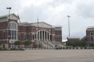
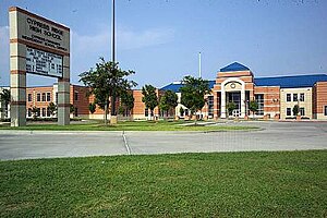
Langham Creek High School is a high school located in an unincorporated area in Harris County, Texas, United States, near Houston. Langham Creek, which was established in 1984, is part of the Cypress Fairbanks Independent School District. Several communities, including Concord Bridge, Westgate, Northglen, Copper Lakes, and parts of the Copperfield subdivision, are zoned to the school.
Mayde Creek High School
Public school in Texas, United States
Distance: Approx. 5756 meters
Latitude and longitude: 29.80637,-95.69557
Mayde Creek High School (MCHS) is a public high school located on Groschke Road in unincorporated Harris County, Texas, and is part of the Katy Independent School District. Mayde Creek serves the portions of the city of Houston located in Katy ISD, including Addicks. Mayde Creek also serves many unincorporated communities in Harris County.

Berry Center of Northwest Houston
Sports complex in Harris County, Texas, United States
Distance: Approx. 7030 meters
Latitude and longitude: 29.90583333,-95.68861111
The Berry Center of Northwest Houston (commonly known as Berry Center) is a multi-purpose sports complex located in Cypress, Texas. It was completed in March 2006 and consists of five separate facilities: an arena, stadium, theater, conference center and food production center. It was named after former Cy-Fair ISD superintendent Richard E. Berry.

Bear Creek Pioneers Park
Distance: Approx. 4257 meters
Latitude and longitude: 29.824784,-95.6247
Bear Creek Pioneers Park is a 2,154-acre (8.72 km2) park located in the U.S. city of Houston, Texas, at 3535 War Memorial Drive.

Cypress Ridge High School
Public school in Texas, United States
Distance: Approx. 7277 meters
Latitude and longitude: 29.8925,-95.6049
Cypress Ridge High School is a public secondary school located in unincorporated Harris County, Texas, near Houston. It was established in 2002 as Cypress-Fairbanks Independent School District High School #7. Cypress Ridge provides the deaf education program for Cy Fair ISD and surrounding school districts.

Addicks Reservoir
Reservoir in Texas, United States
Distance: Approx. 7249 meters
Latitude and longitude: 29.7908,-95.6236
The Addicks Reservoir and Addicks Dam in conjunction with the Barker Reservoir prevent downstream flooding of Buffalo Bayou in the city of Houston, Texas. Both reservoirs were authorized under the Rivers and Harbors Act of June 20, 1938, which was modified by the Flood Control Acts of 1938, 1954, and 1965. The US Army Corps of Engineers (USACE) completed construction of Addicks Dam and the outlet facility in 1948.
Houston Ballet's Ben Stevenson Academy
Ballet school in Houston, Texas
Distance: Approx. 7013 meters
Latitude and longitude: 29.901196,-95.621352
Houston Ballet's Ben Stevenson Academy is a ballet training school affiliated with the Houston Ballet. The academy is housed in Houston Ballet Center for Dance in Houston, Texas.

West Houston Airport
Airport in Houston
Distance: Approx. 3499 meters
Latitude and longitude: 29.81833333,-95.6725
West Houston Airport (IATA: IWS, ICAO: KIWS, FAA LID: IWS) is a privately owned, public use airport in Harris County, Texas, 15 miles west of Downtown Houston in the Greater Katy area. It opened in 1962 and was known as Lakeside Airport until the early 1980s due to its location near the edge of Addicks reservoir. The National Plan of Integrated Airport Systems for 2011–2015 categorized it as a general aviation reliever airport.
Barker, Texas
Unincorporated community in Texas, United States
Distance: Approx. 7458 meters
Latitude and longitude: 29.78444444,-95.685
Barker is an unincorporated community in western Harris County, Texas, United States. It lies along local roads off Interstate 10 and is seventeen miles west of downtown Houston. Its elevation is 102 feet (31 m), and it is located at 29°47′4″N 95°41′6″W (29.7843955, -95.6849469).

Copperfield, Texas
Distance: Approx. 4234 meters
Latitude and longitude: 29.8829,-95.643
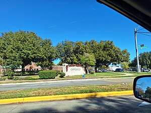
Copperfield is a series of master-planned subdivisions in unincorporated northwestern Harris County, Texas, United States. The community, developed by Friendswood Development Company, has 1,800 acres (7.3 km2) of land. Horsepen Bayou and its tributaries are within the community.

Houston Methodist West Hospital
Hospital in Texas, United States
Distance: Approx. 7414 meters
Latitude and longitude: 29.7875,-95.6925
Houston Methodist West Hospital, located in west Houston, Texas, is one of seven community hospitals that are part of Houston Methodist. It employs about 1,500 people, has an estimated 800 affiliated doctors and admits roughly 12,000 patients annually. The hospital serves the Katy community.

Houston Wing
United States historical air display organization
Distance: Approx. 3316 meters
Latitude and longitude: 29.82194444,-95.67694444
Houston Wing was founded in June 1978 as the West Houston Squadron (then under the West Texas Wing) of the Commemorative Air Force It is a United States historical air display organization and public history education focused on vintage aircraft of military aviation mainly of World War II time period. It also has a sizable museum with a broad collection of artifacts and themed displays.
Weather in this IP's area
few clouds
17 Celsius
17 Celsius
16 Celsius
18 Celsius
1014 hPa
81 %
1014 hPa
1010 hPa
10000 meters
0.45 m/s
1.34 m/s
77 degree
19 %
06:48:52
17:26:26