206.220.202.1 - IP Lookup: Free IP Address Lookup, Postal Code Lookup, IP Location Lookup, IP ASN, Public IP
Country:
Region:
City:
Location:
Time Zone:
Postal Code:
ISP:
ASN:
language:
User-Agent:
Proxy IP:
Blacklist:
IP information under different IP Channel
ip-api
Country
Region
City
ASN
Time Zone
ISP
Blacklist
Proxy
Latitude
Longitude
Postal
Route
db-ip
Country
Region
City
ASN
Time Zone
ISP
Blacklist
Proxy
Latitude
Longitude
Postal
Route
IPinfo
Country
Region
City
ASN
Time Zone
ISP
Blacklist
Proxy
Latitude
Longitude
Postal
Route
IP2Location
206.220.202.1Country
Region
arizona
City
prescott
Time Zone
America/Phoenix
ISP
Language
User-Agent
Latitude
Longitude
Postal
ipdata
Country
Region
City
ASN
Time Zone
ISP
Blacklist
Proxy
Latitude
Longitude
Postal
Route
Popular places and events near this IP address

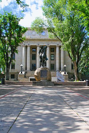
Prescott, Arizona
City in Arizona, United States
Distance: Approx. 1052 meters
Latitude and longitude: 34.58527778,-112.44694444
Prescott ( PRESS-kət) is a city in and the county seat of Yavapai County, Arizona, United States. As of 2020 Census, the city's population was 45,827. In 1864, Prescott was designated as the capital of the Arizona Territory, replacing the temporary capital of Fort Whipple.

Yavapai-Prescott Tribe
Federally recognized tribe in Arizona
Distance: Approx. 3113 meters
Latitude and longitude: 34.55055556,-112.435
The Yavapai-Prescott Indian Tribe (Yavapai language: Wiikvteepaya), formerly known as the Yavapai-Prescott Tribe of the Yavapai Reservation, a federally recognized tribe of Yavapai people. Fewer than 200 people are enrolled in the tribe.

Prescott National Cemetery
Veterans cemetery in Yavapai County, Arizona
Distance: Approx. 3238 meters
Latitude and longitude: 34.54694444,-112.4475
Prescott National Cemetery is a United States National Cemetery located in the city of Prescott, in Yavapai County, Arizona. Administered by the United States Department of Veterans Affairs, it encompasses 15.4 acres (6.2 ha), and has over 7,500 interments. Beginning in 2020 its new columbaria is accepting new inurnments.

Yavapai College
Community college in Yavapai County, Arizona, US
Distance: Approx. 3183 meters
Latitude and longitude: 34.547652,-112.45365
Yavapai College is a public community college in Yavapai County, Arizona. The main campus is in Prescott, with locations in Clarkdale, Prescott Valley, Chino Valley and Sedona.
KNOT
Radio station in Prescott, Arizona
Distance: Approx. 3462 meters
Latitude and longitude: 34.545,-112.44611111
KNOT (1450 AM) is a radio station licensed to Prescott, Arizona. Its signal is relayed on FM translators K280GH (103.9) Prescott, Arizona and K300CI (107.9) Flagstaff, Arizona. In October 2015 KNOT changed their format from oldies to Contemporary Christian music, branded as "Arizona Shine".
Spring Ridge Academy
Behavioral health residential facility
Distance: Approx. 2829 meters
Latitude and longitude: 34.5959797,-112.4681734
Spring Ridge Academy, was a behavioral health residential facility for female adolescents 13-17 years old. In 2023, Spring Ridge Academy announced on their website they had permanently closed.

Fort Whipple, Arizona
Former US Army installation in Yavapai County, Arizona
Distance: Approx. 2393 meters
Latitude and longitude: 34.55472222,-112.45277778
Fort Whipple is a former United States (U.S.) Army post that was temporarily established at Del Rio Springs, north of present-day Chino Valley, Arizona, and later relocated to a permanent site near present-day Prescott, Arizona.
Watson Lake (Arizona)
Reservoir near Prescott, AZ
Distance: Approx. 2657 meters
Latitude and longitude: 34.58694444,-112.42333333
Watson Lake is one of two reservoirs at the Granite Dells, in Prescott, Arizona, that was formed in the early 1900s when the Chino Valley Irrigation District built a dam on Granite Creek. The City of Prescott bought the reservoir and surrounding land in 1997 to preserve it as recreational land. Local rockclimbers use the granite cliffs above and adjacent to the lake for top-roping and lead climbing.
Prescott High School (Arizona)
Public school in Prescott, Arizona, United States
Distance: Approx. 3012 meters
Latitude and longitude: 34.563068,-112.477959
Prescott High School is a public high school located in the city of Prescott, Arizona. It is the only high school in the Prescott Unified School District. Historically, Prescott High School drew students from various adjacent school districts, mostly in Prescott Valley (Humboldt Unified School District) and Chino Valley, Arizona (Chino Valley Unified School District); those districts later established their own high schools.

Kestrel High School
Public charter high school in Prescott, Arizona
Distance: Approx. 3446 meters
Latitude and longitude: 34.546385,-112.460038
Kestrel High School was a small public charter high school in Prescott, Arizona. It was operated by Kestrel Schools, Inc. It opened in 2000, and its first graduating class was in 2001.

Museum of Indigenous People
Museum in Prescott, Arizona
Distance: Approx. 3730 meters
Latitude and longitude: 34.5435,-112.459
The Museum of Indigenous People, formerly known as the Smoki Museum of American Indian Art and Culture, is located in Prescott, Yavapai County, Arizona and holds collections of Native American artifacts.

Prescott Armory Historic District
United States historic place
Distance: Approx. 2232 meters
Latitude and longitude: 34.557222,-112.440556
The Prescott Armory Historic District is a 12 acres (4.9 ha) historic district which was listed on the National Register of Historic Places in 1994. It is a group of properties which "are all associated with Depression Era construction between 1929 and 1939." The district includes the Prescott Citizen's Cemetery, the Smoki Pueblo and Museum, Prescott's National Guard Armory (now Prescott Activity Center), and the City Park and Ballfield (now Ken Lindley Field). All four of the buildings and two structures in the district are vernacular architecture (i.e.
Weather in this IP's area
clear sky
3 Celsius
1 Celsius
2 Celsius
4 Celsius
1018 hPa
34 %
1018 hPa
832 hPa
10000 meters
2.63 m/s
2.43 m/s
170 degree
