Country:
 USA
USARegion:
City:
Latitude and Longitude:
Time Zone:
Postal Code:
IP information under different IP Channel
ip-api
Country
Region
City
ASN
Time Zone
ISP
Blacklist
Proxy
Latitude
Longitude
Postal
Route
IPinfo
Country
Region
City
ASN
Time Zone
ISP
Blacklist
Proxy
Latitude
Longitude
Postal
Route
MaxMind
Country
Region
City
ASN
Time Zone
ISP
Blacklist
Proxy
Latitude
Longitude
Postal
Route
Luminati
Country
USRegion
or
City
salem
ASN
Time Zone
America/Los_Angeles
ISP
ONLINEMAC
Latitude
Longitude
Postal
db-ip
Country
Region
City
ASN
Time Zone
ISP
Blacklist
Proxy
Latitude
Longitude
Postal
Route
ipdata
Country
Region
City
ASN
Time Zone
ISP
Blacklist
Proxy
Latitude
Longitude
Postal
Route
Popular places and events near this IP address

West Salem, Salem, Oregon
Neighborhood in Polk County, Oregon, United States
Distance: Approx. 3128 meters
Latitude and longitude: 44.93888889,-123.06083333
West Salem is a neighborhood in Salem, Oregon, United States, located in the far northwest part of the city. West Salem is the only part of the city that is located in Polk County. The neighborhood is separated from the rest of Salem by the Willamette River, which serves as West Salem's southeast border.

Old West Salem City Hall
United States historic place
Distance: Approx. 3096 meters
Latitude and longitude: 44.93944444,-123.06027778
The Old West Salem City Hall served West Salem, Oregon, United States, as its city hall from 1935 until the city merged with Salem in 1949. It was built using WPA funds. After serving as a city hall, it was used for other Salem government functions.
A. C. Gilbert's Discovery Village
United States historic place
Distance: Approx. 3691 meters
Latitude and longitude: 44.945,-123.04111111
The Gilbert House Children's Museum is a private nonprofit 501(c)(3) children's museum within Riverfront Park located in Salem, Oregon, United States. Founded in 1989. The museum has 16 hands-on S.T.E.A.M. exhibits, a 20,000 ft2 Outdoor Discovery Area, field trips, STEM Workshops, membership opportunities, summer camps, and educational programs in the sciences, arts, and humanities.

Mill Creek (Marion County, Oregon)
River in Oregon, United States
Distance: Approx. 3569 meters
Latitude and longitude: 44.95138889,-123.03805556
Mill Creek is a 26-mile (42 km) tributary of the Willamette River that drains a 111-square-mile (290 km2) area of Marion County in the U.S. state of Oregon. Flowing generally west from its source south of Silver Falls State Park, it passes through the cities of Aumsville, Stayton, Sublimity, and Turner before emptying into the Willamette in Salem. Salem's first gristmill and sawmill were built on the creek in 1840–41 by members of the Oregon Mission.

Union Street Railroad Bridge
Bridge in West Salem, Oregon
Distance: Approx. 3573 meters
Latitude and longitude: 44.94691667,-123.04116667
The Union Street Railroad Bridge is a vertical lift, Pratt through truss bridge that spans the Willamette River in Salem, Oregon, United States, built in 1912–13. It was last used by trains in the early 1990s and was sold for one dollar in 2003 to the City of Salem, which converted it to bicycle and pedestrian use in 2008–2009. It was added to the National Register of Historic Places in 2006.

Marion Street Bridge
Bridge in Salem, Oregon
Distance: Approx. 3549 meters
Latitude and longitude: 44.94583333,-123.0425
The Marion Street Bridge is an automobile bridge located in Salem, Oregon, United States. It spans the Willamette River to connect Salem and West Salem, and acts as a conduit for Oregon Route 22. The bridge carries vehicular traffic one way westbound.

Center Street Bridge
Bridge in Salem, Oregon
Distance: Approx. 3547 meters
Latitude and longitude: 44.945,-123.04333333
The Center Street Bridge is an automobile bridge located in Salem, Oregon, United States. It spans the Willamette River, connecting West Salem and Oregon Route 22 to Salem. It carries vehicle traffic eastbound from Route 22 and directly from Wallace Road.

Edward W. St. Pierre House
Historic house in Oregon, United States
Distance: Approx. 2112 meters
Latitude and longitude: 44.944577,-123.081946
The Edward W. St. Pierre House is a historic house in the West Salem neighborhood of Salem, Oregon, United States. It is also known as Elkirk Ranch and was built in 1911.

Riverfront Park (Salem, Oregon)
Park in Salem, Oregon, U.S.
Distance: Approx. 3762 meters
Latitude and longitude: 44.942,-123.04316
Riverfront Park is a 23-acre park located along the Willamette River in Salem, Oregon, in the United States. Features include the Riverfront Carousel (2001), A. C. Gilbert's Discovery Village, an amphitheatre, and Eco-Earth Globe, an outdoor sculpture and community art project completed in 2003. It is located on former industrial land owned by the Boise Cascade corporation redeveloped as part of the Riverfront-Downtown Urban Renewal Area.

Tom McCall Memorial
Sculpture in Salem, Oregon, U.S.
Distance: Approx. 3708 meters
Latitude and longitude: 44.94318,-123.04271
Tom McCall Memorial is an outdoor bronze sculpture of former Oregon Governor Tom McCall by Rip Caswell, located in Salem, Oregon, in the United States.

Peter Courtney Minto Island Bridge
Bicycle and pedestrian bridge in Salem, Oregon, U.S.
Distance: Approx. 3909 meters
Latitude and longitude: 44.93861111,-123.045
The Peter Courtney Minto Island Bridge is a bicycle and pedestrian Bridge in Salem, Oregon, United States, connecting downtown Salem to Minto-Brown Island Park. With a budget of $10 million, it was approved by the City of Salem in 2010, with construction beginning in May 2015. The bridge is named in honor of Peter Courtney, the longest-serving legislator in Oregon history, who had advocated for the construction of a bridge connecting downtown Salem to Minto-Brown for decades.
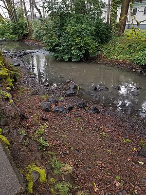
Salem Ditch
River in Oregon, United States
Distance: Approx. 3569 meters
Latitude and longitude: 44.95138889,-123.03805556
Salem Ditch is an artificial canal in Marion County, Oregon, United States. It drains into Mill Creek.
Weather in this IP's area
broken clouds
16 Celsius
15 Celsius
14 Celsius
17 Celsius
1024 hPa
64 %
1024 hPa
1013 hPa
10000 meters
4.63 m/s
140 degree
75 %
07:33:48
18:20:12