Country:
Region:
City:
Latitude and Longitude:
Time Zone:
Postal Code:
IP information under different IP Channel
ip-api
Country
Region
City
ASN
Time Zone
ISP
Blacklist
Proxy
Latitude
Longitude
Postal
Route
IPinfo
Country
Region
City
ASN
Time Zone
ISP
Blacklist
Proxy
Latitude
Longitude
Postal
Route
MaxMind
Country
Region
City
ASN
Time Zone
ISP
Blacklist
Proxy
Latitude
Longitude
Postal
Route
Luminati
Country
Region
or
City
amity
ASN
Time Zone
America/Los_Angeles
ISP
ONLINEMAC
Latitude
Longitude
Postal
db-ip
Country
Region
City
ASN
Time Zone
ISP
Blacklist
Proxy
Latitude
Longitude
Postal
Route
ipdata
Country
Region
City
ASN
Time Zone
ISP
Blacklist
Proxy
Latitude
Longitude
Postal
Route
Popular places and events near this IP address

Amity, Oregon
City in Oregon, United States
Distance: Approx. 2273 meters
Latitude and longitude: 45.11555556,-123.20333333
Amity is a city in Yamhill County, Oregon, United States. As of the 2020 Census, the population was 1,757.

Whiteson, Oregon
Unincorporated community in the state of Oregon, United States
Distance: Approx. 3916 meters
Latitude and longitude: 45.15138889,-123.19666667
Whiteson is an unincorporated community in Yamhill County, Oregon, United States. Oregon Geographic Names states that Whiteson is named for either for Henry White, who laid out the town site and gave the railroad right-of-way, or for William White. It is possible they are members of the same family.
Hopewell, Oregon
Unincorporated community in the state of Oregon, United States
Distance: Approx. 7000 meters
Latitude and longitude: 45.09694444,-123.09194444
Hopewell is an unincorporated community in Yamhill County, Oregon, United States. It is at the eastern terminus of Oregon Route 153, 10 miles (16 km) south of Dayton and a few miles west of Wheatland, at the east base of the Eola Hills. Hopewell post office was established in 1897, and closed out to Amity in 1903.
Eola-Amity Hills AVA
Distance: Approx. 8473 meters
Latitude and longitude: 45.056,-123.116
The Eola-Amity Hills AVA is an American Viticultural Area located in Polk County and Yamhill County, Oregon. It is entirely contained within the Willamette Valley AVA, and stretches from the city of Amity in the north to Salem in the south. The Eola and Amity hills cover an area west of the Willamette River approximately 15 miles (24 km) long by 6 miles (10 km) wide.
Eola Hills
Distance: Approx. 6369 meters
Latitude and longitude: 45.07539583,-123.12371167
The Eola Hills are a range of hills northwest of Salem, Oregon, United States. They stretch from the community of Eola about 10 miles (16 km) north to Yamhill County. They are divided from the Salem Hills by the Willamette River at Eola.
Willamette Valley Medical Center
Hospital in Oregon, United States
Distance: Approx. 8865 meters
Latitude and longitude: 45.199,-123.1647
Willamette Valley Medical Center is a for-profit Level III acute care hospital in McMinnville, Oregon, United States, adjacent to the McMinnville Airport on Oregon Route 18. Opened at a different location as McMinnville Community Hospital, the four-story medical center has 60 licensed hospital beds. It is owned by Lifepoint.
Maud Williamson State Recreation Site
State park in Oregon, United States
Distance: Approx. 8866 meters
Latitude and longitude: 45.0965072,-123.0670441
Maud Williamson State Recreation Site is a state park in Yamhill County, Oregon, United States, administered by the Oregon Parks and Recreation Department. The park is located at the intersection of Oregon Route 221 and Oregon Route 153 near Wheatland. The park entrance is across from Wheatland Road, which leads to the Wheatland Ferry.
KKJC-LP
Radio station in McMinnville, Oregon
Distance: Approx. 4870 meters
Latitude and longitude: 45.16083333,-123.15388889
KKJC-LP (93.5 FM) is a radio station broadcasting a Religious Talk format licensed to McMinnville, Oregon, United States. The station is currently owned by Calvary Chapel of Mcminnville, Inc. On 2 July 2009, KKJC was granted Special Temporary Authority to change its frequency to 93.5 MHz.

Amity High School (Oregon)
Public school in Amity, Oregon, United States
Distance: Approx. 2238 meters
Latitude and longitude: 45.116178,-123.203044
Amity High School is a public high school in Amity, Oregon, United States.
Amity Hills
Distance: Approx. 1554 meters
Latitude and longitude: 45.13111111,-123.16361111
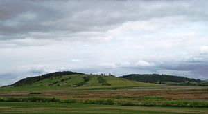
The Amity Hills are a range of hills northeast of Amity, in Yamhill County, Oregon, United States. A northern spur or extension of the Eola Hills, they are separated from them by a pass between Amity and Hopewell. They stretch about four miles from Amity towards Dayton Prairie.

Whiteson station
Former rail station in Oregon
Distance: Approx. 4120 meters
Latitude and longitude: 45.1529,-123.1982
Whiteson railway station or Whites railway station or White's Junction was a railway station in Whiteson, Oregon, where the Dayton, Sheridan and Grande Ronde Railroad crossed the west side line of the Oregon and California Railroad.
Amity School District
School district in Oregon, USA
Distance: Approx. 2604 meters
Latitude and longitude: 45.11277778,-123.20666667
Amity School District 4J is a rural public school district located in Yamhill County, Oregon. The district contains 3 schools and serves the residents of Amity and the surrounding areas.
Weather in this IP's area
overcast clouds
20 Celsius
19 Celsius
18 Celsius
21 Celsius
1023 hPa
56 %
1023 hPa
1007 hPa
10000 meters
0.45 m/s
215 degree
99 %
07:34:24
18:20:22


