Country:
 USA
USARegion:
City:
Latitude and Longitude:
Time Zone:
Postal Code:
IP information under different IP Channel
ip-api
Country
Region
City
ASN
Time Zone
ISP
Blacklist
Proxy
Latitude
Longitude
Postal
Route
IPinfo
Country
Region
City
ASN
Time Zone
ISP
Blacklist
Proxy
Latitude
Longitude
Postal
Route
MaxMind
Country
Region
City
ASN
Time Zone
ISP
Blacklist
Proxy
Latitude
Longitude
Postal
Route
Luminati
Country
USRegion
or
City
sheridan
ASN
Time Zone
America/Los_Angeles
ISP
ONLINEMAC
Latitude
Longitude
Postal
db-ip
Country
Region
City
ASN
Time Zone
ISP
Blacklist
Proxy
Latitude
Longitude
Postal
Route
ipdata
Country
Region
City
ASN
Time Zone
ISP
Blacklist
Proxy
Latitude
Longitude
Postal
Route
Popular places and events near this IP address

Sheridan, Oregon
City in Oregon, United States
Distance: Approx. 1117 meters
Latitude and longitude: 45.09611111,-123.39833333
Sheridan is a city in Yamhill County, Oregon, United States. Platted in the 1860s when it received a post office, the city was incorporated in 1880. A major fire burned much of the city in 1913, and a flood covered much of the city in 1964.

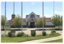
Sheridan High School (Oregon)
Public school in Sheridan, Yamhill County, Oregon, United States
Distance: Approx. 1086 meters
Latitude and longitude: 45.09525,-123.3945
Sheridan High School is a public high school in Sheridan, Oregon, United States.

Travelers Home
Historic house in Oregon, United States
Distance: Approx. 1655 meters
Latitude and longitude: 45.100534,-123.394238
Travelers Home is an Italian Villa and Queen Anne style home in Sheridan, Oregon, United States. It was built in 1892, and the building was added to the National Register of Historic Places on July 8, 1982. The building, also known as Savage-Mendenhall-Seth House, has been used as both a hotel and residence.
Federal Correctional Institution, Sheridan
United States Federal Prison located in the State of Oregon
Distance: Approx. 1408 meters
Latitude and longitude: 45.08388889,-123.38166667
The Federal Correctional Institution, Sheridan (FCI Sheridan) is a medium-security United States federal prison for male inmates in Oregon. Opened in 1989, it is operated by the Federal Bureau of Prisons, a division of the United States Department of Justice. The facility also includes a detention center housing male offenders and an adjacent minimum-security satellite prison camp also for male offenders.

Sheridan Bridge (Oregon)
Bridge in Sheridan, Oregon
Distance: Approx. 1458 meters
Latitude and longitude: 45.098912,-123.395433
Sheridan Bridge is a two-lane steel Truss bridge carrying vehicular traffic in Sheridan, Oregon, United States. Construction began in 1938 and finished in 1939. This 258-foot (79 m) bridge connects the northern and southern portions of the town across the South Yamhill River in Yamhill County.

Shipley, Oregon
Unincorporated community in the state of Oregon, United States
Distance: Approx. 2845 meters
Latitude and longitude: 45.09583333,-123.43277778
Shipley, Oregon is an unincorporated community in Yamhill County, Oregon, United States. Most of the area has been annexed by the city of Sheridan.

Delphian School
Private school in Sheridan, Yamhill County, Oregon, United States
Distance: Approx. 4496 meters
Latitude and longitude: 45.107282,-123.44801
Delphian School is a co-ed K–12 private school operated by Delphi Schools. It uses study techniques created by Scientology founder L. Ron Hubbard, known as Study Tech. It is located on a 720-acre campus in unincorporated Yamhill County, Oregon, near Sheridan.

Riverside, Yamhill County, Oregon
Unincorporated community in the state of Oregon, United States
Distance: Approx. 4191 meters
Latitude and longitude: 45.08861111,-123.4525
Riverside is an unincorporated historic locale in Yamhill County, Oregon, United States. It lies at an elevation of 213 feet (65 m).

Sheridan Japanese School
Public school in Sheridan, Yamhill County, Oregon, United States
Distance: Approx. 1276 meters
Latitude and longitude: 45.097558,-123.399537
Sheridan Japanese School was a public charter school in Sheridan, Oregon, United States. The school has been accredited by the Northwest Association of Accredited Schools since 2000. It was a Japanese-language school.

Willamina High School
Public school in Willamina, Yamhill County, Oregon, United States
Distance: Approx. 6727 meters
Latitude and longitude: 45.075794,-123.483624
Willamina High School is a public high school in Willamina, Oregon, United States.

Ballston, Oregon
Unincorporated community in the state of Oregon, United States
Distance: Approx. 6537 meters
Latitude and longitude: 45.06666667,-123.32083333
Ballston is an unincorporated community, in Polk County, Oregon, United States. It is southeast of Sheridan and southwest of Amity. It is considered a ghost town.
Willamina Creek
River in Oregon, United States
Distance: Approx. 6077 meters
Latitude and longitude: 45.07833333,-123.47583333
Willamina Creek is a tributary, about 20 miles (32 km) long, of the South Yamhill River in the U.S. state of Oregon. Beginning in the Northern Oregon Coast Range in Yamhill County, it briefly enters and exits a small part of eastern Tillamook County, then flows generally south to meet the larger stream at Willamina, near the border with Polk County.
Weather in this IP's area
overcast clouds
16 Celsius
14 Celsius
15 Celsius
17 Celsius
1024 hPa
19 %
1024 hPa
1015 hPa
10000 meters
1.25 m/s
2.95 m/s
168 degree
88 %
07:35:15
18:21:18