206.190.213.38 - IP Lookup: Free IP Address Lookup, Postal Code Lookup, IP Location Lookup, IP ASN, Public IP
Country:
 USA
USARegion:
City:
Location:
Time Zone:
Postal Code:
ISP:
ASN:
language:
User-Agent:
Proxy IP:
Blacklist:
IP information under different IP Channel
ip-api
Country
Region
City
ASN
Time Zone
ISP
Blacklist
Proxy
Latitude
Longitude
Postal
Route
db-ip
Country
Region
City
ASN
Time Zone
ISP
Blacklist
Proxy
Latitude
Longitude
Postal
Route
IPinfo
Country
Region
City
ASN
Time Zone
ISP
Blacklist
Proxy
Latitude
Longitude
Postal
Route
IP2Location
206.190.213.38Country
usRegion
california
City
san mateo
Time Zone
America/Los_Angeles
ISP
Language
User-Agent
Latitude
Longitude
Postal
ipdata
Country
Region
City
ASN
Time Zone
ISP
Blacklist
Proxy
Latitude
Longitude
Postal
Route
Popular places and events near this IP address
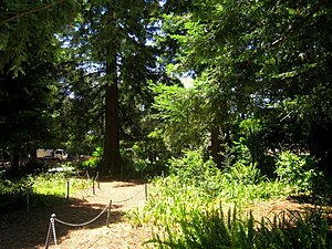
San Mateo Arboretum
Distance: Approx. 1110 meters
Latitude and longitude: 37.5609,-122.3212
The San Mateo Arboretum is an arboretum in San Mateo, California containing old stands of pine, oak, cedar, and redwood planted over 100 years ago on the William Kohl property by John McLaren. The Arboretum is located in San Mateo's Central Park, which also houses the San Mateo Arboretum Society near the Kohl Pump House area of the park. The San Mateo Arboretum Society is a volunteer run, nonprofit, founded in 1975 by Marion Panaretos.

San Mateo High School
Public secondary school in San Mateo, California, United States
Distance: Approx. 1219 meters
Latitude and longitude: 37.57722222,-122.33
San Mateo High School is a National Blue Ribbon comprehensive four-year public high school in San Mateo, California, United States. It serves grades 9–12 and is one of the seven San Mateo Union High School District public high schools.

San Mateo Creek (San Francisco Bay Area)
River in California, United States
Distance: Approx. 1339 meters
Latitude and longitude: 37.575,-122.30472222
San Mateo Creek (Spanish for: St. Matthew Creek) is a perennial stream whose watershed includes Crystal Springs Reservoir, for which it is the only natural outlet after passing Crystal Springs Dam.

San Mateo station
Train station in San Mateo, California, U.S.
Distance: Approx. 531 meters
Latitude and longitude: 37.5683,-122.3241
San Mateo station is the northernmost of the three Caltrain stations in San Mateo, California. It is in downtown San Mateo.

Rancho San Mateo
Land in California
Distance: Approx. 1425 meters
Latitude and longitude: 37.58,-122.33
Rancho San Mateo was a 6,439-acre (26.06 km2) Mexican land grant on the San Francisco Peninsula, in present day San Mateo County, California. It was given in 1846 by Governor Pio Pico to Cayetano Arenas. Rancho San Mateo extended from the foothills of the Santa Cruz Mountains to San Francisco Bay.
CuriOdyssey
Zoo in San Mateo, California
Distance: Approx. 1768 meters
Latitude and longitude: 37.586554,-122.317636
CuriOdyssey is a science museum and zoo in San Mateo, California containing animals and interactive science exhibits. CuriOdyssey is home to nearly 100 rescued animals, most native to California, that cannot survive in the wild. CuriOdyssey's exhibits include a science playground where kids play with scientific phenomena.
Stanbridge Academy
School in California, United States
Distance: Approx. 1142 meters
Latitude and longitude: 37.575323,-122.330459
Stanbridge Academy is a K–12 school for students with mild to moderate learning differences and social communication challenges. Stanbridge Academy was founded in 1982, and its campus is located in San Mateo, California, United States.

Draper University
Private for-profit school in San Mateo, California, United States
Distance: Approx. 965 meters
Latitude and longitude: 37.5635,-122.325
Draper University, also known as Draper University of Heroes, is a private, for-profit school located in San Mateo, California, United States. Founded by venture capitalist Tim Draper in 2012, Draper University partnered with Arizona State University (ASU) in 2013 to offer students 15 course credits for a sixteen-week semester program. Prior to the partnership with ASU, the school was unaccredited.

Central Park (San Mateo)
Public park in San Mateo, California, United States
Distance: Approx. 1041 meters
Latitude and longitude: 37.56183333,-122.32266667
Central Park is the first public park in San Mateo, California, a 16.5-acre (7 ha) urban park bounded by El Camino Real (to the southwest), 5th Avenue (to the northwest), Laurel Avenue (to the northeast) and 9th Avenue (to the southeast). It was established via a 1922 bond measure of US$80,000 (equivalent to $1,460,000 in 2023) to purchase the land originally owned by Charles B. Polhemus, and currently hosts a baseball field, tennis courts, sculptures, playground, Japanese tea garden, recreation center, miniature train, rose garden and the San Mateo Arboretum.

National Bank of San Mateo
United States historic place
Distance: Approx. 536 meters
Latitude and longitude: 37.56666667,-122.32222222
The National Bank of San Mateo, at 164 S. B St. in San Mateo, California, is a Beaux Arts-style bank built in 1924. It was listed on the National Register of Historic Places in 1997.

Mission Hospice
Historical place in San Mateo County, United States
Distance: Approx. 1020 meters
Latitude and longitude: 37.56505,-122.328
Mission Hospice, also called (Mission Dolores Outpost and Mission San Mateo), is a historical site in San Mateo, California in San Joaquin County on the San Mateo Creek. Mission Dolores Outpost site is a California Historical Landmark No. 393 listed on March 8, 1948.
Sushi Yoshizumi
Japanese restaurant in San Mateo, California, U.S.
Distance: Approx. 649 meters
Latitude and longitude: 37.565162,-122.321205
Sushi Yoshizumi is a Japanese restaurant in San Mateo, California. The restaurant has received a Michelin star.
Weather in this IP's area
light rain
11 Celsius
11 Celsius
10 Celsius
12 Celsius
1022 hPa
93 %
1022 hPa
1011 hPa
9656 meters
6.17 m/s
9.77 m/s
160 degree
100 %