206.180.76.52 - IP Lookup: Free IP Address Lookup, Postal Code Lookup, IP Location Lookup, IP ASN, Public IP
Country:
Region:
City:
Location:
Time Zone:
Postal Code:
IP information under different IP Channel
ip-api
Country
Region
City
ASN
Time Zone
ISP
Blacklist
Proxy
Latitude
Longitude
Postal
Route
Luminati
Country
ASN
Time Zone
America/Chicago
ISP
ZITOMEDIA611
Latitude
Longitude
Postal
IPinfo
Country
Region
City
ASN
Time Zone
ISP
Blacklist
Proxy
Latitude
Longitude
Postal
Route
IP2Location
206.180.76.52Country
Region
pennsylvania
City
jamestown
Time Zone
America/New_York
ISP
Language
User-Agent
Latitude
Longitude
Postal
db-ip
Country
Region
City
ASN
Time Zone
ISP
Blacklist
Proxy
Latitude
Longitude
Postal
Route
ipdata
Country
Region
City
ASN
Time Zone
ISP
Blacklist
Proxy
Latitude
Longitude
Postal
Route
Popular places and events near this IP address

Adamsville, Pennsylvania
Census-designated place in Pennsylvania, United States
Distance: Approx. 6318 meters
Latitude and longitude: 41.51055556,-80.36972222
Adamsville is a census-designated place (CDP) in Crawford County, Pennsylvania, United States. The population was 67 at the 2010 census, down from 117 in 2000.

Pymatuning South, Pennsylvania
Census-designated place in Pennsylvania, United States
Distance: Approx. 3112 meters
Latitude and longitude: 41.50972222,-80.45888889
Pymatuning South is a census-designated place (CDP) in Crawford County, Pennsylvania, United States. The population was 479 at the 2010 census.

West Fallowfield Township, Crawford County, Pennsylvania
Township in Pennsylvania, United States
Distance: Approx. 6300 meters
Latitude and longitude: 41.51666667,-80.37444444
West Fallowfield Township is a township in Crawford County, Pennsylvania, United States. The population was 576 at the 2020 census, down from 605 at the 2010 census.

West Shenango Township, Pennsylvania
Township in Pennsylvania, United States
Distance: Approx. 7331 meters
Latitude and longitude: 41.51666667,-80.51638889
West Shenango Township is a township in Crawford County, Pennsylvania, United States. The population was 433 at the 2020 census, down from 504 at the 2010 census.

Greene Township, Mercer County, Pennsylvania
Township in Pennsylvania, United States
Distance: Approx. 7671 meters
Latitude and longitude: 41.45,-80.51638889
Greene Township is a township in Mercer County, Pennsylvania, United States. At the 2020 census, the township population was 1,051, down from 1,091 in 2010.

Jamestown, Pennsylvania
Borough in Pennsylvania, United States
Distance: Approx. 3 meters
Latitude and longitude: 41.48638889,-80.43833333
Jamestown is a borough in northwestern Mercer County, Pennsylvania, United States, along the Shenango River. The population was reported as 580 on the 2020 census. It is part of the Hermitage micropolitan area.

Sugar Grove Township, Mercer County, Pennsylvania
Township in Pennsylvania, United States
Distance: Approx. 5611 meters
Latitude and longitude: 41.46666667,-80.37638889
Sugar Grove Township is a township in Mercer County, Pennsylvania. The population was 950 at the 2020 census, a decrease from 971 in 2010.

Pymatuning State Park (Pennsylvania)
State park in Crawford County, Pennsylvania
Distance: Approx. 6024 meters
Latitude and longitude: 41.52333333,-80.49111111
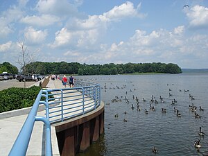
Pymatuning State Park is a Pennsylvania state park covering 21,122 acres (8,548 ha) in Conneaut, North Shenango, Pine, Sadsbury, South Shenango, West Fallowfield and West Shenango Townships, Crawford County, Pennsylvania, in the United States. Pymatuning State Park is the largest state park in Pennsylvania and contains the 17,088 acres (69.15 km2) of Pymatuning Lake, three-quarters of which is in Pennsylvania and one-quarter of which is in Ohio. A 1.7-mile (2.7 km) causeway extends between Pennsylvania and Ohio near the center of the lake.

Pymatuning Reservoir
Reservoir in Ohio, US
Distance: Approx. 2339 meters
Latitude and longitude: 41.49833333,-80.46138889
Pymatuning Reservoir is a man-made lake in Crawford County, Pennsylvania and Ashtabula County, Ohio in the United States, on land that was once a very large swamp. Much of it is incorporated into two state parks: Pymatuning State Park in Pennsylvania, and Pymatuning State Park in Ohio.
1998 Pymatuning earthquake
Distance: Approx. 4878 meters
Latitude and longitude: 41.49,-80.38
The 1998 Pymatuning earthquake occurred in the U.S. state of Pennsylvania on September 25 at 19:52 UTC. With a magnitude of 5.2 mbLg, it was the largest recorded earthquake in Pennsylvania's history.

Gibson House (Jamestown, Pennsylvania)
Historic house in Pennsylvania, United States
Distance: Approx. 234 meters
Latitude and longitude: 41.48472222,-80.44
The Gibson House, also known as The Mark Twain Manor, is an historic home which is located in Jamestown, Mercer County, Pennsylvania. It was added to the National Register of Historic Places in 1978.

Greenville Municipal Airport (Pennsylvania)
Airport
Distance: Approx. 5883 meters
Latitude and longitude: 41.44694444,-80.39138889
The Greenville Municipal Airport (FAA LID: 4G1) is a public use airport which is located three nautical miles (6 km) north of the central business district of Greenville, a borough in Mercer County, Pennsylvania, United States. It is owned by the Borough of Greenville. This airport is included in the National Plan of Integrated Airport Systems for 2011–2015, which categorized it as a general aviation facility.
Weather in this IP's area
broken clouds
-11 Celsius
-18 Celsius
-12 Celsius
-10 Celsius
1023 hPa
83 %
1023 hPa
978 hPa
10000 meters
3.27 m/s
9.81 m/s
283 degree
57 %