206.170.91.218 - IP Lookup: Free IP Address Lookup, Postal Code Lookup, IP Location Lookup, IP ASN, Public IP
Country:
Region:
City:
Location:
Time Zone:
Postal Code:
ISP:
ASN:
language:
User-Agent:
Proxy IP:
Blacklist:
IP information under different IP Channel
ip-api
Country
Region
City
ASN
Time Zone
ISP
Blacklist
Proxy
Latitude
Longitude
Postal
Route
db-ip
Country
Region
City
ASN
Time Zone
ISP
Blacklist
Proxy
Latitude
Longitude
Postal
Route
IPinfo
Country
Region
City
ASN
Time Zone
ISP
Blacklist
Proxy
Latitude
Longitude
Postal
Route
IP2Location
206.170.91.218Country
Region
california
City
los angeles
Time Zone
America/Los_Angeles
ISP
Language
User-Agent
Latitude
Longitude
Postal
ipdata
Country
Region
City
ASN
Time Zone
ISP
Blacklist
Proxy
Latitude
Longitude
Postal
Route
Popular places and events near this IP address
Jan Kesner Gallery
Photography art gallery in Los Angeles, California, United States
Distance: Approx. 580 meters
Latitude and longitude: 34.073934,-118.314326
The Jan Kesner Gallery is a fine art photography gallery in Los Angeles, California. It was the first woman-owned photography gallery in Los Angeles when it was established in 1987. The gallery is known primarily for its focus on contemporary and master works with conceptual or minimal themes, and for its support of regional and international photography.

Rancho La Brea
Land grant in California, United States
Distance: Approx. 1116 meters
Latitude and longitude: 34.07,-118.3
Rancho La Brea was a 4,439-acre (17.96 km2) Mexican land grant in present-day Los Angeles County, California, given in 1828 to Antonio Jose Rocha and Nemisio Dominguez by José Antonio Carrillo, the alcalde of Los Angeles. Rancho La Brea consisted of one square league of land of what is now Wilshire's Miracle Mile, Hollywood, and parts of West Hollywood. The grant included the famous La Brea Tar Pits.

Melrose Hill, Los Angeles
Neighborhood of Los Angeles in California, United States of America
Distance: Approx. 760 meters
Latitude and longitude: 34.083381,-118.307303
Melrose Hill is a neighborhood in Los Angeles. A portion of the neighborhood is designated as a Historic Preservation Overlay Zone.

St. Brendan Catholic Church, Los Angeles
Church in California , United States
Distance: Approx. 1035 meters
Latitude and longitude: 34.06871,-118.31474
St. Brendan Catholic Church is a Catholic church in the Roman Catholic Archdiocese of Los Angeles, located in the Windsor Square section of Los Angeles, California. The current Gothic Revival-style church was built in 1927 and has also served as a location for various Hollywood productions.

Jardinette Apartments
United States historic place
Distance: Approx. 895 meters
Latitude and longitude: 34.0847,-118.31
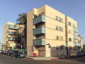
Jardinette Apartments, now known as Marathon Apartments, is a four-story apartment building in Hollywood, Los Angeles, California, designed by modernist Richard Neutra. It was Neutra's first commission in the United States.
Wilshire Branch Library
United States historic place
Distance: Approx. 303 meters
Latitude and longitude: 34.07444444,-118.31083333
Wilshire Branch Library, a branch of the Los Angeles Public Library, is a captivating piece of history nestled in the Mid-Wilshire section of Los Angeles, California. Constructed in 1926, this architectural gem was designed by the renowned architect Allen Ruoff, drawing inspiration from the Italian Romanesque style. In 1987, the Wilshire Branch and several other branch libraries in Los Angeles were added to the National Register of Historic Places as part of a thematic group submission.
South Serrano Avenue Historic District
Historic district in California, United States
Distance: Approx. 1191 meters
Latitude and longitude: 34.06638889,-118.30555556
The South Serrano Avenue Historic District is a historic district of early 20th Century homes along the 400 block of South Serrano Avenue in the Mid-City section of Los Angeles, California. The block of well-preserved homes was added to the National Register of Historic Places in 1988. It is the sole intact block of single family homes in an area having many large apartment buildings.
Hollywood Melrose Hotel
United States historic place
Distance: Approx. 829 meters
Latitude and longitude: 34.083334,-118.313079
The Hollywood Melrose Hotel, also known previously as the Melrose Arms and later as the Monte Cristo Island Apartments, is a historic building on Melrose Avenue in Hollywood, California. Designed by S. Charles Lee, the structure was built in 1927. It has been used both as a hotel and apartments over the years of its existence, with commercial establishments on the first floor.

Wilton Historic District
Historic district in California, United States
Distance: Approx. 726 meters
Latitude and longitude: 34.07111111,-118.31305556
The Wilton Historic District is a historic district of single family residences in Los Angeles, California from the early 20th century.

Little Bangladesh, Los Angeles
Neighborhood of Los Angeles in California, United States
Distance: Approx. 1335 meters
Latitude and longitude: 34.069,-118.2979
Little Bangladesh (Bengali: লিটল বাংলাদেশ) is a neighborhood in Los Angeles, California.
Beverly Hot Springs
Thermal springs in Los Angeles, California
Distance: Approx. 126 meters
Latitude and longitude: 34.07661111,-118.30763889
Beverly Hot Springs is the only remaining natural geothermal hot spring within the center of the city of Los Angeles. It is located between Beverly Hills and downtown Los Angeles on what is now Oxford Avenue.
Polar Palace
Indoor, artificial ice rink
Distance: Approx. 883 meters
Latitude and longitude: 34.0822504,-118.3158343
The Polar Palace in Los Angeles, California was an indoor, artificial ice rink. Primarily used as a figure skating rink, the building was also used for ice hockey and carnival shows throughout the years.
Weather in this IP's area
clear sky
8 Celsius
7 Celsius
7 Celsius
9 Celsius
1018 hPa
81 %
1018 hPa
994 hPa
10000 meters
1.54 m/s
110 degree

