Country:
 Germany
Region:
City:
Latitude and Longitude:
Time Zone:
Postal Code:
IP information under different IP Channel
ip-api
Country
Region
City
ASN
Time Zone
ISP
Blacklist
Proxy
Latitude
Longitude
Postal
Route
IPinfo
Country
Region
City
ASN
Time Zone
ISP
Blacklist
Proxy
Latitude
Longitude
Postal
Route
MaxMind
Country
Region
City
ASN
Time Zone
ISP
Blacklist
Proxy
Latitude
Longitude
Postal
Route
Luminati
Country
DERegion
he
City
frankfurtammain
ASN
Time Zone
Europe/Berlin
ISP
Viewqwest Pte Ltd
Latitude
Longitude
Postal
db-ip
Country
Region
City
ASN
Time Zone
ISP
Blacklist
Proxy
Latitude
Longitude
Postal
Route
ipdata
Country
Region
City
ASN
Time Zone
ISP
Blacklist
Proxy
Latitude
Longitude
Postal
Route
Popular places and events near this IP address
Grand Duchy of Frankfurt
State
Distance: Approx. 235 meters
Latitude and longitude: 50.11666667,8.68333333
The Grand Duchy of Frankfurt was a German satellite state of Napoleonic creation. It came into existence in 1810 through the combination of the former territories of the Archbishopric of Mainz along with the Free City of Frankfurt itself.

Confederation of the Rhine
Napoleonic union of German client states
Distance: Approx. 235 meters
Latitude and longitude: 50.11666667,8.68333333
The Confederated States of the Rhine, simply known as the Confederation of the Rhine or Rhine Confederation, was a confederation of German client states established at the behest of Napoleon some months after he defeated Austria and Russia at the Battle of Austerlitz. Its creation brought about the dissolution of the Holy Roman Empire shortly afterward. The Confederation of the Rhine lasted for only seven years, from 1806 to 1813, dissolving after Napoleon's defeat in the War of the Sixth Coalition.
Frankfurt Auschwitz trials
Series of trials in Germany
Distance: Approx. 208 meters
Latitude and longitude: 50.117,8.683
The Frankfurt Auschwitz trials, known in German as Der Auschwitz-Prozess, or Der zweite Auschwitz-Prozess (literally, the 'second Auschwitz trial'), was a series of trials running from 20 December 1963 to 19 August 1965, charging 22 defendants under German criminal law for their roles in the Holocaust as mid- to lower-level officials in the Auschwitz-Birkenau death and concentration camp complex. Hans Hofmeyer led the "criminal case against Mulka and others" (reference number 4 Ks 3/63) as chief judge. Overall, only 789 individuals of the approximately 8,200 surviving SS personnel who served at Auschwitz and its sub-camps were ever tried, of whom 750 received sentences.

Innenstadt (Frankfurt am Main)
Quarter of Frankfurt am Main in Hesse, Germany
Distance: Approx. 203 meters
Latitude and longitude: 50.12027778,8.68277778
The Innenstadt (inner city) is the central city district of Frankfurt am Main, Germany. It is part of the Ortsbezirk Innenstadt I. Its western part forms part of Frankfurt's central business district, the Bankenviertel. Germany's most expensive shopping streets and real estate are found within the city district.

Frankfurter Engel
Memorial to homosexual victims during Nazi Germany
Distance: Approx. 224 meters
Latitude and longitude: 50.11680556,8.68525
The Frankfurter Engel (German for Frankfurt angel) is a memorial in the city of Frankfurt am Main in southwestern Germany; it is dedicated to homosexual people who were persecuted under Nazi rule, and as well as under Paragraph 175 of the German Criminal Code during the 1950s and 1960s.
Eschenheimer Turm
Landmark of Frankfurt
Distance: Approx. 377 meters
Latitude and longitude: 50.1169,8.67972
Eschenheimer Turm (Eschenheim Tower) was a city gate, part of the late-medieval fortifications of Frankfurt am Main, and is a landmark of the city. The tower, which was erected at the beginning of the fifteenth century, is at once the oldest and most unaltered building in the largely reconstructed Frankfurter Neustadt (new town), now better known as the Innenstadt (city center).
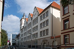
Musterschule
Gymnasium school in Frankfurt, Germany
Distance: Approx. 374 meters
Latitude and longitude: 50.12194444,8.68555556
The Musterschule ("model school") is a gymnasium in Frankfurt, Germany. It was founded on 18 April 1803 by Wilhelm Friedrich Hufnagel as a Realschule and is Frankfurt's second oldest higher school after the Lessing Gymnasium. It received the name Musterschule due to being an experimental and progressive school based on Johann Heinrich Pestalozzi's educational ideas.
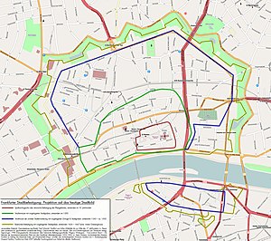
Wallanlagen
Distance: Approx. 214 meters
Latitude and longitude: 50.1187,8.6812
The Wallanlagen (lit., "Wall Park") is a park area in Frankfurt, Germany, which forms a five-kilometre-long green belt around the city centre. The parklands run along the course of the former city walls, which were built from the 14th century and which were torn down in the early 19th century. The former course of the city wall was landscaped as a park between 1804 and 1812.

Maingau Clinic of the Red Cross
Distance: Approx. 287 meters
Latitude and longitude: 50.1193522,8.6880881
The Maingau Clinic of the Red Cross (German: Klinik Maingau vom Roten Kreuz) is a clinic in Frankfurt, Germany, which is run by the German Red Cross. It is located near the Eschenheimer Anlage park in central Frankfurt, with the address Scheffelstraße 2–14. The clinic traces its history to the 1890 establishment of the Maingau Nursing Society by the Frankfurt branch of the Patriotic Women's Association.
Philanthropin
Jewish elementary school and gymnasium in Frankfurt, Germany
Distance: Approx. 342 meters
Latitude and longitude: 50.1211,8.6872
The Philanthropin (Greek for "place of humanity") is a Jewish elementary school and gymnasium in Frankfurt, Germany. It was founded in 1804 by Mayer Amschel Rothschild.

DSK Hyp
German subsidiary of Skandinaviska Enskilda Banken
Distance: Approx. 263 meters
Latitude and longitude: 50.116705,8.682235
DSK Deutsch-Skandinavische Verwaltungs AG (formerly SEB AG and DSK Hyp AG) is the German subsidiary of one of the largest Swedish banks, the Skandinaviska Enskilda Banken (SEB).

Church of St Peter, Frankfurt
Church in Frankfurt, Hesse, Germany
Distance: Approx. 137 meters
Latitude and longitude: 50.1175,8.6838
The Church of St Peter (German: Peterskirche) is a former evangelical church located in the Innenstadt area of Frankfurt, Germany. It has been known as jugend-kultur-kirche sankt peter since 2007, when it became a youth centre. The church built between 1891 and 1894 on a neo-renaissance design by Hans Grisebach and Georg Dinklage.It was built on the site of the historic St Peter's Churchyard (German: Peterskirchhof), where most of Frankfurt's dead was buried until 1828.
Weather in this IP's area
heavy intensity shower rain
19 Celsius
20 Celsius
18 Celsius
21 Celsius
1010 hPa
94 %
1010 hPa
997 hPa
8000 meters
1.03 m/s
40 %
06:51:08
19:54:56