206.126.94.137 - IP Lookup: Free IP Address Lookup, Postal Code Lookup, IP Location Lookup, IP ASN, Public IP
Country:
Region:
City:
Location:
Time Zone:
Postal Code:
ISP:
ASN:
language:
User-Agent:
Proxy IP:
Blacklist:
IP information under different IP Channel
ip-api
Country
Region
City
ASN
Time Zone
ISP
Blacklist
Proxy
Latitude
Longitude
Postal
Route
db-ip
Country
Region
City
ASN
Time Zone
ISP
Blacklist
Proxy
Latitude
Longitude
Postal
Route
IPinfo
Country
Region
City
ASN
Time Zone
ISP
Blacklist
Proxy
Latitude
Longitude
Postal
Route
IP2Location
206.126.94.137Country
Region
quebec
City
montreal
Time Zone
America/Montreal
ISP
Language
User-Agent
Latitude
Longitude
Postal
ipdata
Country
Region
City
ASN
Time Zone
ISP
Blacklist
Proxy
Latitude
Longitude
Postal
Route
Popular places and events near this IP address

McGill University Health Centre
Hospital in Quebec, Canada
Distance: Approx. 338 meters
Latitude and longitude: 45.472891,-73.600974
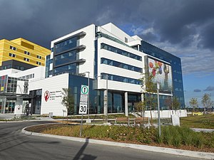
The McGill University Health Centre (MUHC; French: Centre universitaire de santé McGill; CUSM) is one of two major healthcare networks in the city of Montreal, Quebec. It is affiliated with McGill University and one of the largest medical complexes in Montreal. It is the largest hospital system in Canada by bed capacity.

Vendôme station
Montreal Metro station
Distance: Approx. 141 meters
Latitude and longitude: 45.47388889,-73.60388889
Vendôme station (French pronunciation: [vɑ̃dom] ) is an intermodal transit station in the borough of Côte-des-Neiges–Notre-Dame-de-Grâce in Montreal, Quebec, Canada, near the town of Westmount in the Westmount Adjacent area of Notre-Dame-de-Grâce that adjoins the Décarie Expressway. It is operated by the Société de transport de Montréal (STM) and serves the Orange Line of the Montreal Metro. The Metro station connects to Exo's commuter rail network by a pedestrian tunnel, permitting access to platforms providing service on the Vaudreuil-Hudson, Saint-Jérôme and Candiac lines.

Royal Victoria Hospital, Montreal
Hospital in Quebec, Canada
Distance: Approx. 245 meters
Latitude and longitude: 45.471851,-73.602716
The Royal Victoria Hospital (RVH), colloquially known as the "Royal Vic" or "The Vic", is a hospital in Montreal, Quebec, Canada. It forms the largest base hospital of the McGill University Health Centre (MUHC), which is affiliated with McGill University. The hospital was established in 1893 and was based at Pine Avenue, now known as the Legacy site, until 2015, when major hospital operations were moved to the Glen site (1001 Décarie Boulevard), named for the former Glen railway yards.
Shriners Hospital for Children – Canada
Hospital in Quebec, Canada
Distance: Approx. 297 meters
Latitude and longitude: 45.4719,-73.6019
The Shriners Hospital for Children – Canada (French: Hôpital Shriners pour enfants – Canada; also known as Shriners Children's Canada and informally as the Montreal Shriner's Hospital) is the Canadian branch of the Shriners Hospitals for Children network. It is located in Notre-Dame-de-Grâce, Montreal, Quebec, at 1003 Decarie Boulevard. It overlooks downtown Montreal, and is close to Royal Victoria Hospital of the McGill University Health Centre (MUHC) hospital network, with which it is associated but not fully affiliated.

Montreal Chest Institute
Hospital in Quebec, Canada
Distance: Approx. 338 meters
Latitude and longitude: 45.472891,-73.600974
Montreal Chest Institute is a health centre in Montreal specializing in respiratory medicine. It is affiliated with the Royal Victoria Hospital, and by extension, McGill University Health Centre. On June 14, 2015, the historic Institute moved into the new MUHC Glen Site.

Turcot Interchange
Interchange in Montreal, Quebec
Distance: Approx. 747 meters
Latitude and longitude: 45.467776,-73.599472
The Turcot Interchange is a three-level four-way freeway interchange within the city of Montreal, Quebec, Canada. Located southwest of downtown, the interchange links Autoroutes 15 (Décarie and Décarie South Expressways) and 20 (Remembrance Highway), and Route 136 (Ville-Marie Expressway), and provides access to the Champlain Bridge via the Décarie South Expressway. It takes its name from the nearby Philippe-Turcot Street and Turcot village, which were in turn named after Philippe Turcot (1791–1861) who was a merchant owning land in Saint-Henri.

Oxford Park, Montreal
Urban park in Montreal, Canada
Distance: Approx. 509 meters
Latitude and longitude: 45.4688,-73.6075
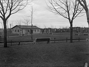
Oxford Park, officially named Georges-Saint-Pierre Park since 1996 and located in the southern part of the Notre-Dame-de-Grâce neighbourhood, is a park in Montreal, Quebec, Canada. It was known as the Oxford Park in the 19th century, with activities operated by the Oxford Park Association, and this name is sometimes still used by some people who grew up in the area. In 1996, the City of Montreal formally named it the Georges-Saint-Pierre Park in honour of the founder of the local Caisse Populaire Saint-Raymond, a community credit union.
Monument aux braves de N.D.G.
Distance: Approx. 659 meters
Latitude and longitude: 45.4725,-73.6137
The Monument aux braves de N.D.G. is a war memorial in the Montreal neighbourhood Notre-Dame-de-Grâce.

Empress Theatre (Montreal)
Movie theatre in Quebec, Canada
Distance: Approx. 611 meters
Latitude and longitude: 45.4718,-73.6129
The Empress Theatre (also known as Cinema V), is an abandoned Egyptian Revival style theatre located on Sherbrooke Street west in the Notre-Dame-de-Grâce district of Montreal, Quebec, Canada. After operating for 65 years, the theater closed in 1992.

Westmount station
Railway station in Montreal, Quebec, Canada
Distance: Approx. 691 meters
Latitude and longitude: 45.47666667,-73.59805556
The Westmount station (French: Gare de Westmount) is a disused railway station in the city of Westmount, Quebec, Canada. Its address is 4848 Saint Catherine Street West at the bottom of Victoria Avenue in the Victoria Village neighbourhood. It was designed for the Canadian Pacific Railway by the company architect, W.S. Painter, and was completed in 1907.
Turcot, Quebec
Distance: Approx. 734 meters
Latitude and longitude: 45.4678,-73.5997
Turcot is a former village in the city of Montreal, Quebec, Canada. A road junction (the Turcot Interchange), a railway yard and a city park are also named Turcot, and a street is named rue Philippe-Turcot. The name comes from Philippe Turcot (1791–1861), a merchant and landowner, who sold building lots over the period 1847 to 1860 that became a village known as Turcot.

Victoria Village, Westmount
Neighbourhood in Westmount, Quebec, Canada
Distance: Approx. 671 meters
Latitude and longitude: 45.478983,-73.6034497
Victoria Village (French: Village Victoria, pronounced [vilaʒ viktɔʁja]) is a commercial and residential neighbourhood in the southwest corner of the city of Westmount, in Greater Montreal, Quebec, Canada. Victoria Village's commerce is centred along Sherbrooke Street and Victoria Avenue; some other businesses are located on Prince Albert Avenue, Claremont Avenue, and Somerville Avenue. The neighbourhood features a variety of businesses including restaurants, coffee shops, grocers, and clothing stores, many of which are independent.
Weather in this IP's area
broken clouds
-4 Celsius
-11 Celsius
-5 Celsius
-3 Celsius
1008 hPa
87 %
1008 hPa
1004 hPa
10000 meters
11.32 m/s
14.92 m/s
250 degree
75 %
